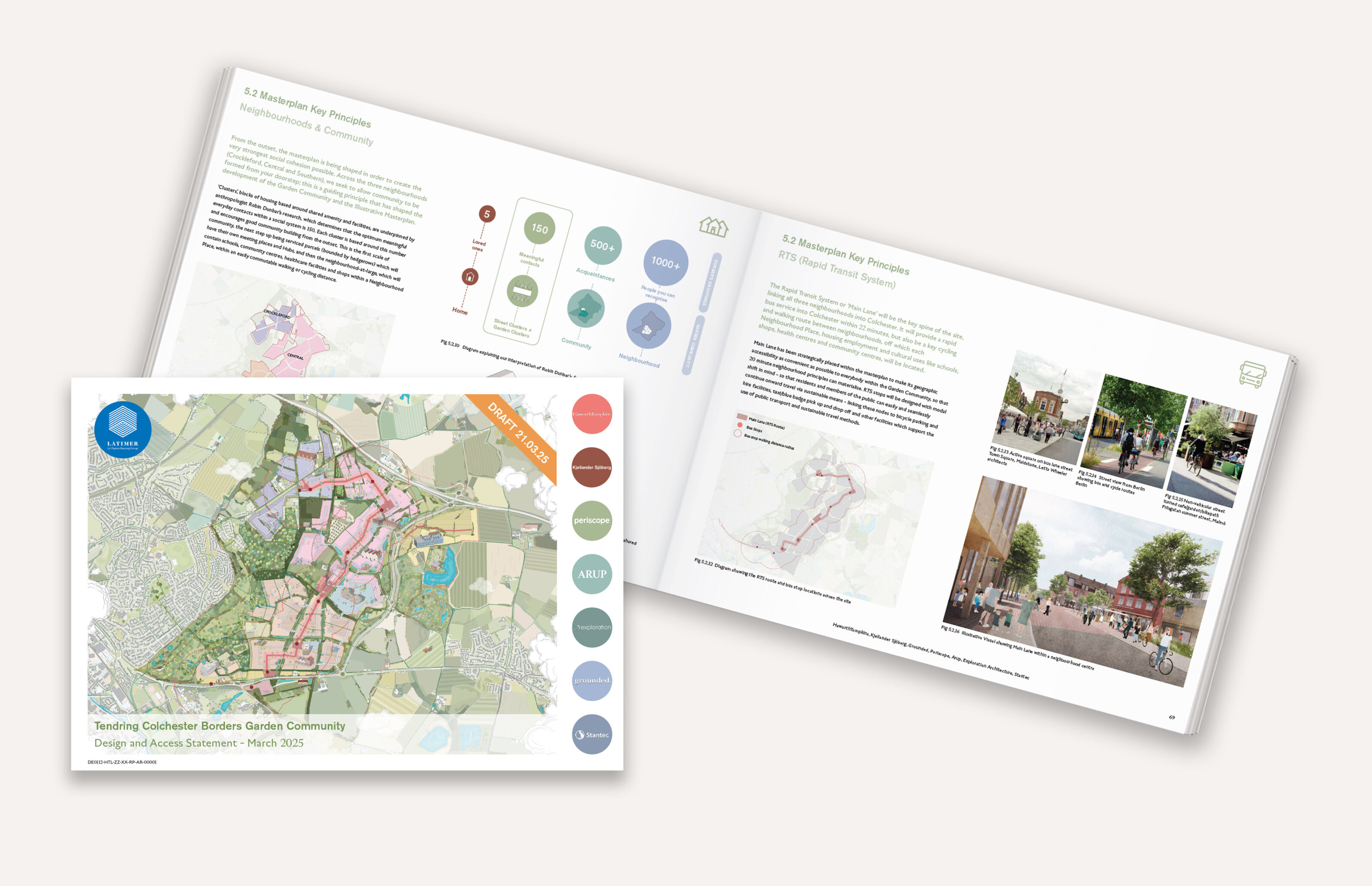
Tendring Colchester Borders Garden Community
Tendring Colchester Borders Garden Community (TCBGC) is a pioneering benchmark for future living, moving beyond static sustainability toward active ecological and social regeneration. Over the next 20 years, Clarion Housing Group and their development arm, Latimer – the UK’s largest housing association – will realize a thriving community of 7,750 climate-resilient homes and thousands of jobs, distributed across three distinct, integrated neighbourhoods.
Kjellander Sjöberg led the strategic site-wide masterplan, and detailed urban design of two of the three neighbourhoods. As a hybrid planning application, KS provided specialized, placemaking expertise to a diverse collaborative team led by Haworth Tompkins, alongside Periscope, Grounded Practice, Arup and Exploration Architecture.
Masterplan promises, outlined in the project brief and secured through planning mechanisms Long-term public benefit
Kjellander Sjöberg’s starting point for the masterplan was to work with what’s already there: the existing rural grain of heritage farmsteads and over 30km of hedgerows directly informs the urban grain of streets and development blocks. Analysis by Grounded of local Essex villages shaped how mixed uses are clustered.
The landscape-led masterplan is underpinned by a visionary framework designed to minimise car dependency. Careful integration of the landscape with architectural proposals have carved out bespoke places for water retention and ecology and diverse places for play for all ages, food growing and mental health and wellbeing.
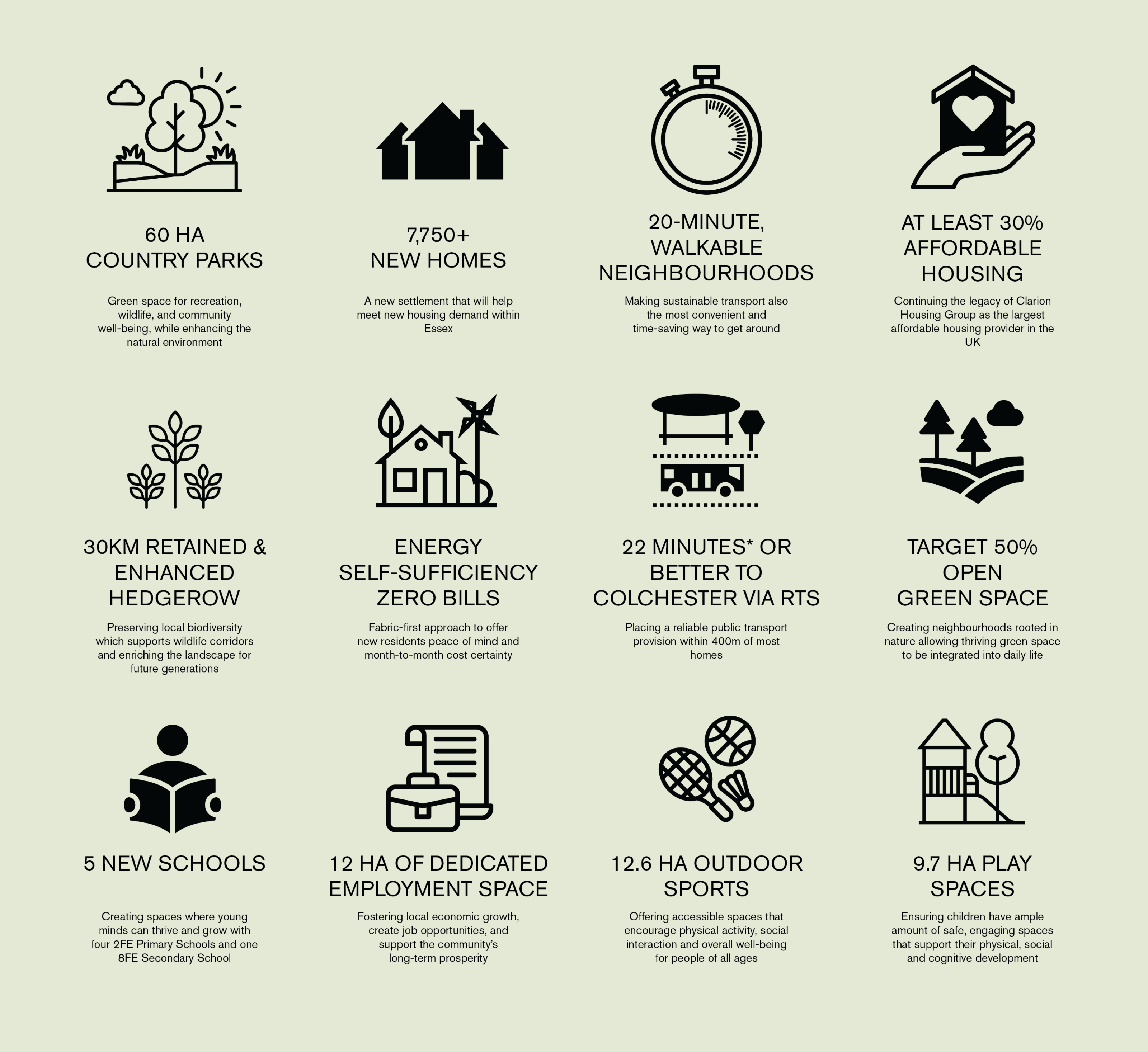
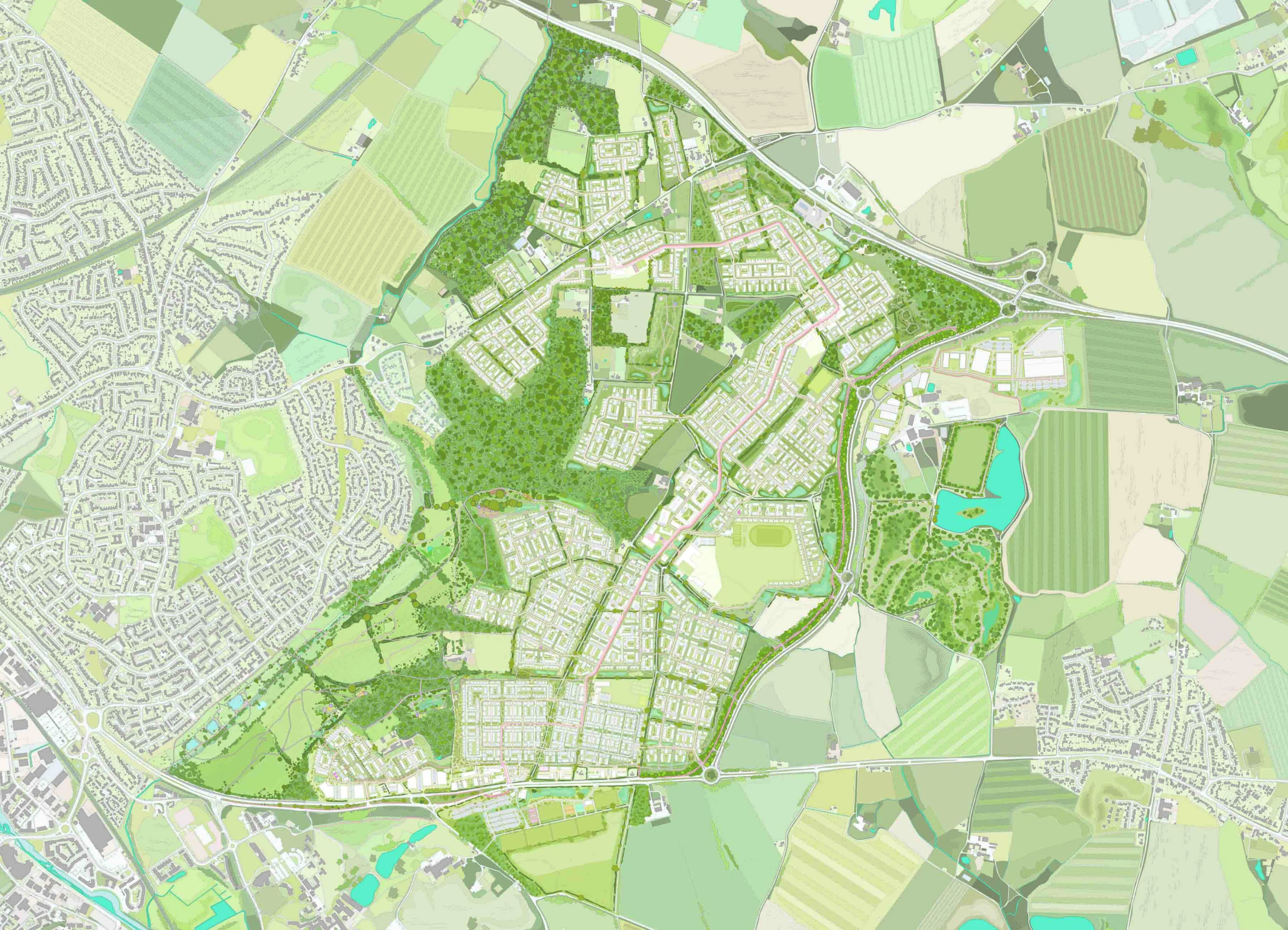
The masterplan covers the expansive 704-hectare site, integrating a new 60-hectare regional park, five schools, three community-focused neighbourhood centres, and a dedicated rapid public transport network. Long-term value and design integrity are locked in through a robust suite of site-specific Design Codes, alongside pioneering stewardship and estate management strategies.
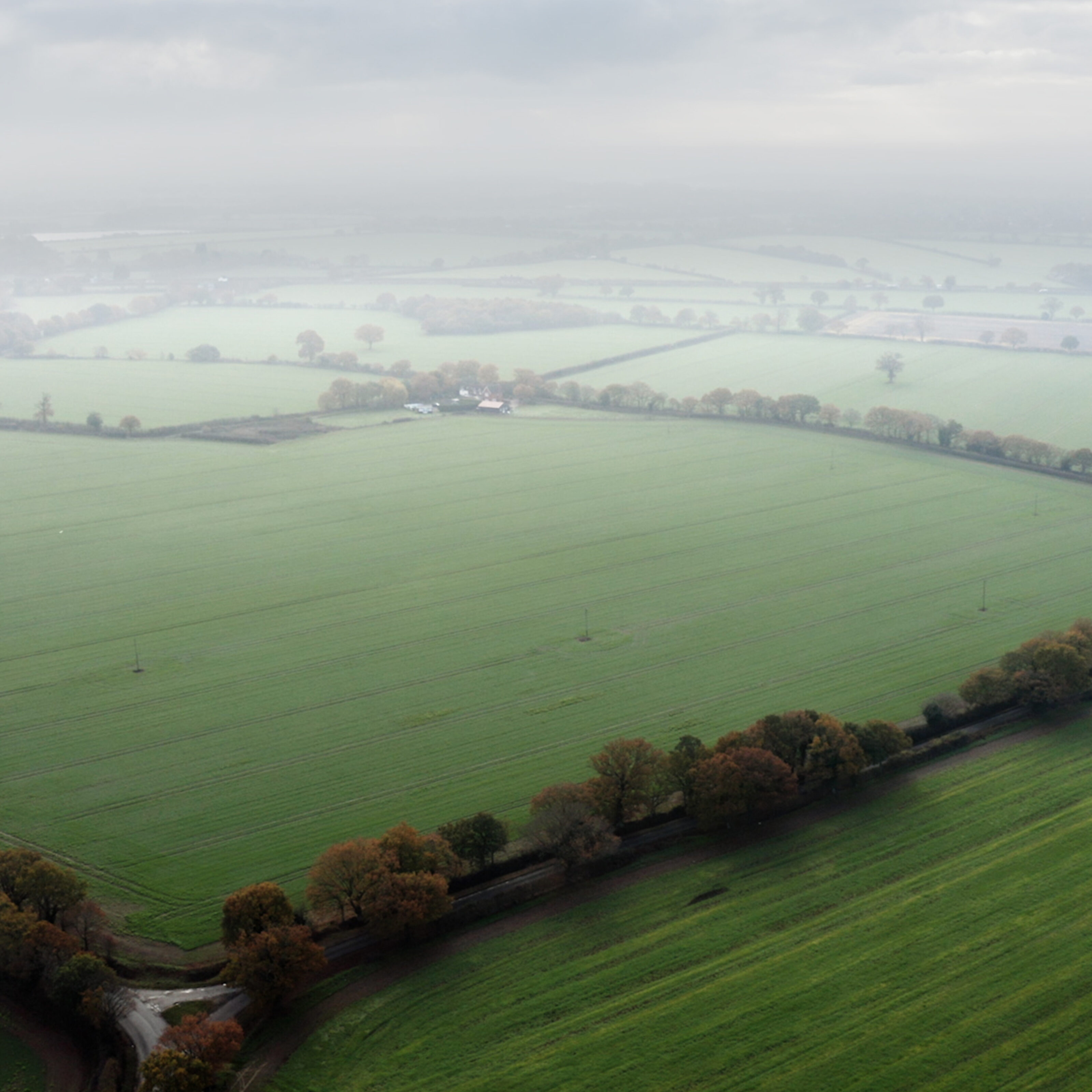
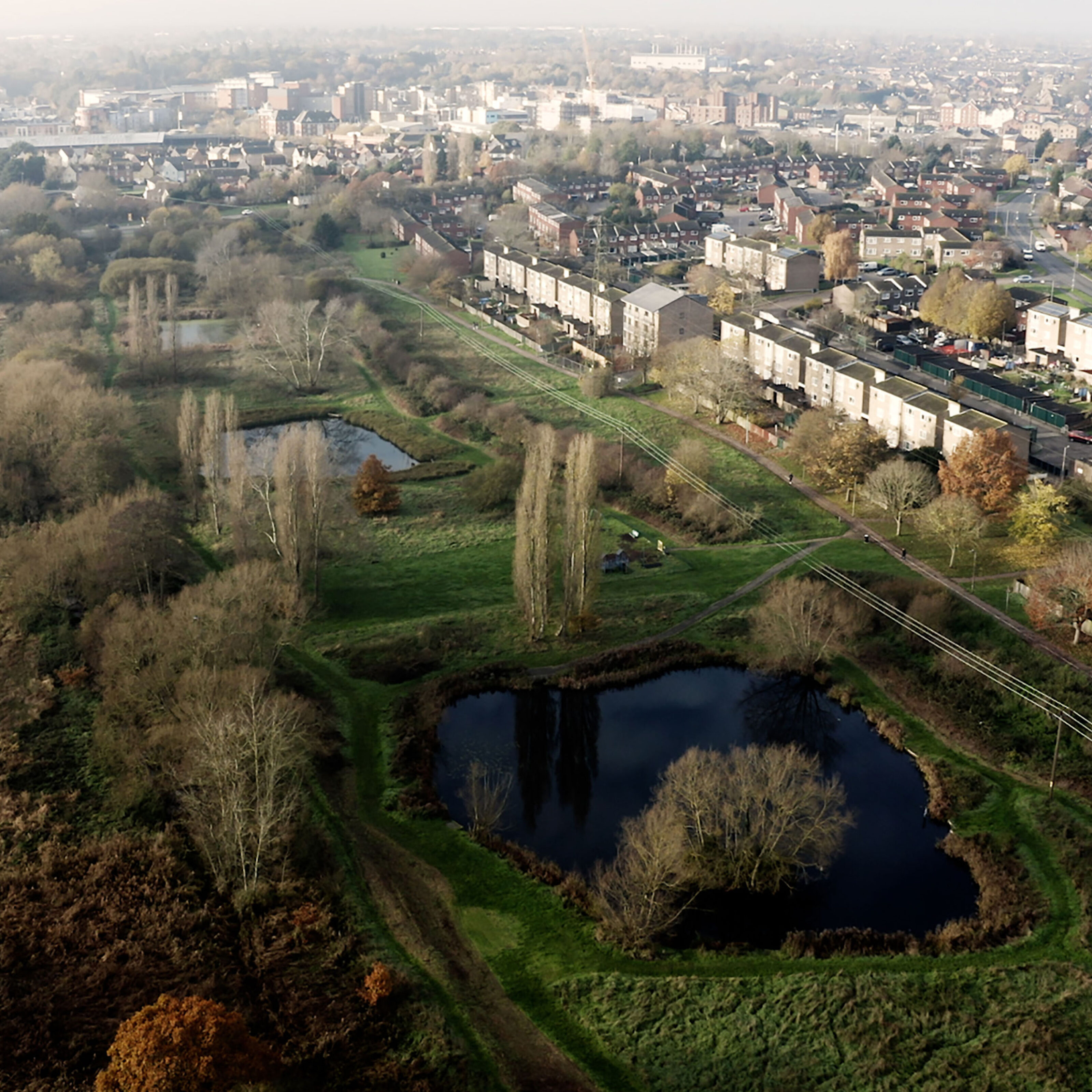
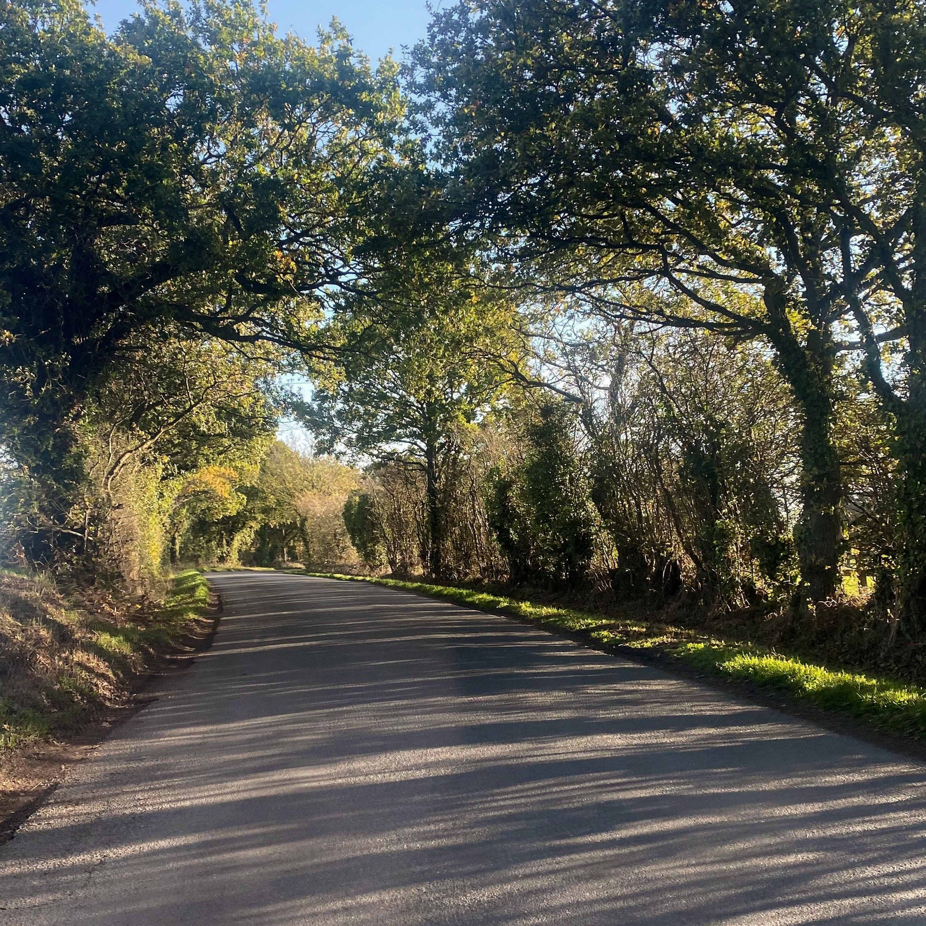
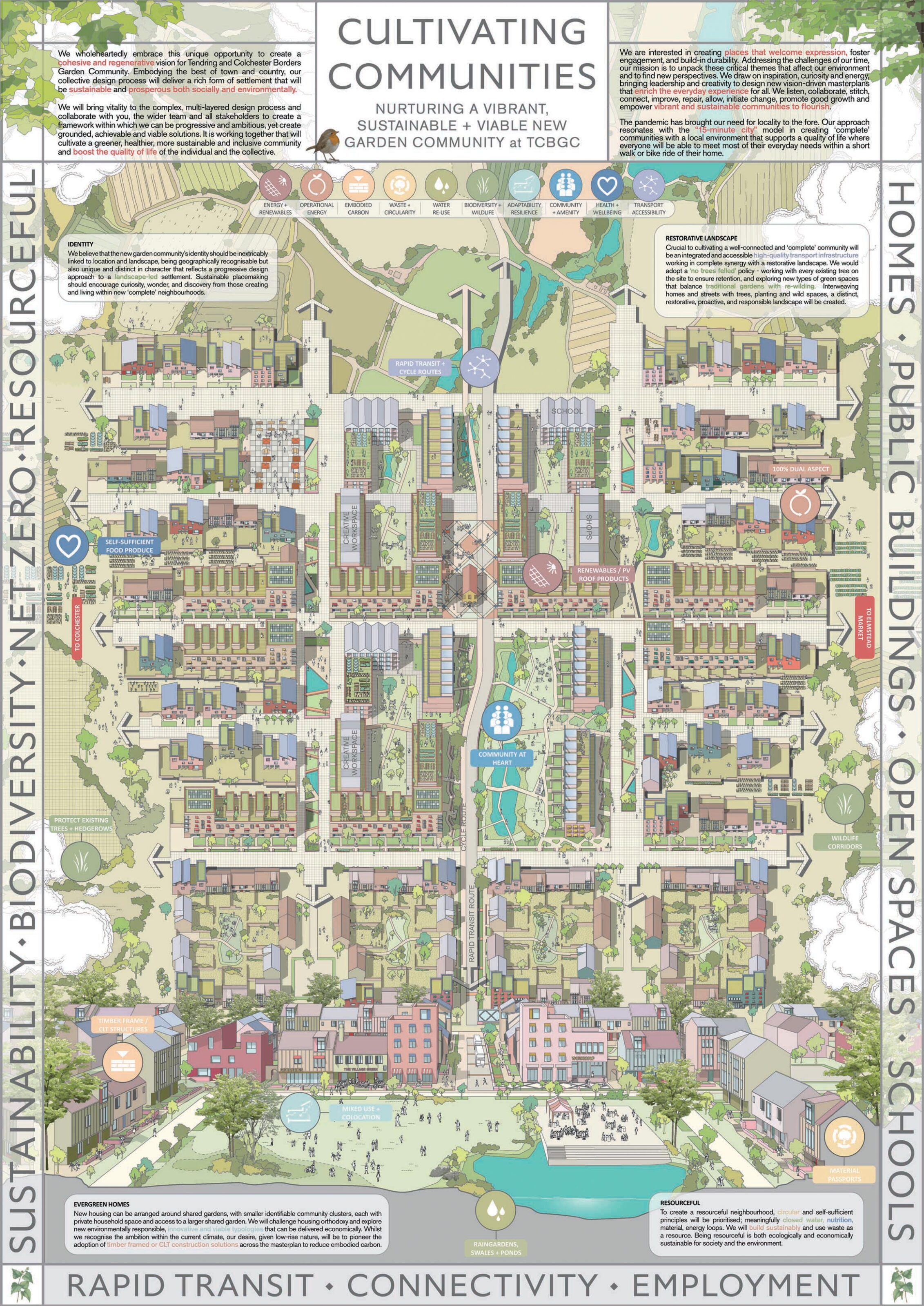
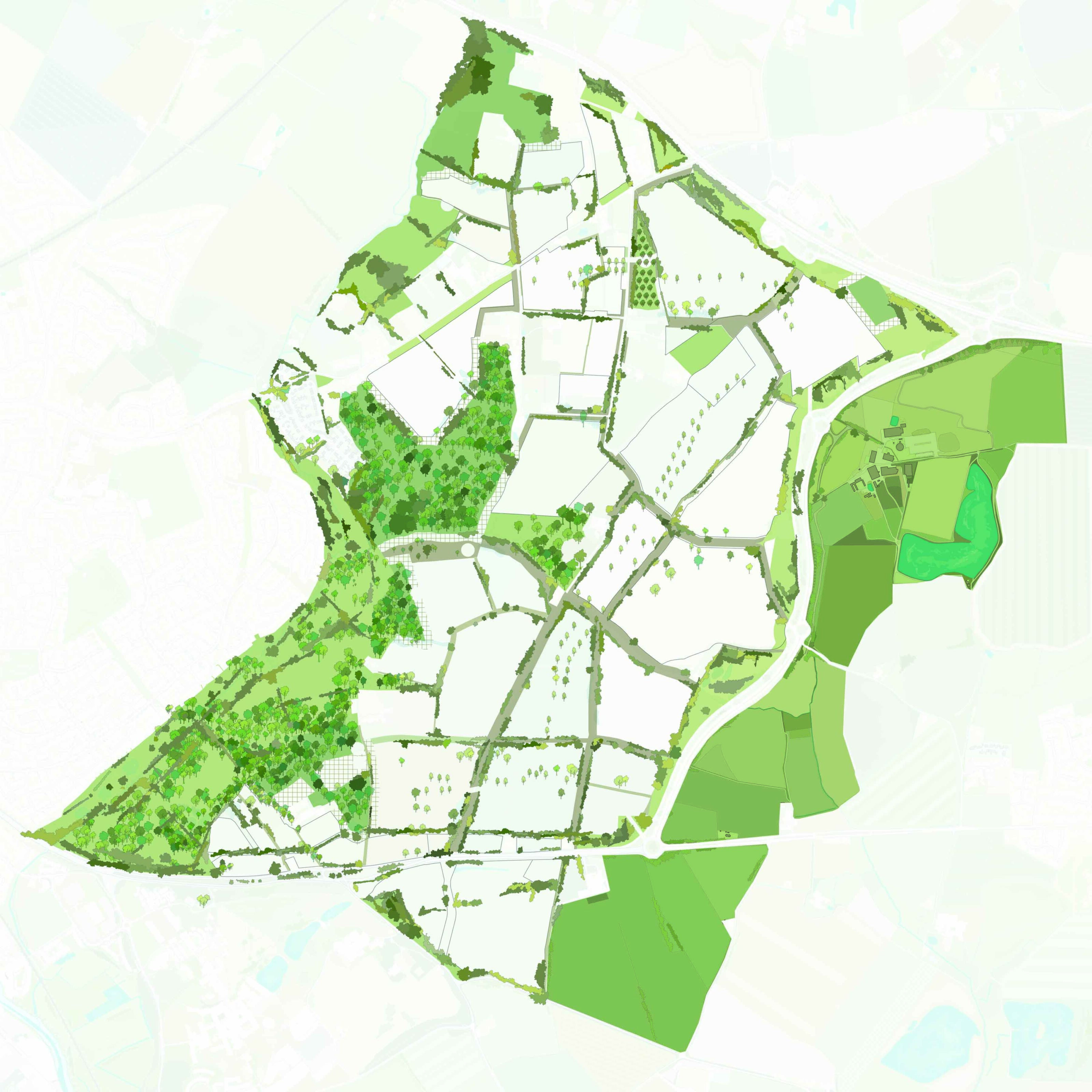
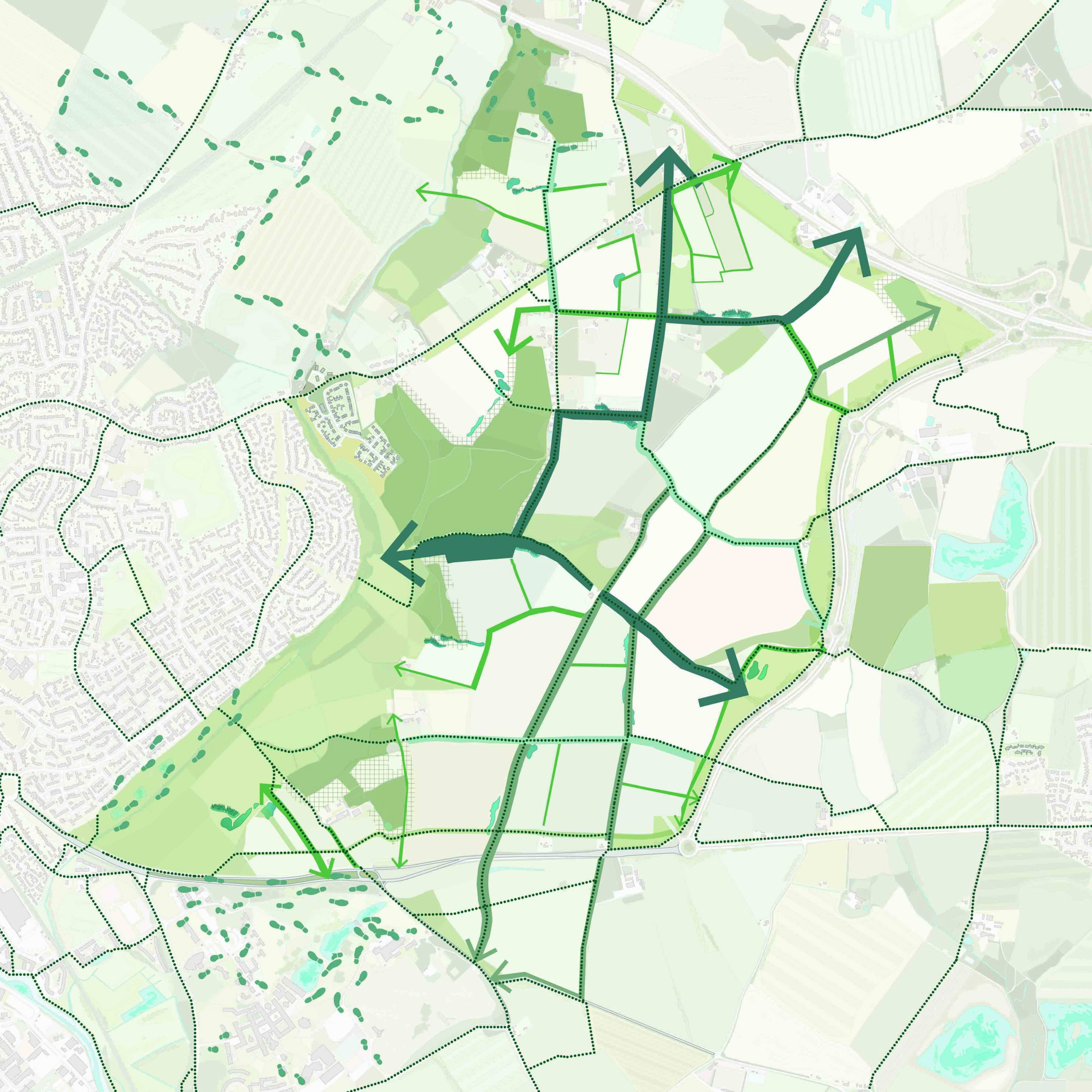
Strategic masterplan together with Haworth Tompkins, Periscope, Grounded Practice, Arup, Exploration Architecture and Stantec. Site images: existing green structure Illustration of masterplan principles. Initial competition entry together with Haworth Tompkins, Periscope, Grounded Practice, Arup and Exploration Architecture. Regenerative, not just sustainable
Over the span of project delivery, farmland will become a landscape that works for people and the local wildlife. The masterplan prioritises safeguarding ancient woodlands, hedgerows and ecologically valuable areas over land with intensive monocultural farming.
The project aims to leave the land in better condition than is it today – ecologically, socially and economically. Four project principles have formed design framework to facilitate near zero impact living and ecological regeneration.
- Be a good ancestor – improve quality of life through long term thinking
- Let nature lead – Integrate system services into the fundamental design
- Promote circular resource use – within closed-loop systems
- A place for everyone – private sufficiency and public luxury
Site-wide masterplan for Tendring Colchester Borders Garden Community Everyday walkable
How do we make a place of this scale, walkable?
Across rural and semi-rural England, access to employment, services, and daily life remains overwhelmingly car-dependent, with personal vehicle ownership functioning as a prerequisite for mobility rather than a choice. A central element of the masterplan brief was to remove this reliance and shift the focus from moving cars to moving people.
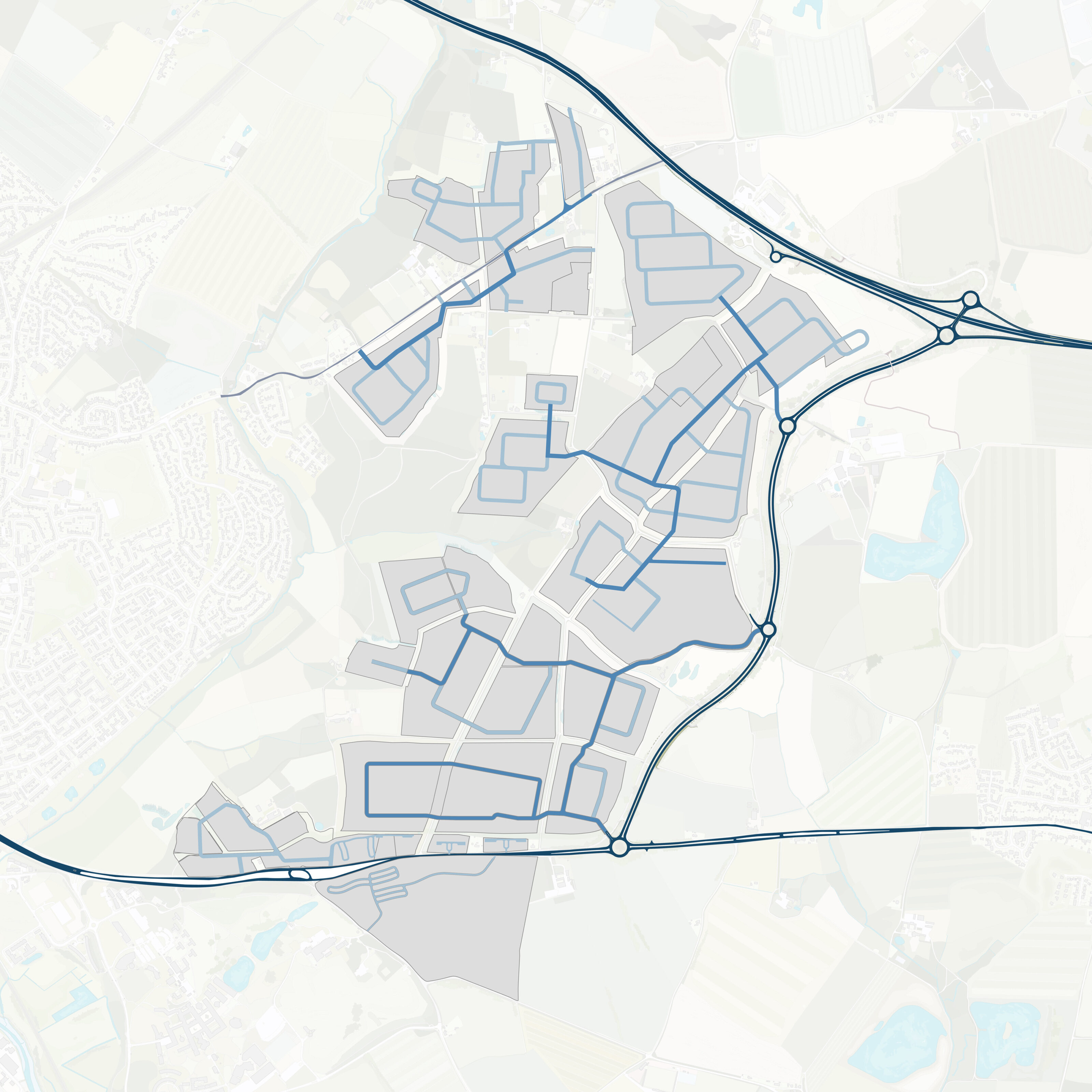
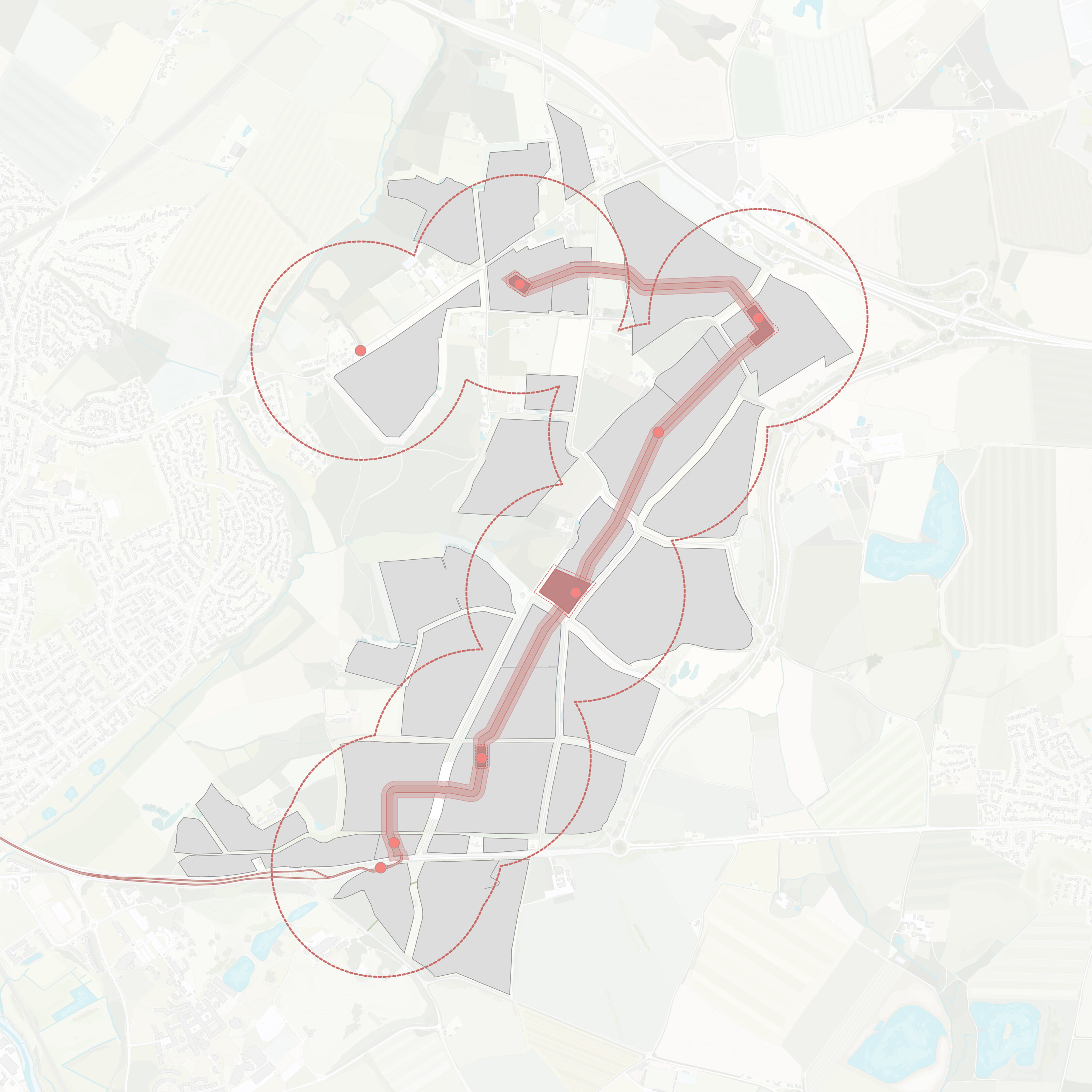
A phased approach to nudge mobility towards active patterns form the groundwork for the location of ‘Main Lane’; the multi-use route for cycle and local bus services, overall vehicular street network, and mobility hub locations.
The Main Lane aims to mediate both ‘Town’ and ‘Country’. It serves as a public space where local life happens – passing right by homes, schools, shops, parks and cultural facilities such as the new Guildhall.
Mobility hubs are where modal shift happens and can vary in scale from a bike stand with maintenance, to a parking barn with a mix of functions including cycle (including cargo bike) hire. These hubs are located in an intricate network in relation to homes, walking and cycle routes and the bus stops along Main Lane.
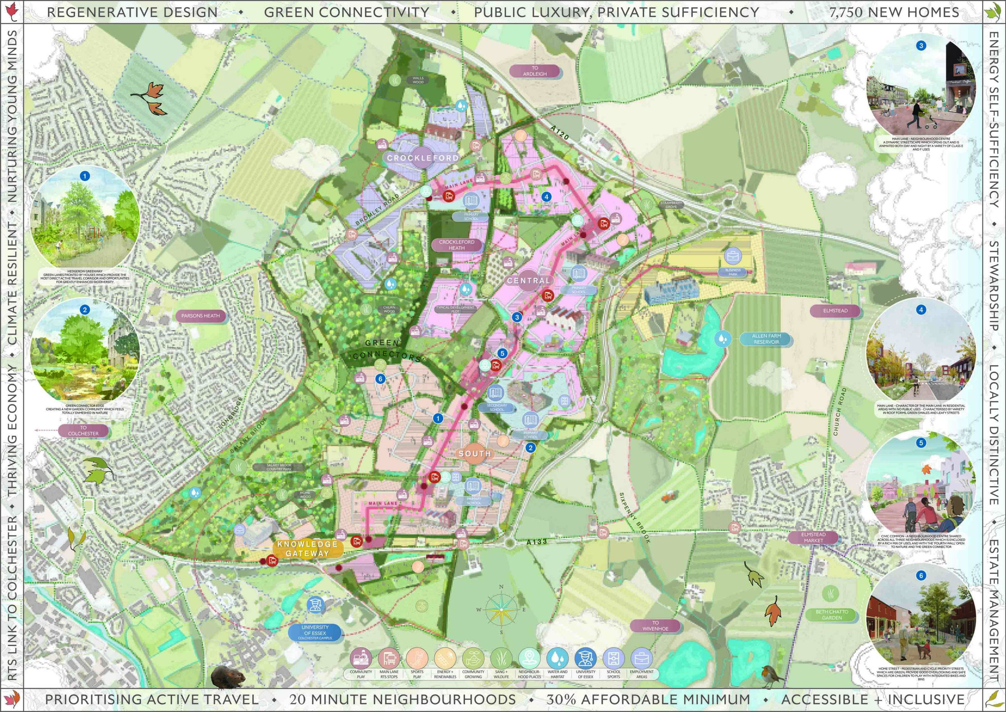
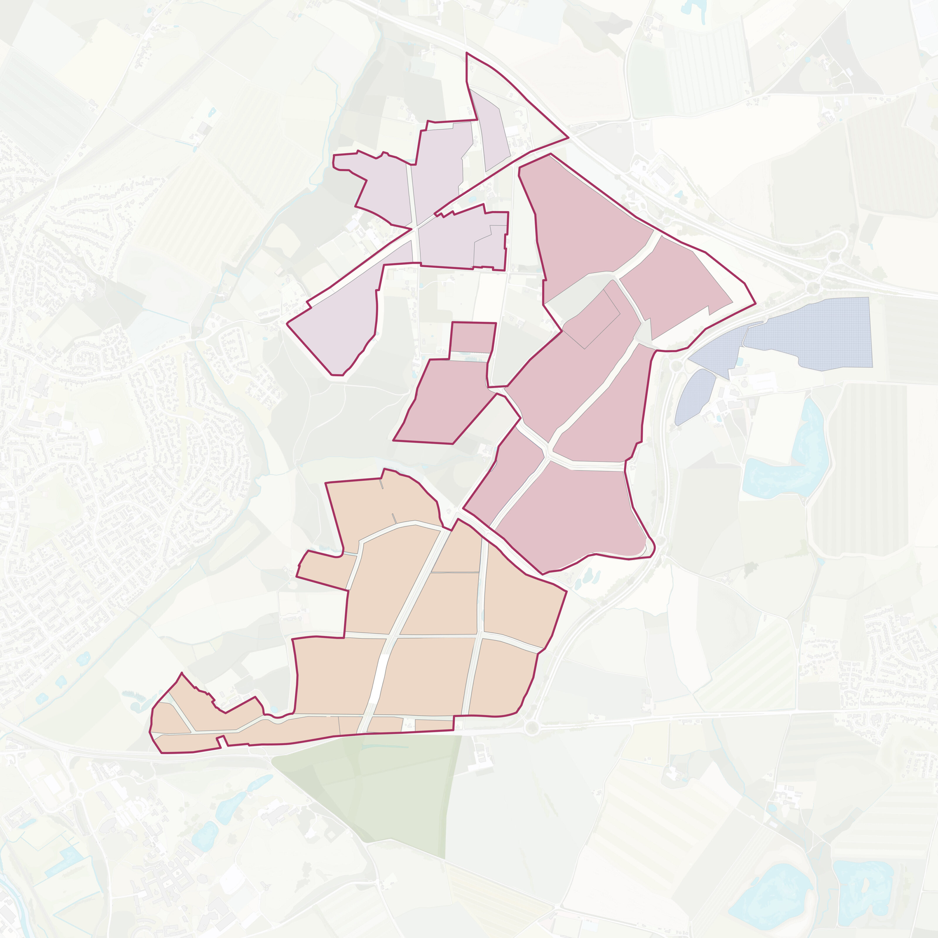
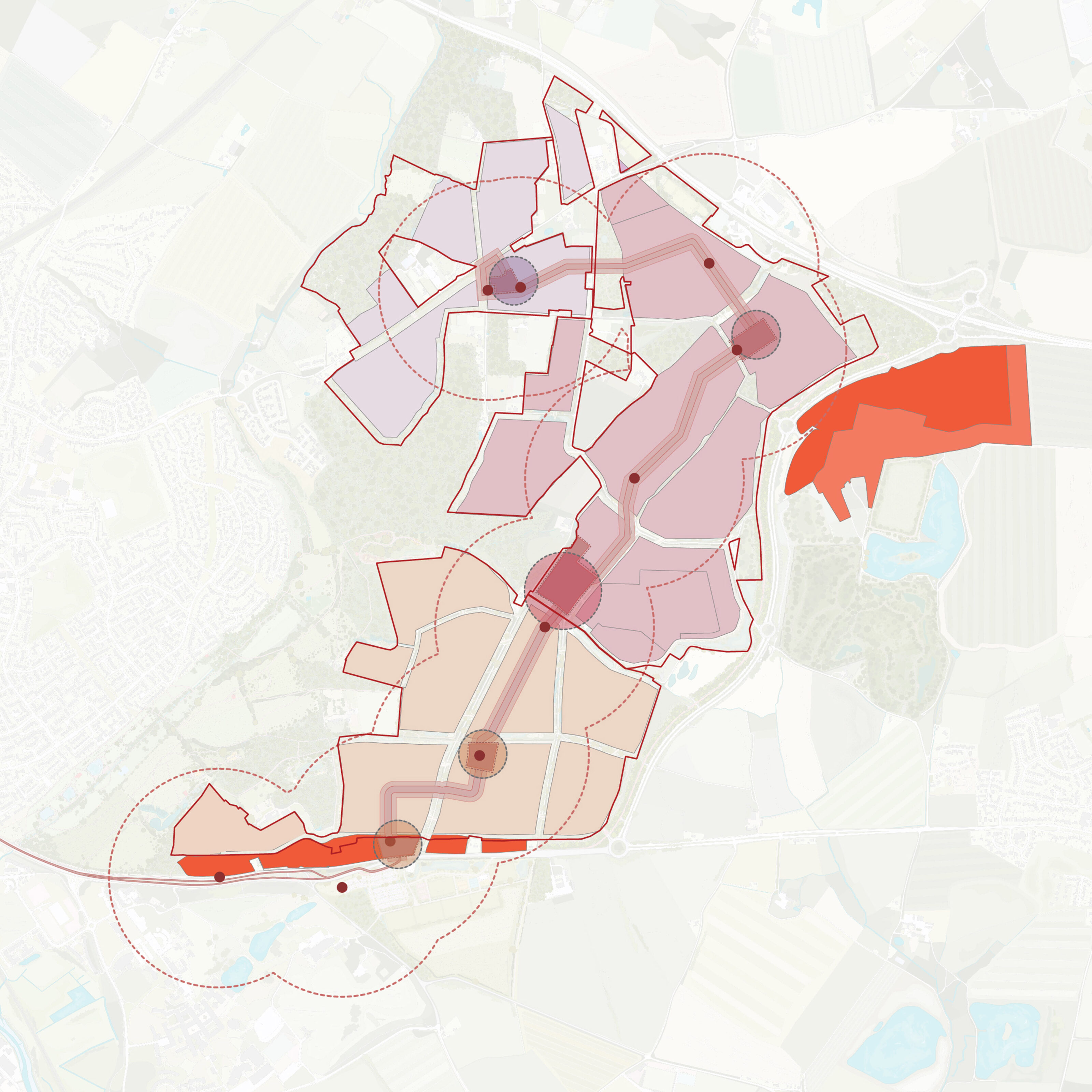
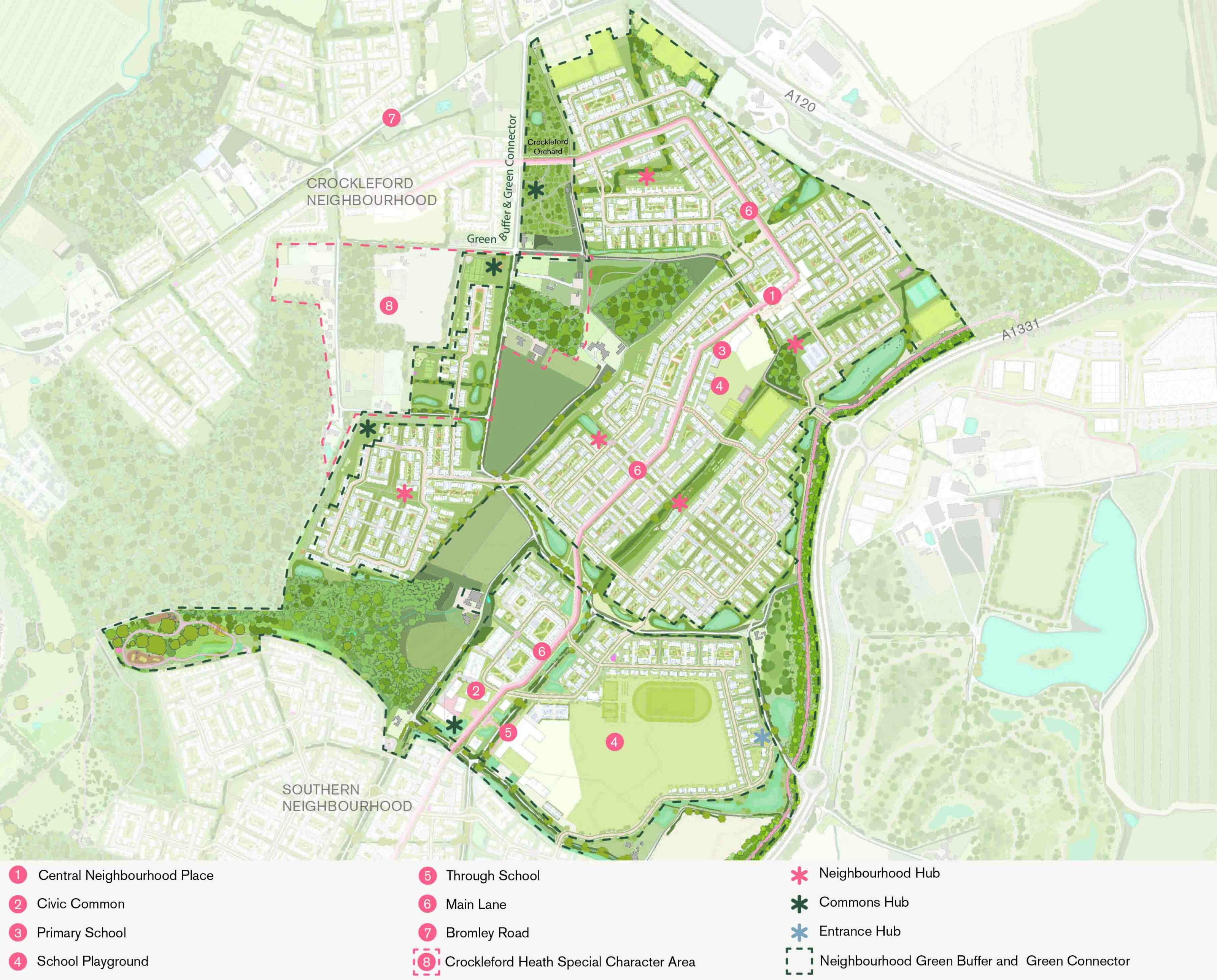
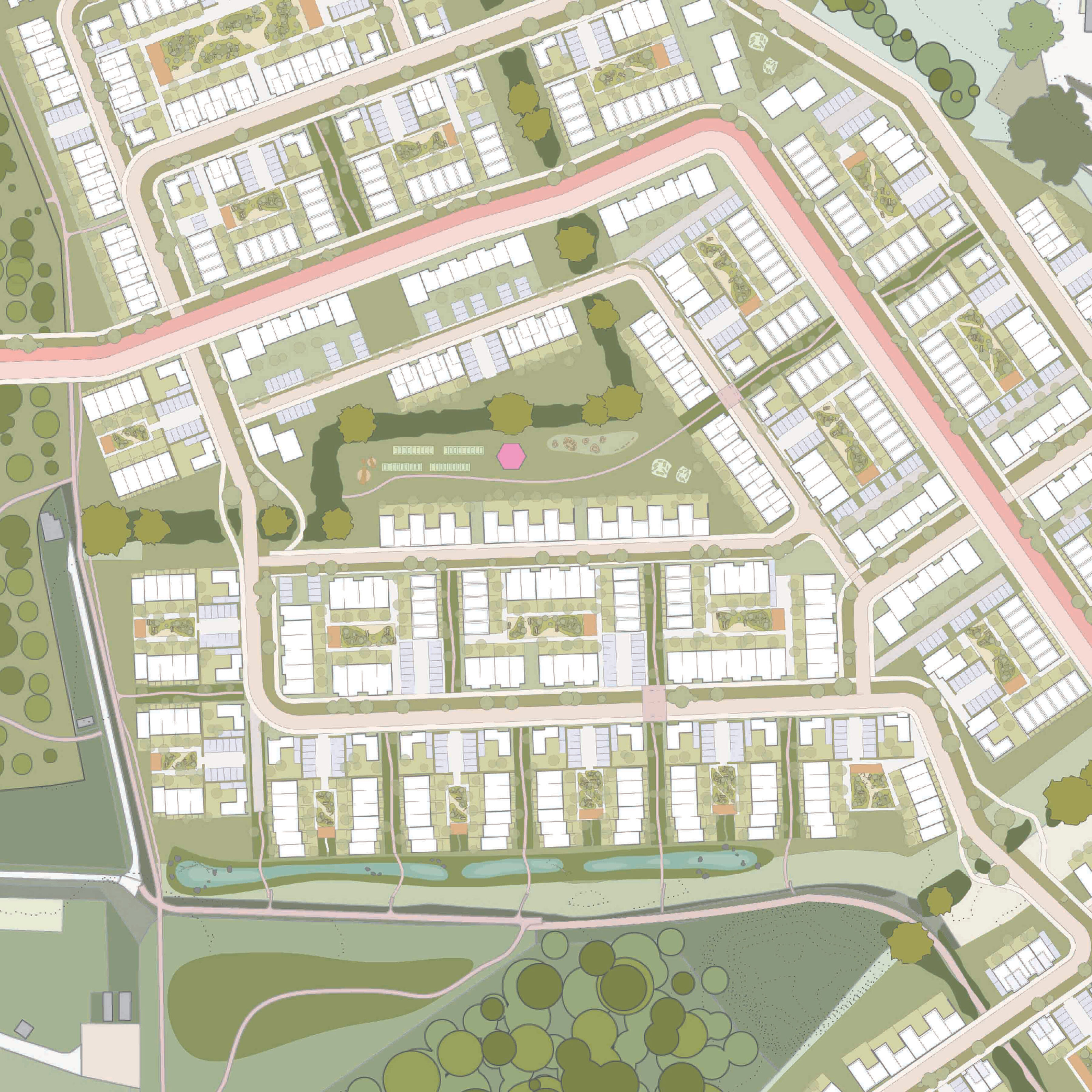
Existing blue and green structures on site Strengthening of existing hedgerow network, remedial work to local habitats Multi-point connection to proposed bypass Establishing three distinct neighbourhoods within the local landscape Adjacent employment hubs in relation to the new neighbourhoods Primary active travel and local public transport route connecting all neighbourhoods Site-wide strategy
Guided by the 20-minute neighbourhood concept, schools, health facilities, local shops, and vibrant spaces for work and play are positioned within a short walk of every doorstep.
Existing landscape structures define the boundaries of three neighbourhoods. Each neighbourhood has a central square, Neighbourhood Place, which offers commercial and community services. Connecting them is the Main Lane – a car-free, multi-modal active route between the three new neighbourhoods – Crockleford, Central and South.
Each of the three neighbourhoods has its own identity, with a distinct mix of home tenure, workplaces, shops and community life. Uses are clustered with intention to embed a spatial economy that is inclusive.
All three neighbourhoods are bounded by and connected via active travel corridors. The ‘Green Connectors’ run in parallel to over 30km of existing farm hedgerows that are retained and thickened with planted buffers across the whole site. Every home is within reach of one; simultaneously ecological corridors, cycle paths, and growing spaces.
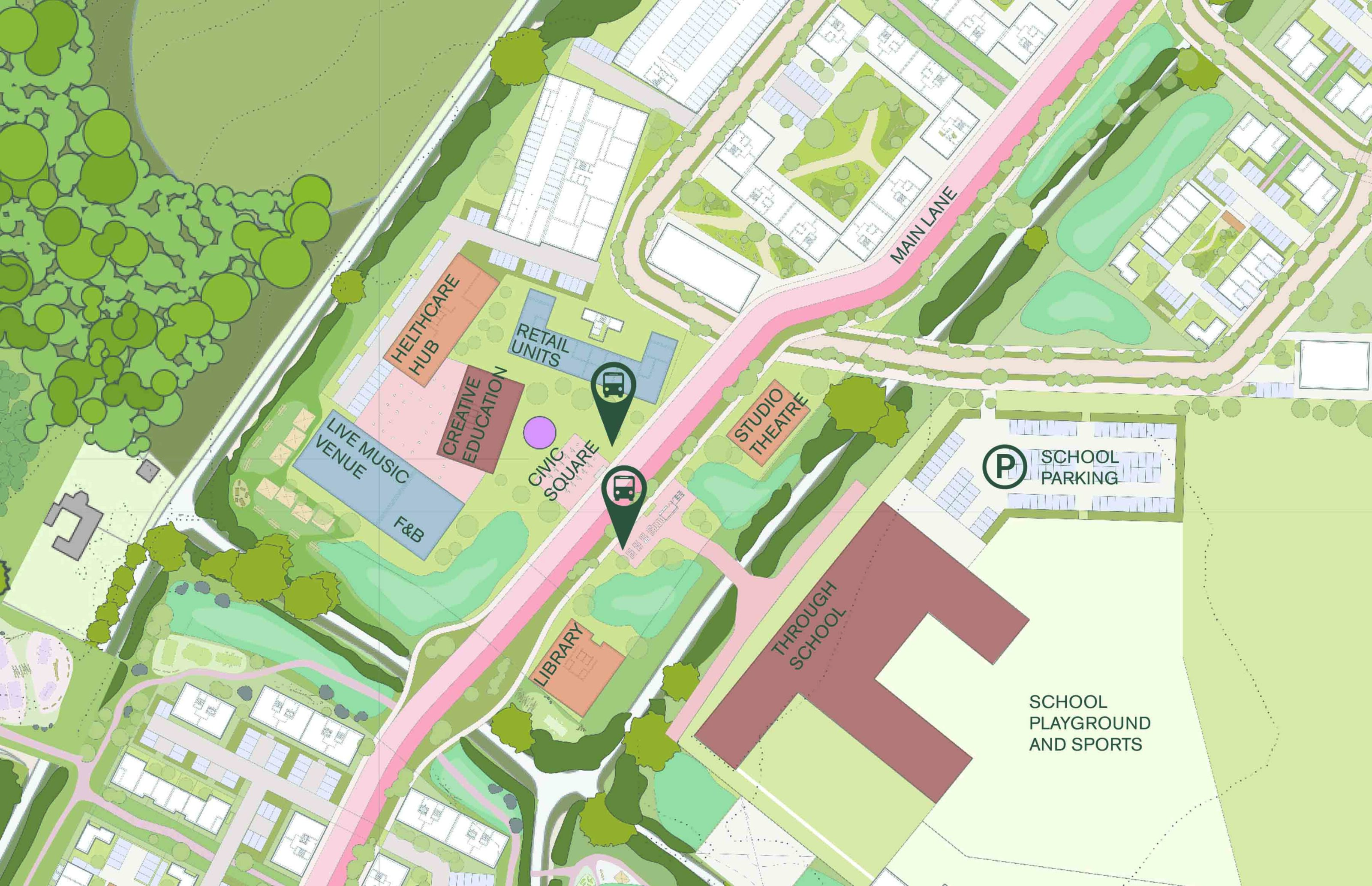
Illustration of the Civic Common Civic Common
While each of the three neighbourhoods have a green and a neighbourhood common, the Civic Common sits at the geographical centre of the Garden Community. As the primary public space, it brings together a healthcare hub, creative education, live music, a studio theatre, a library and Library of Things, and food and drink, all opening onto a single shared landscaped place. Most importantly, it is a common. This is significant for the Garden Community which has prioritized a green and economically neutral space over the usual formal commercial market square or high street.
Water
Water plays an important role in the public spaces across the masterplan.
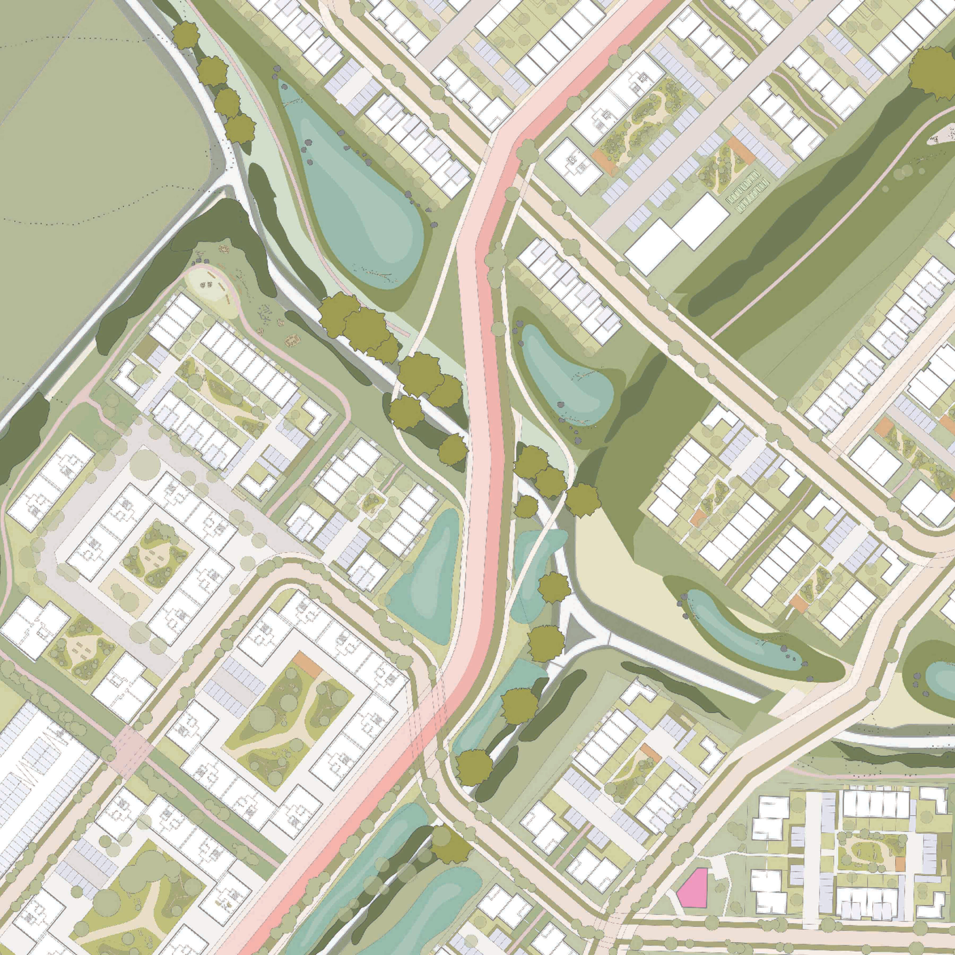
The existing network of hedgerow ditches, ponds, and brooks are retained and enhanced with surface water managed naturally from rooftop to river. The main attenuation features will comprise open, green, sunken detention basins that will serve as multifunctional spaces for play and learning, as well as important spaces for flood management.
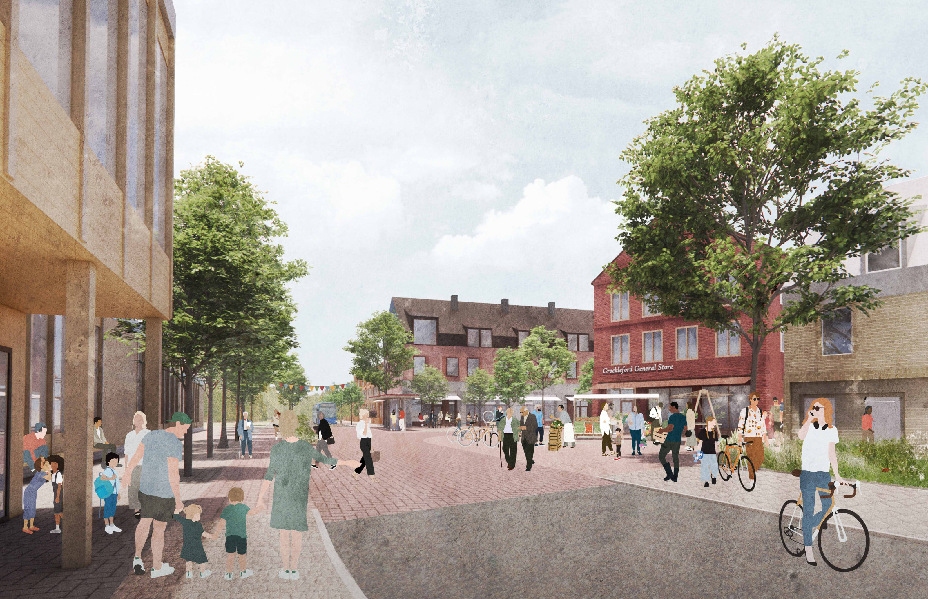
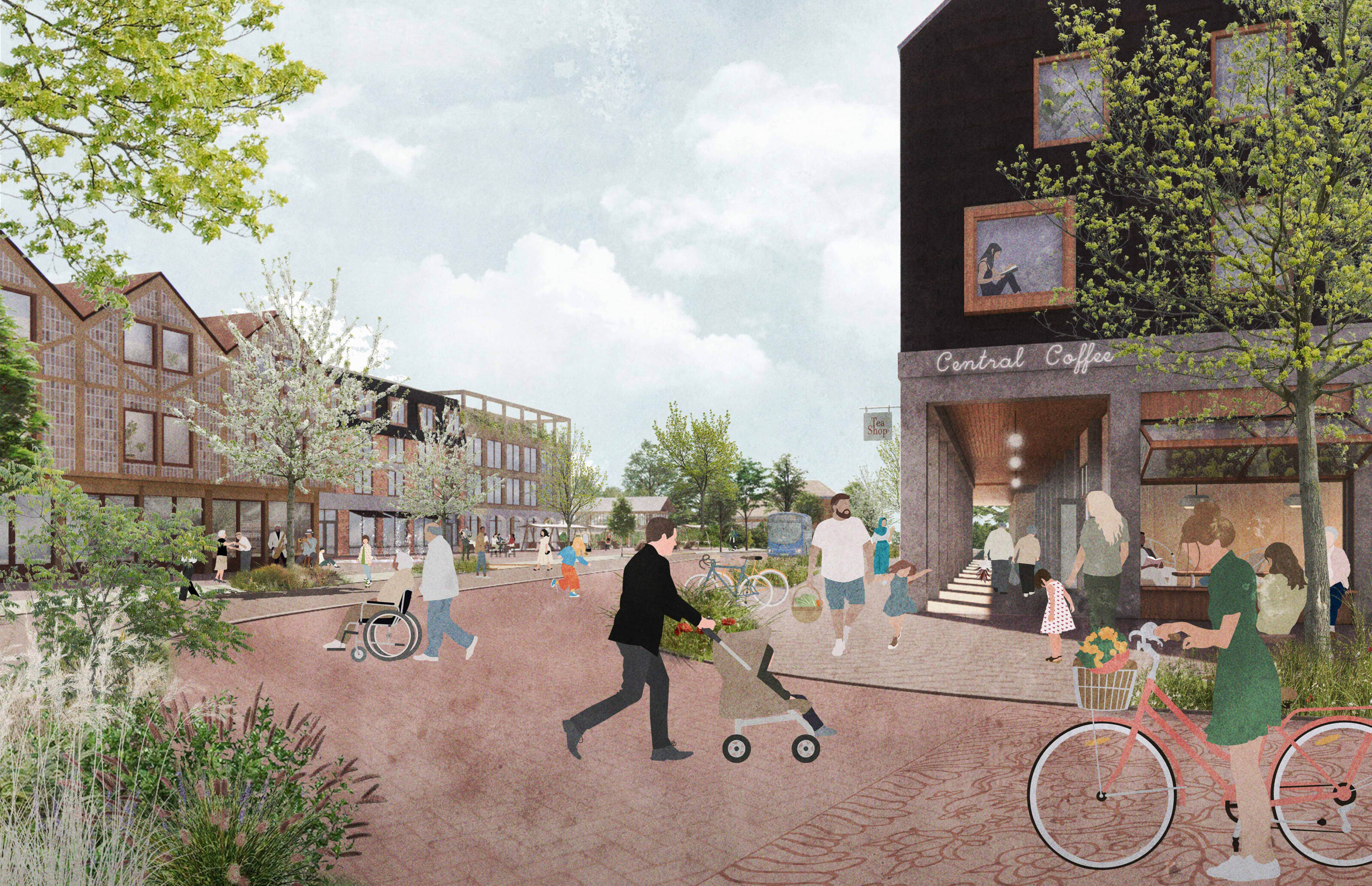
Illustrative visual showing Crockleford village square and school Crockleford Neighbourhood
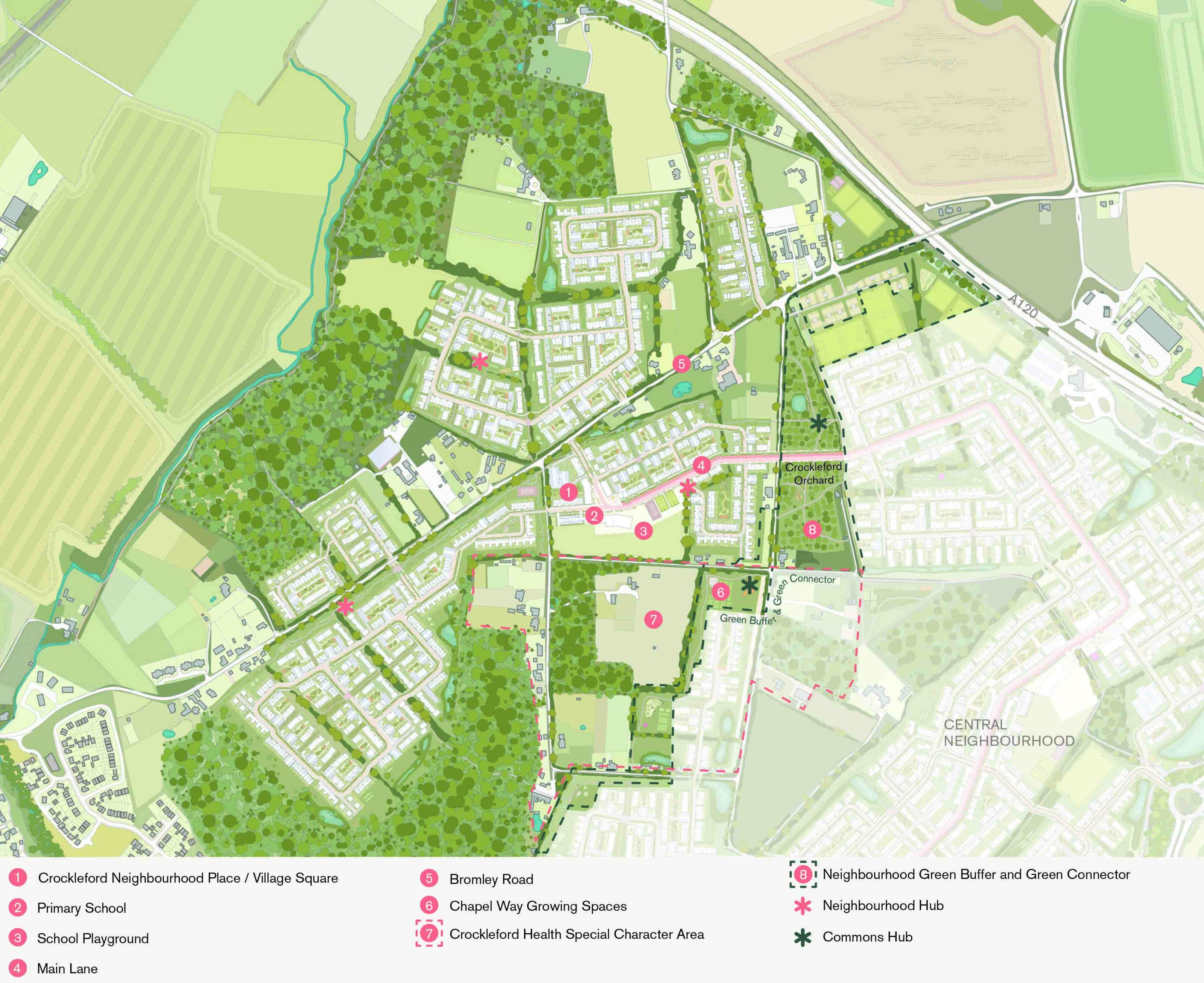
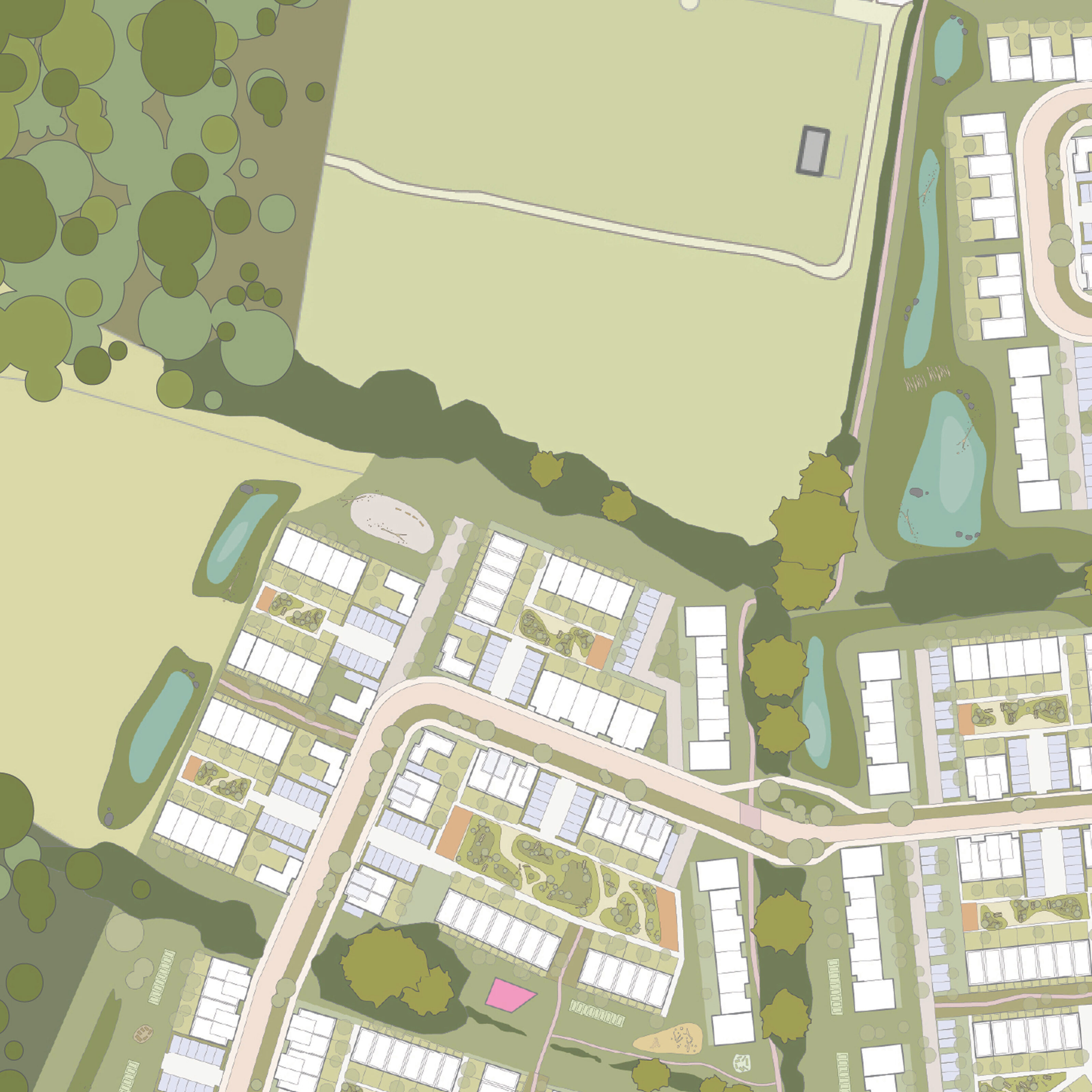
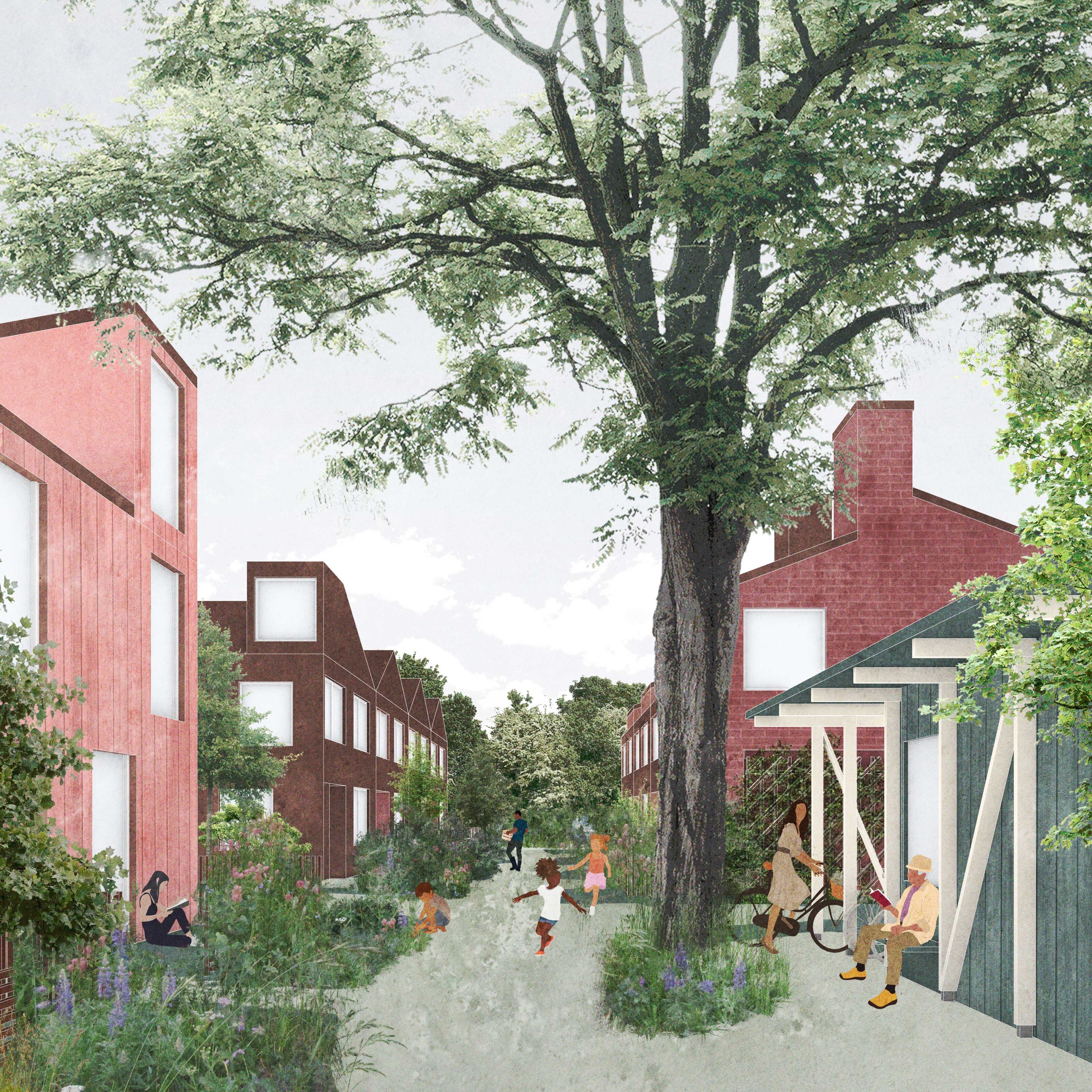
Shaped by its surroundings, Crockleford draws on the farmstead character and country lane grain of Crockleford Heath to create a neighbourhood that belongs to its place. Lower density is calibrated to context as a deliberate design decision.
The arrangement of each development parcel is formed by retaining the existing trees and hedgerows including an existing orchard to in turn shape the active movement network. The Green walks are pedestrian first walkways; quieter more intimate routes that respond to the hamlet settlement grain designed as scenic throughfares rather than active travel corridors.
Crockleford architecture draws from a survey of existing buildings along Bromley Road where the roof is the primary carrier of character; mansard roofs, Dutch mansards, low-slung thatch profiles, doubled gables and expressed dormers.
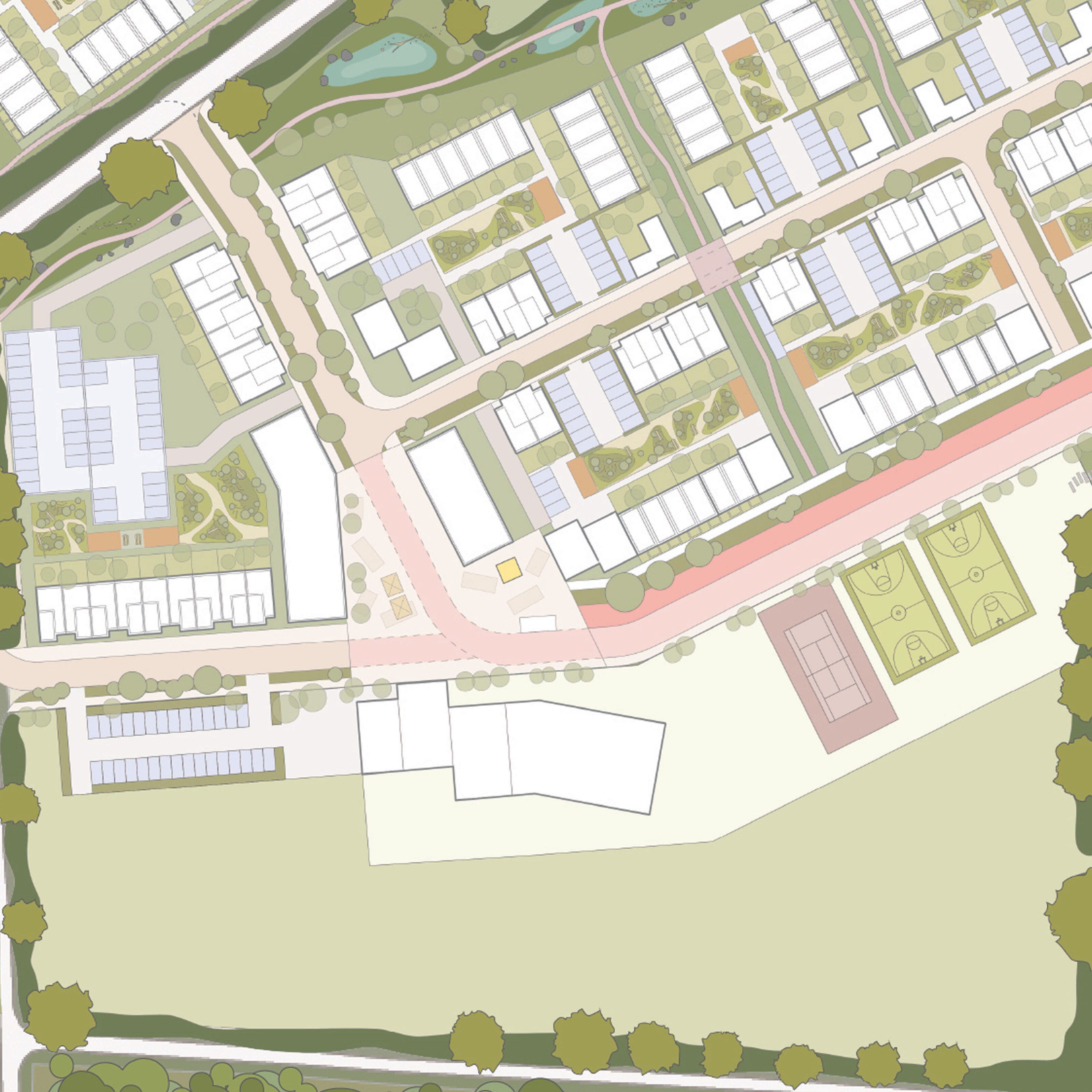
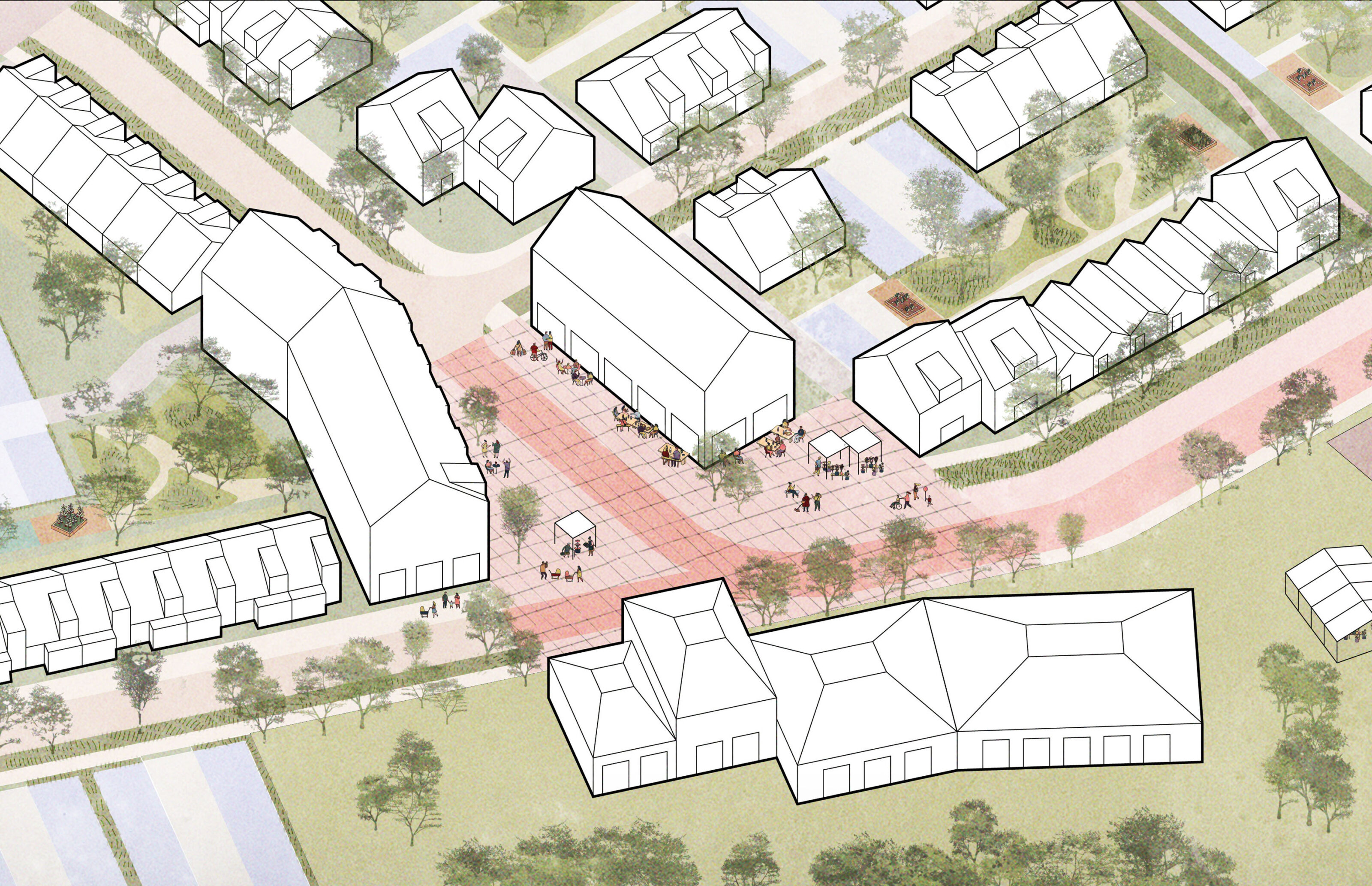
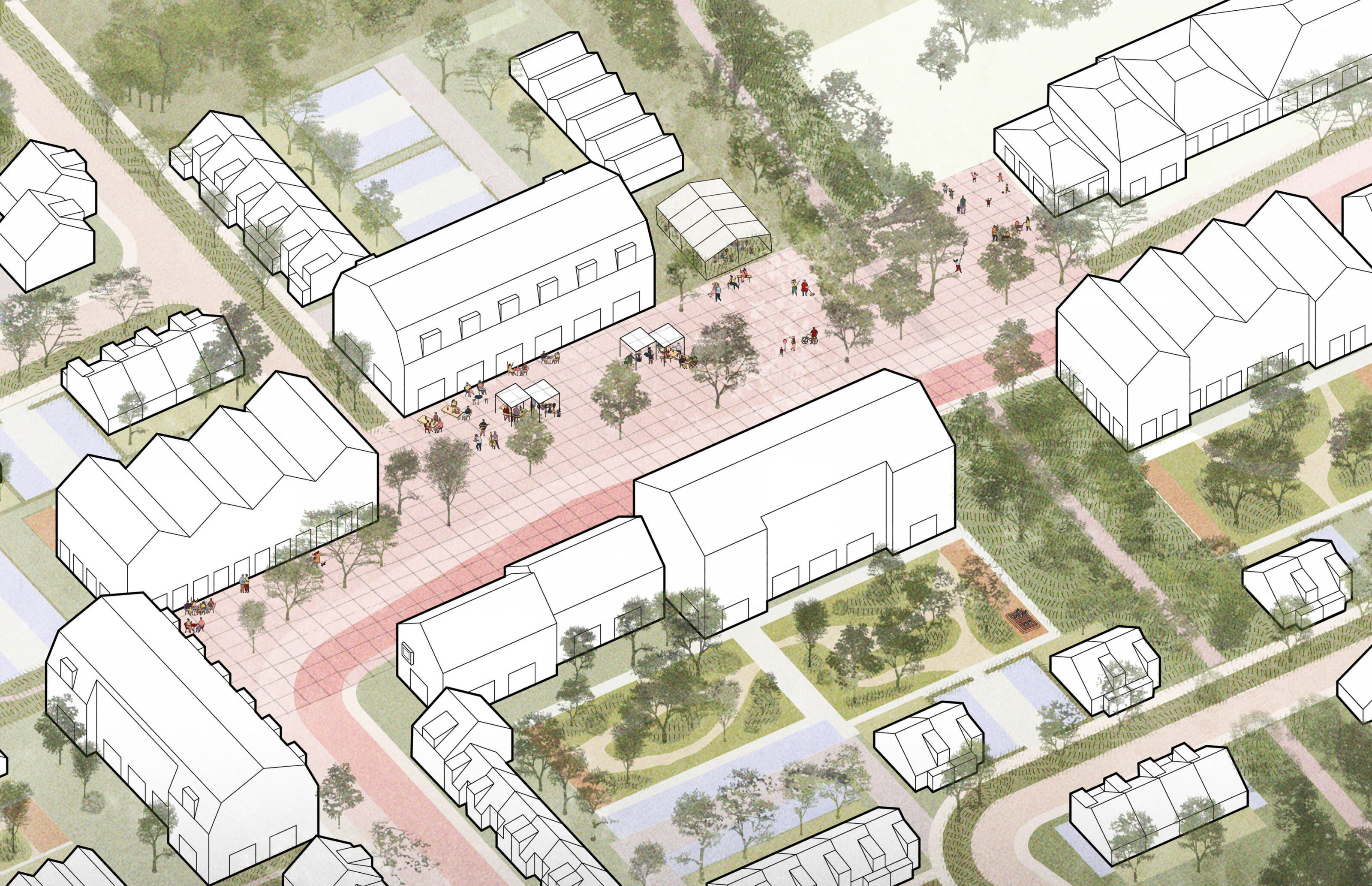
Neighbourhood clusters with ‘Green Connectors’ Crockleford school and village square Intersection of built form, green and blue infrastructure, and fields Axonometric view of Crockleford square and school Crockleford village square
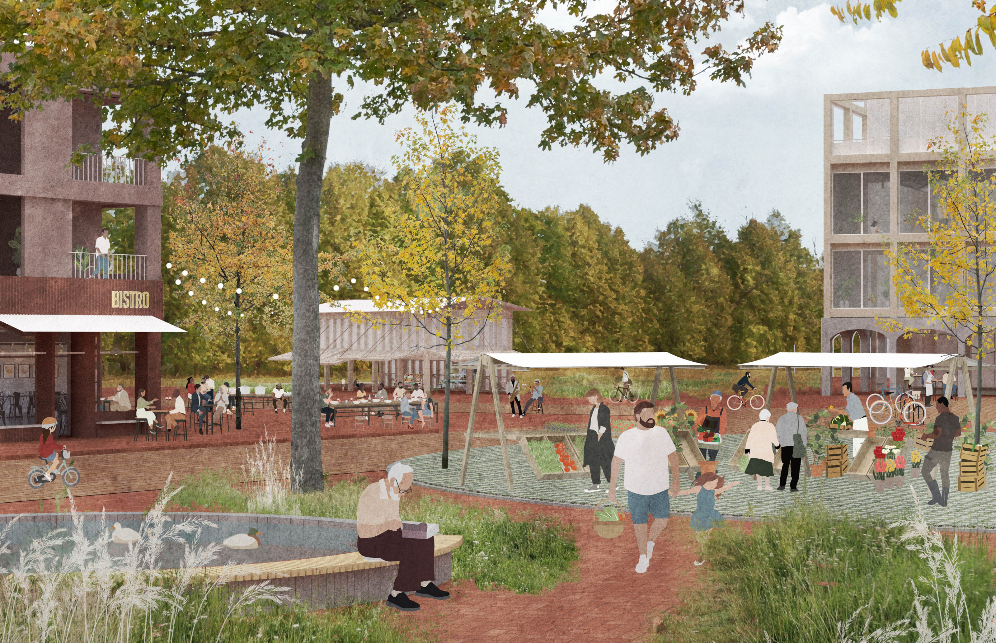
At the heart of Crockleford, the village square brings together the local bus and Main Lane terminus, the primary school entrance, and ground floor commercial space designed for loose-fit community use. The ground floor commercial space has been coded such that a mix of uses can shift and adapt as the neighbourhood grows. Farmers’ markets and seasonal festivals animate the public space, offering food grown in the orchards and growing corridors nearby.
Central Neighbourhood
The Central Neighbourhood is higher in density than its northern neighbour, with a larger offer of community services and functions. The masterplan strategy deliberately places the most significant civic places at the geographic centre of the neighbourhood, in equal parts for activity and accessibility.
The Central Neighbourhood’s urban frontages are divided into distinct types: the ‘Edge Condition’, Main Lane, and the ‘Green Connectors’. Each of these conditions plays a significant role in defining the neighbourhood’s character and relationship with its surroundings.
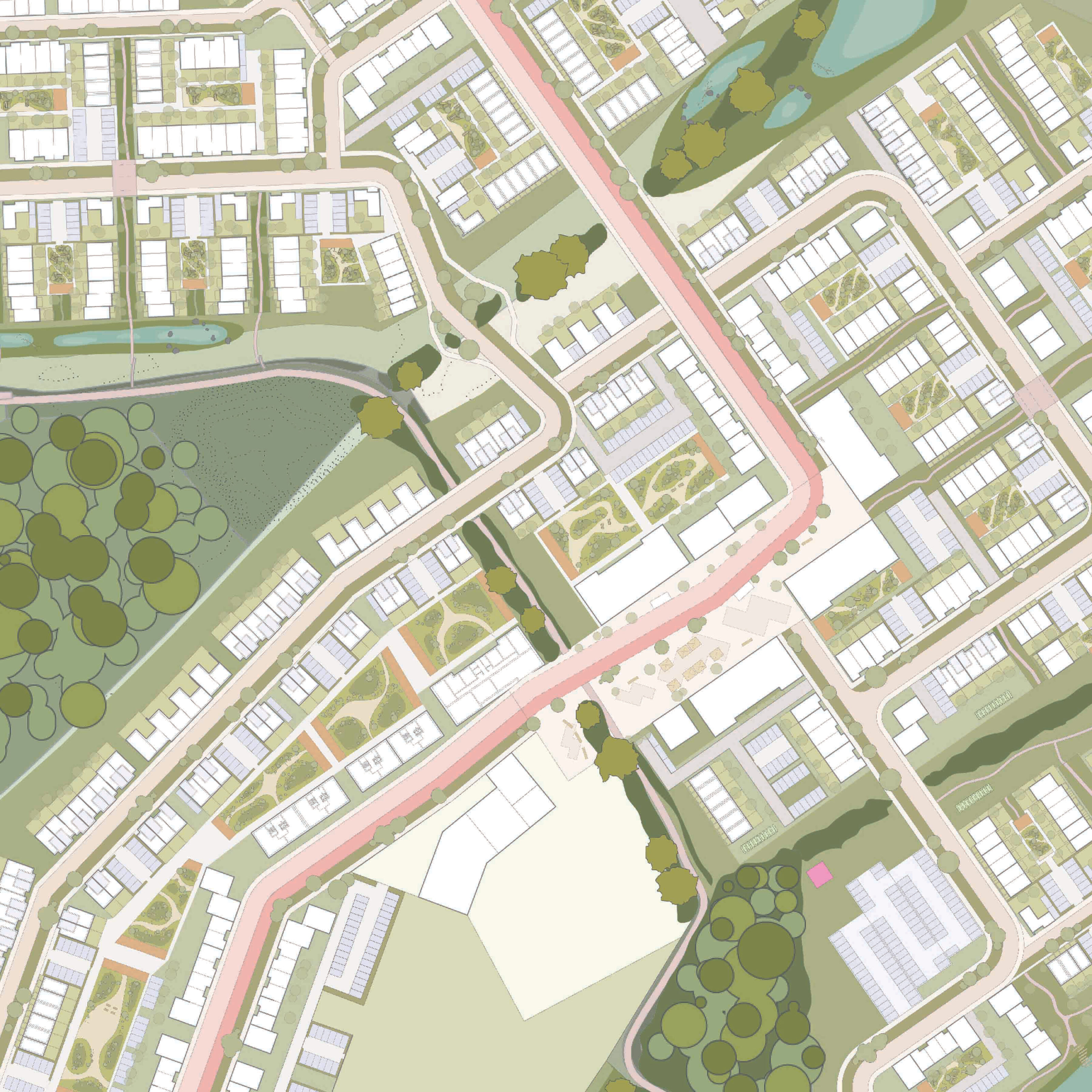
Central Neighbourhood Place Main Lane traverses blue and green infrastructure Central Neighbourhood Place
The Neighbourhood Place serves the rhythms of everyday life – shops, services and the things you need close to home.
Buildings around the Neighbourhood Place step up to three and four storeys, creating a denser urban grain than the streets beyond. Continuous frontages line Main Lane, reinforcing its role as the primary active travel spine through the neighbourhood. Corner buildings rise to the upper end of that range – more deliberate in their massing, anchoring the civic fabric of the square. The shift in scale is gradual, reading as a natural concentration of the neighbourhood rather than an imposed centre.
‘Good places are cultivated. The masterplan holds a long horizon – knowing that streets, transit lines, and green corridors will arrive in stages. The community itself will grow into new ways of moving, living, and relating to place.’
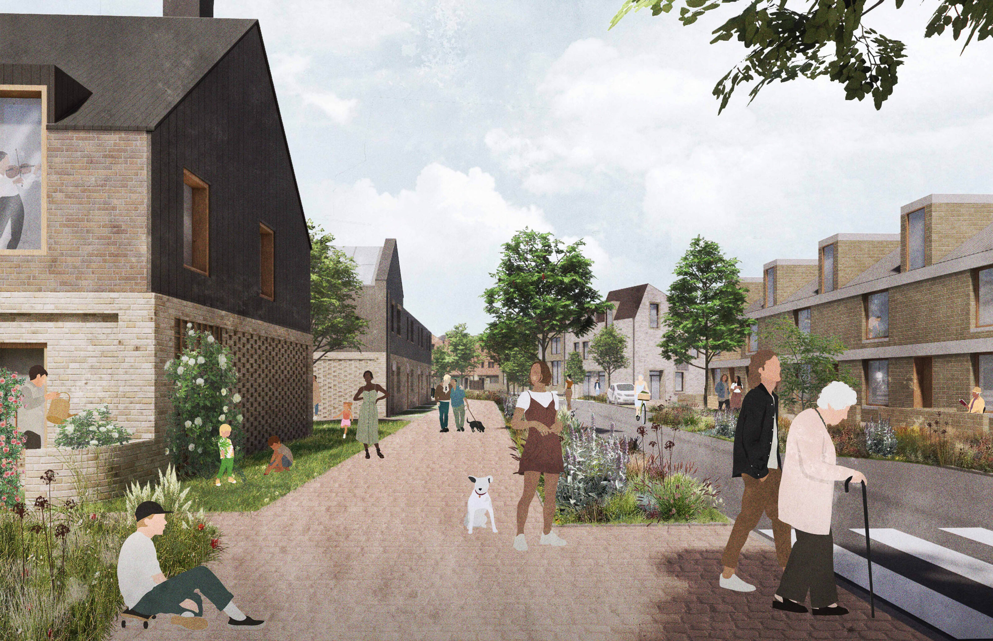
Illustrative view of a home street Good homes
The masterplan aims to provide high-quality housing with a mix of tenures that is sensitive to the local built context and landscape surroundings. A mix of housing types and tenures will be included across the Garden Community to create a thriving, diverse community and to support affordability.
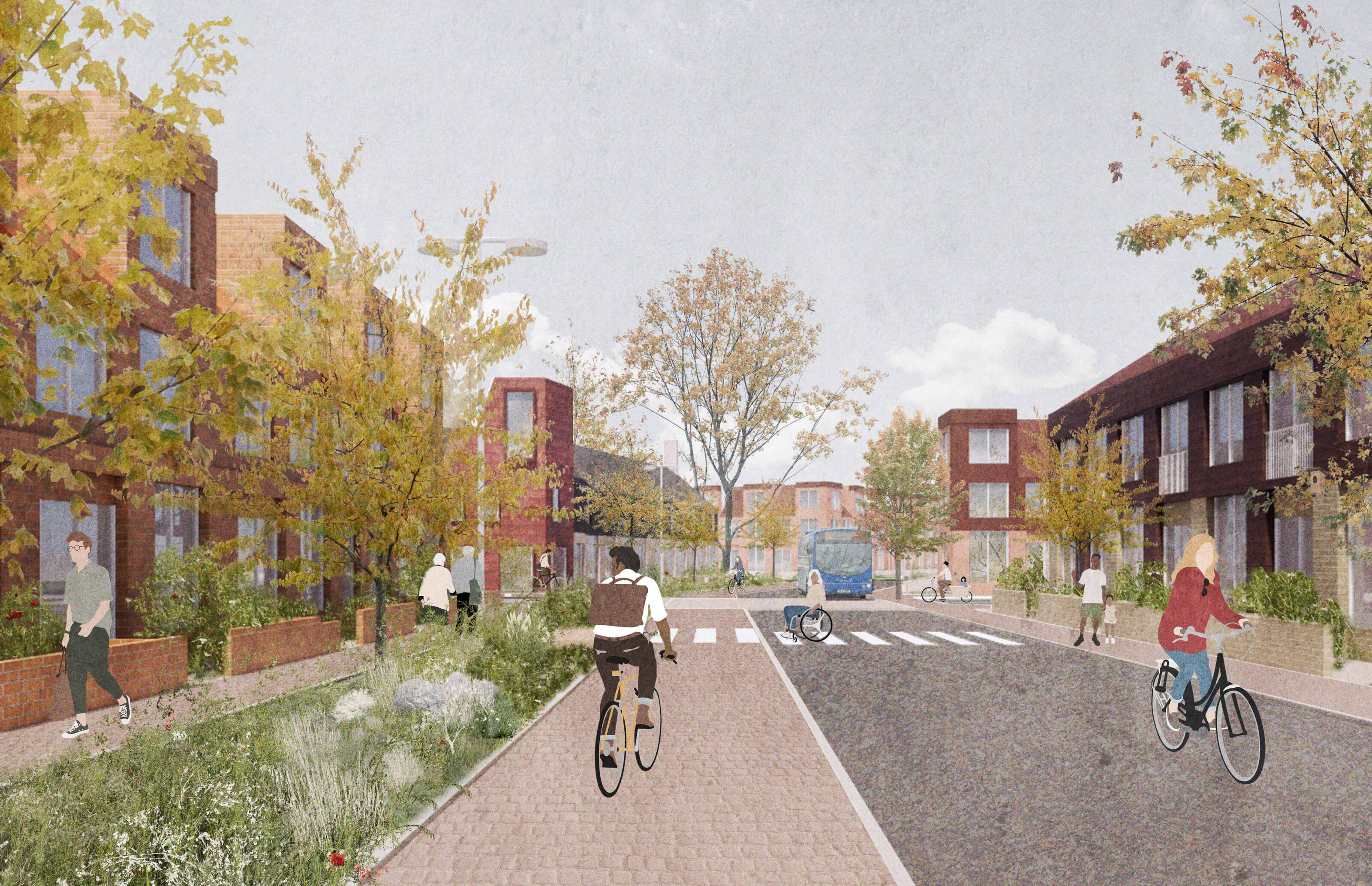
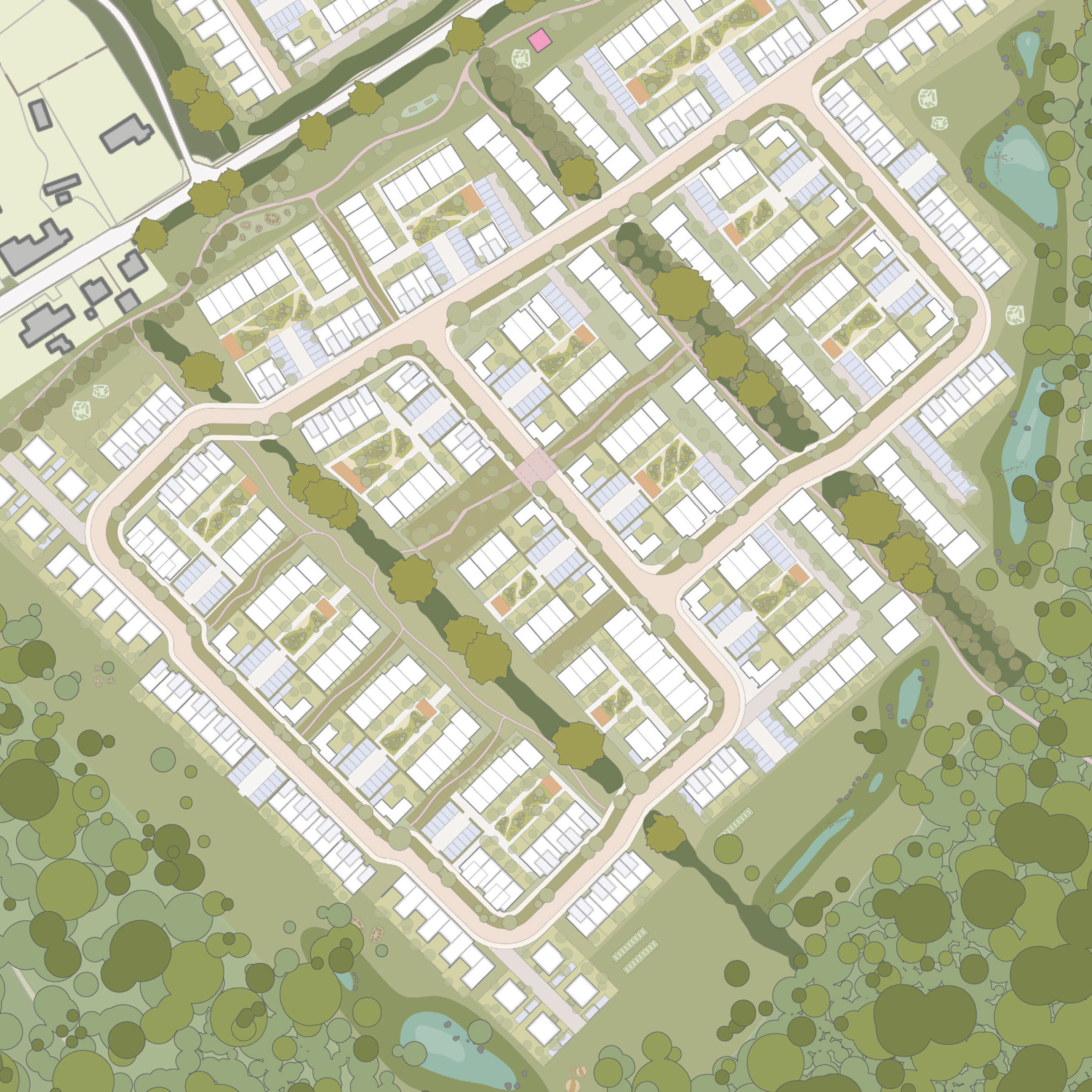
Anchoring the focus of walkability, homes are arranged into ‘Garden Clusters’, which are dwellings organised surrounding a large, shared open space and car access limited to one or two sides.
Clusters should have elements of both private and shared amenity spaces to encourage community and social interaction from home. There are a range of different garden types within the Garden Community that include shared garden spaces, semiprivate garden spaces and private back gardens with shared amenities.
Illustrative view of a primary street Grown, gathered, grounded
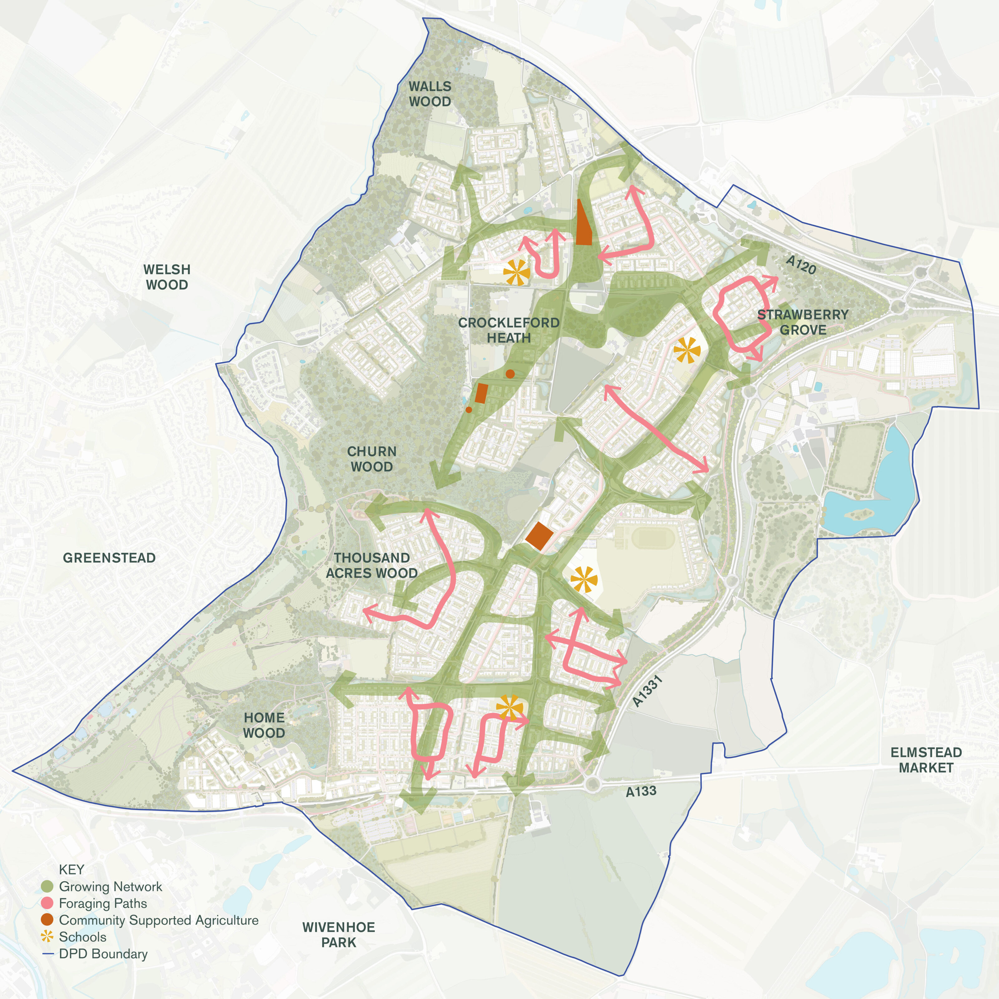
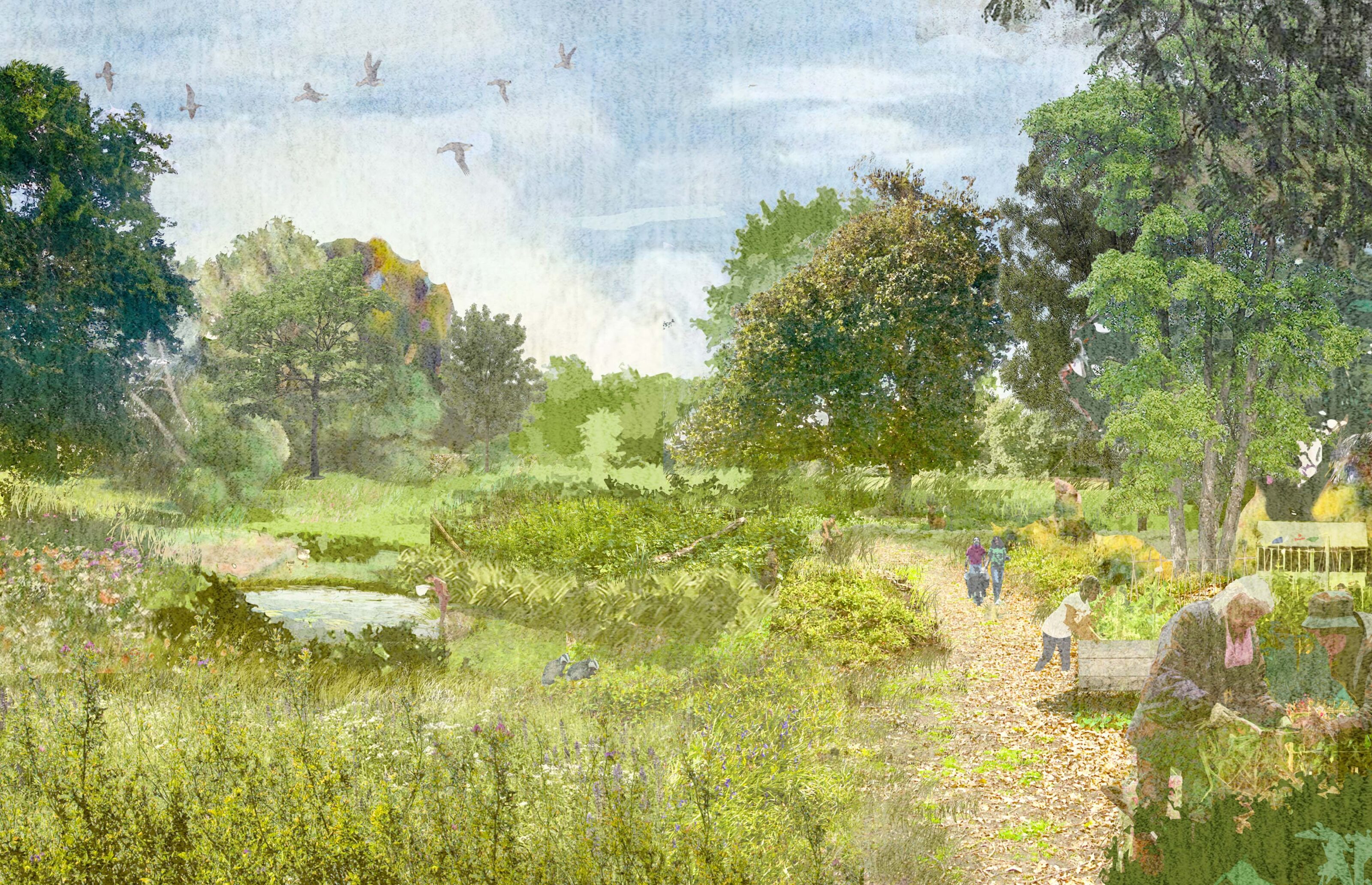
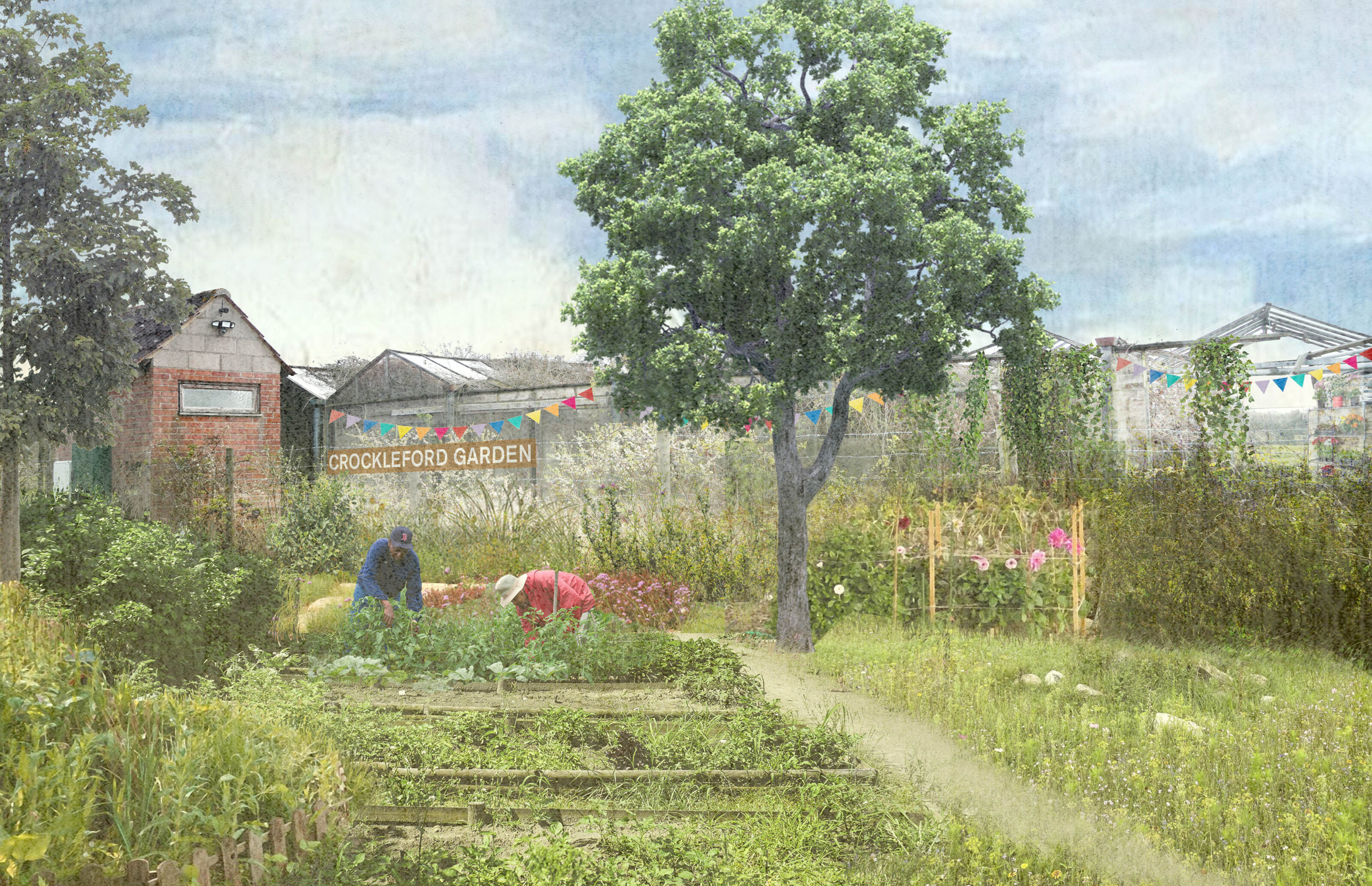
The Garden Community is one of very few new places in England to embed food growing as a core design principle rather than an amenity afterthought. The garden communities growing strategy promotes self-sufficiency and alternative models to build community wealth. The growing network is a central spine weaving through all three neighbourhoods, with foraging routes and community agriculture sites strategically located close to schools.
Chapel Way joins Crockleford with the Central neighbourhood, re-imagining the traditional agrarian margin into a multifunctional ‘grow space’ where raised beds, container gardens, and organic permaculture plots are woven through the landscape.
Crockleford Orchard represents the rich heritage of horticultural practices passed down through generations, each season preserving a slice of community’s history and living memory through harvest.
Illustration showing soft transition zone from protected ecological zones to the residential development area. Image credit: Periscope. Place for community growing. Image credit: Periscope. Design quality
Latimer set the brief for the Garden Community to be ‘England’s most sustainable and inclusive town.’
Over three years the project team engaged with a range of forums to test the brief; Essex Young Designers, public roadshows and independent Quality Review Panels.
In order to lock in quality over the term of delivery, a robust design code was designed, while a live digital twin is planned to monitor how the community performs post occupancy.