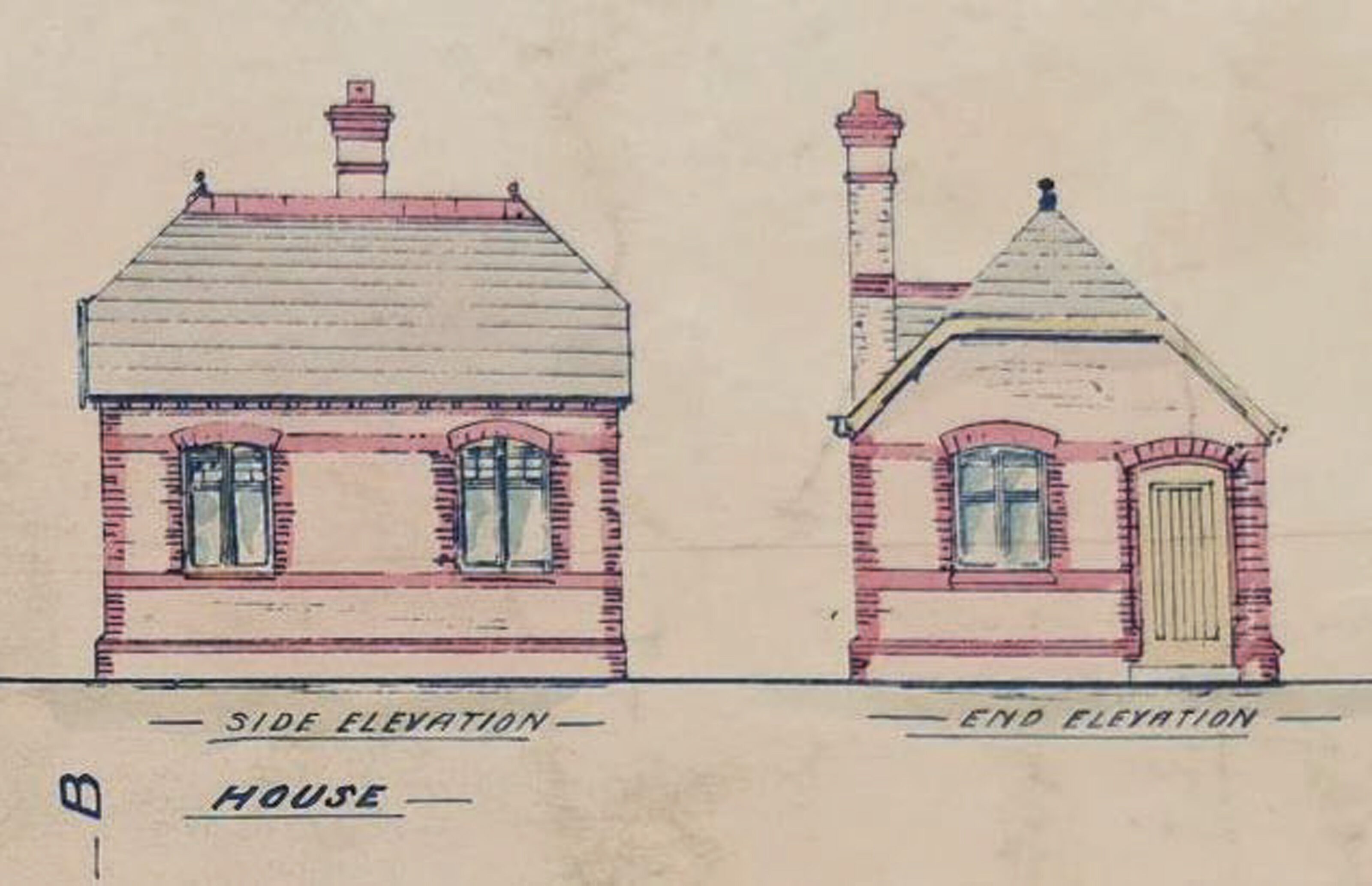
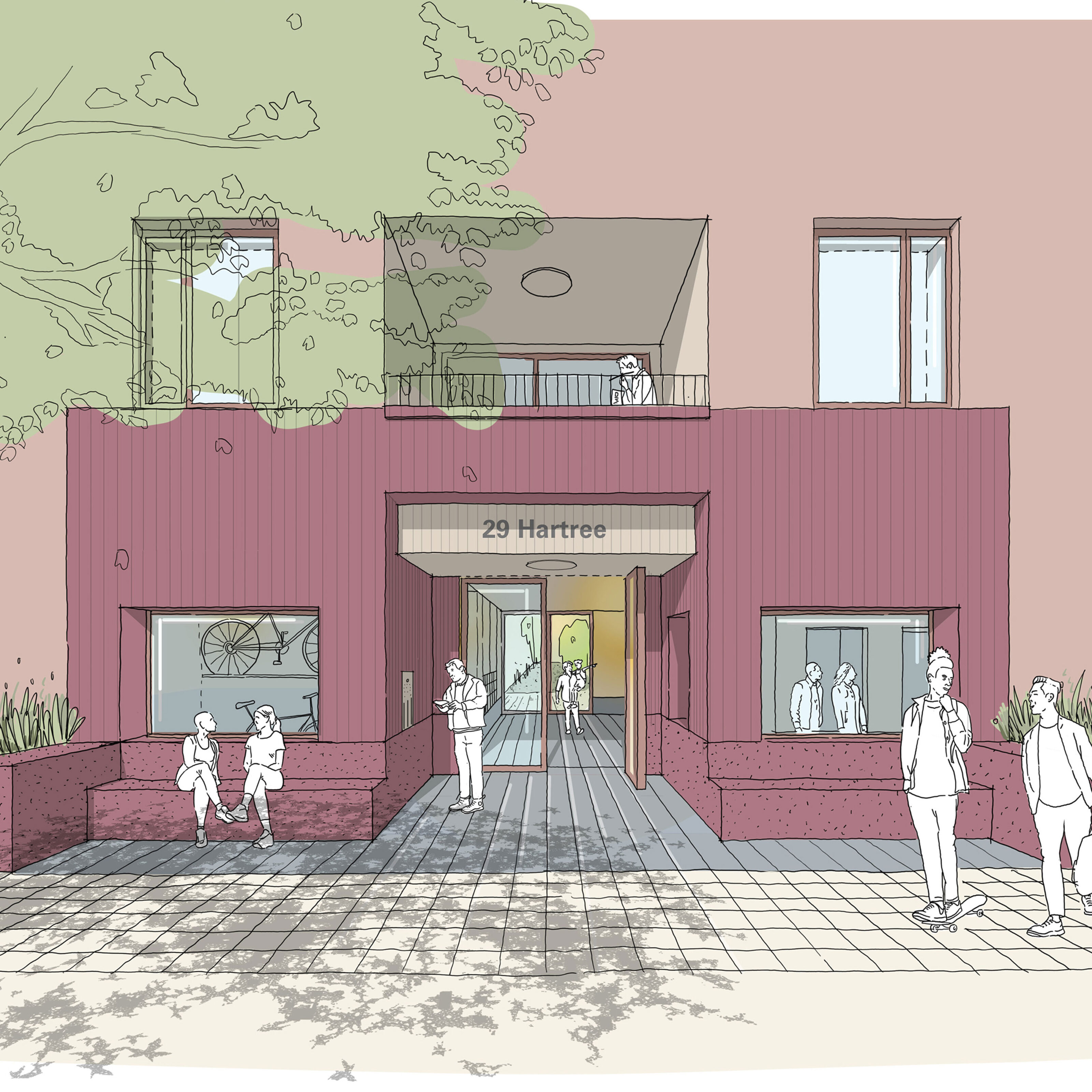
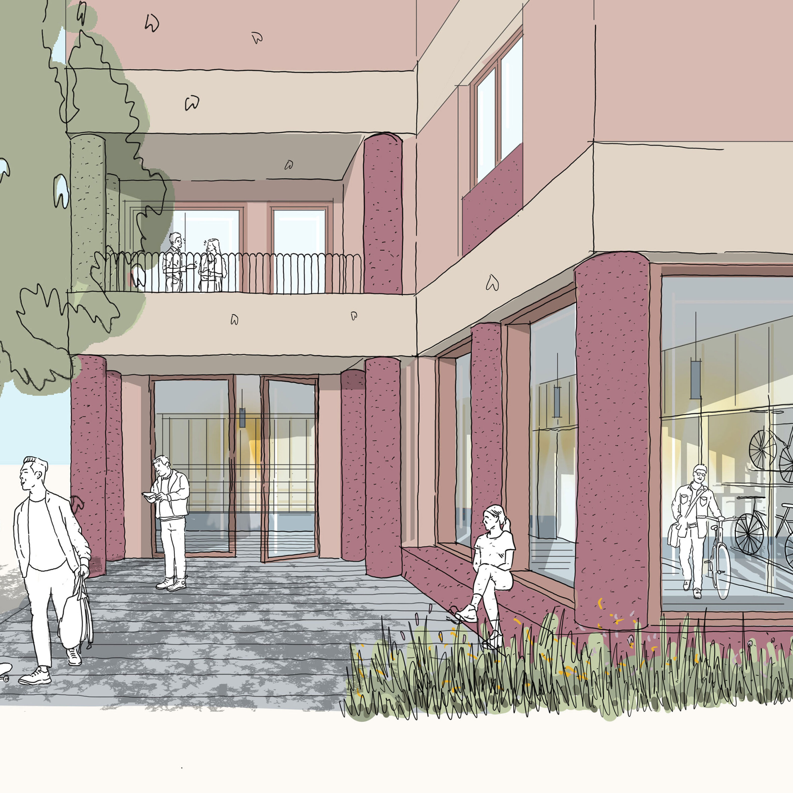
Three images by Bell Phillips Architects exploring the entry spaces for apartment blocks and terraces housing. Focus was given to exemplar access to bike and pram storage, level thresholds, integrated seating and covered shaded zones.
Hartree
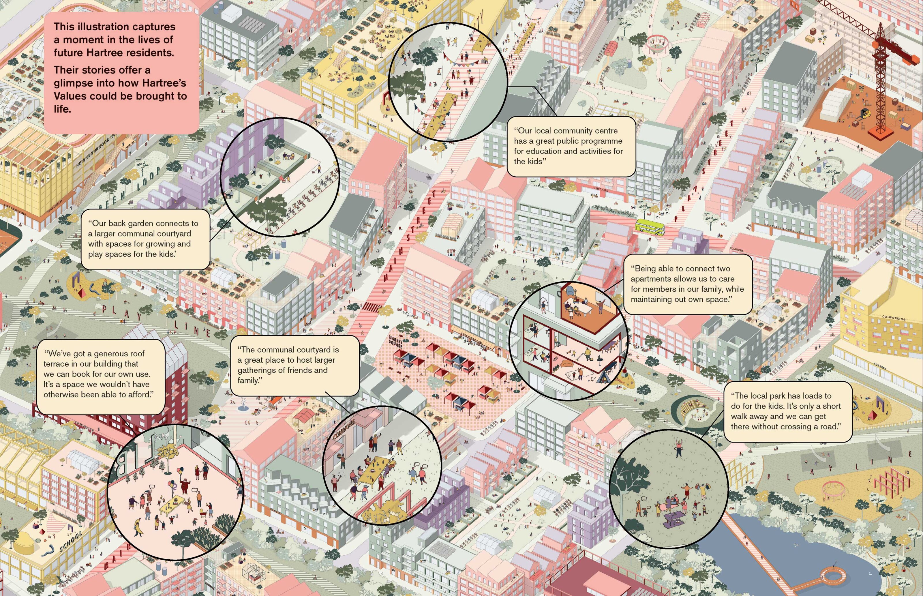
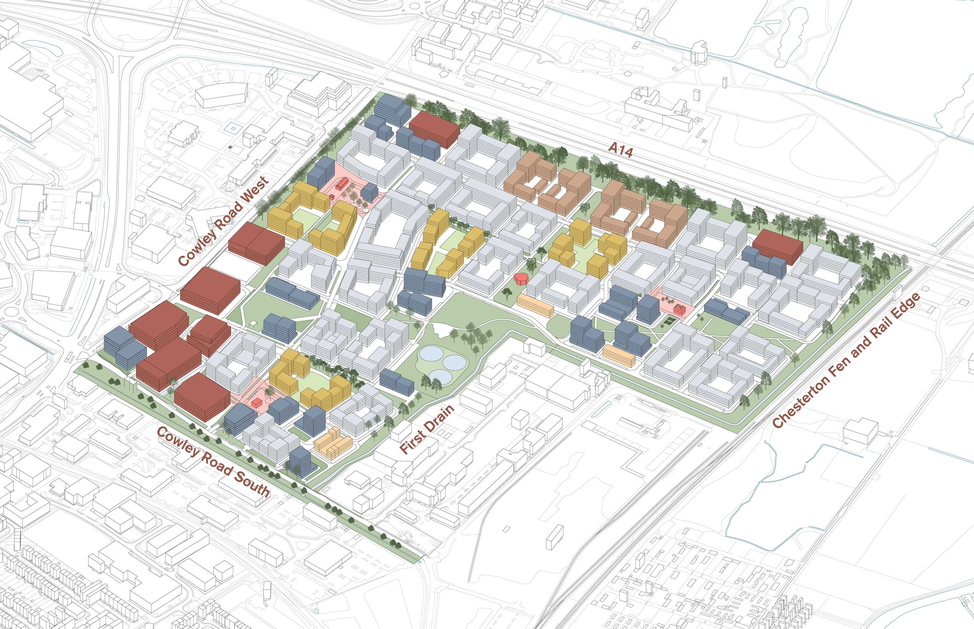
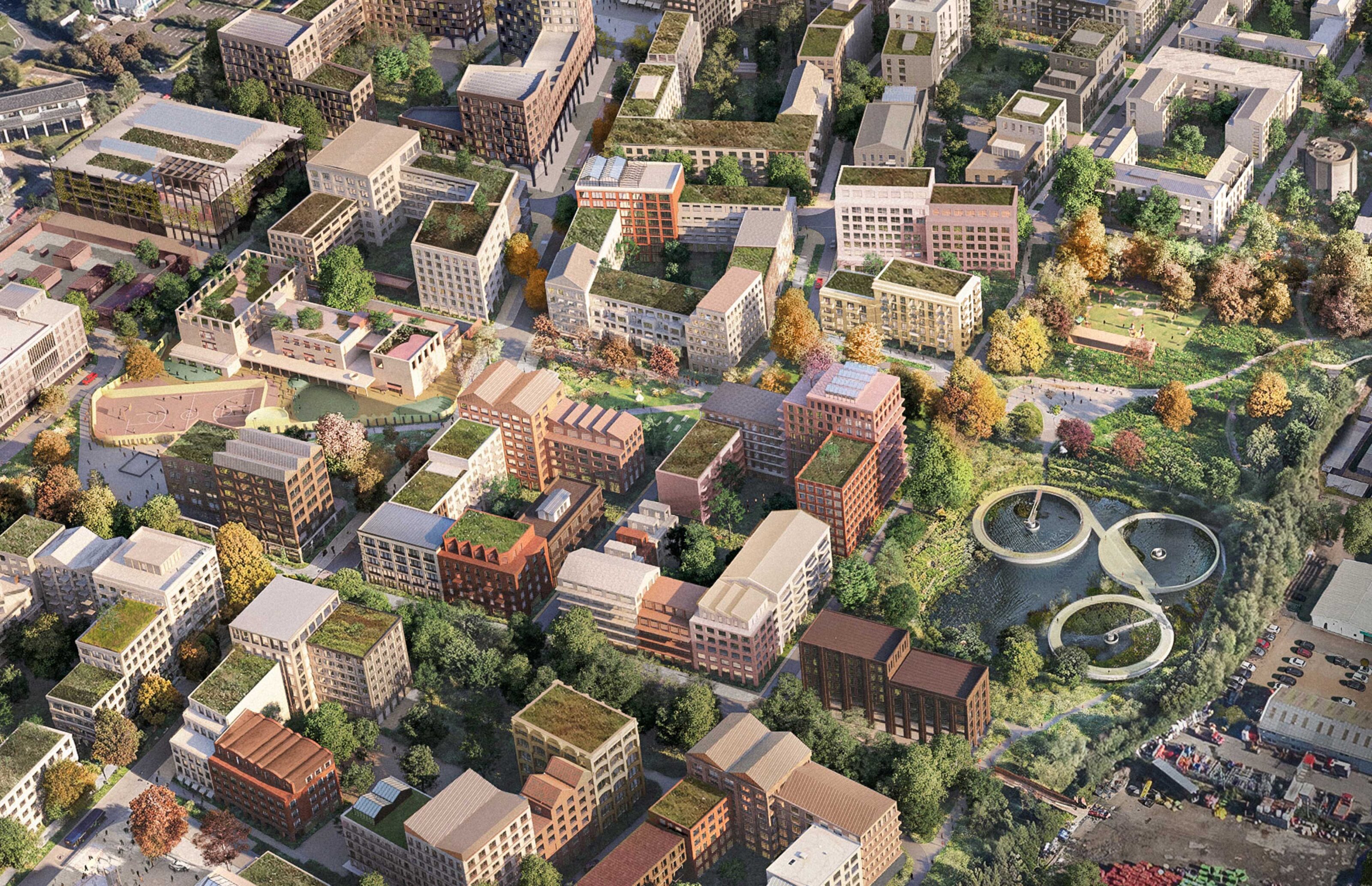
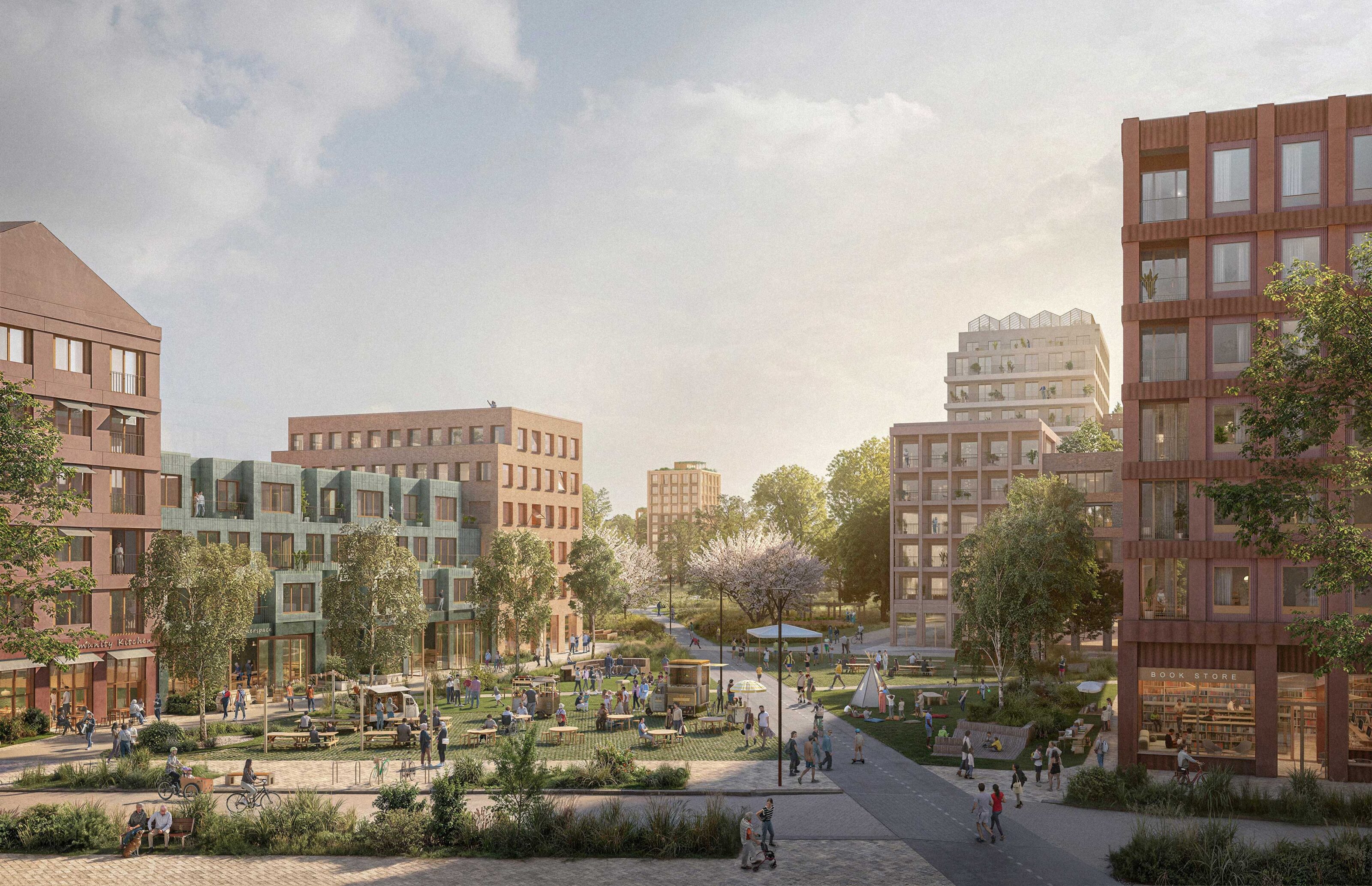
Hartree will be a transformative, sustainable, inclusive, and affordable community – a distinctive place where a population of over 11,000 will shop locally and put down roots and be a part of their neighbourhood. The project is the last large strategic brownfield site in the emerging district of Northeast Cambridge, which aims to create a sustainable economic and employment ecosystem, fuelling jobs, business growth and innovation. A bespoke and practical Sustainability & Quality of Life Framework guided decision-making processes to ensure aspirational targets were measurable and deliverable.
Kjellander Sjöberg was appointed to lead the masterplan process and to develop the vision to outline planning stage in a tight client collaboration with regeneration specialist LandsecU+I and profit-with-purpose developer TOWN. The project was a joint venture with landowners Cambridge City Council and Anglian Water.

A new urban quarter with three promises
Hartree’s Promises & Values embody the spirit of Hartree, guiding the project through its briefing, design, and development stages. They are central to the Sustainability & Quality of Life Framework and are reflected in our Design Principles.
A place that is inclusive, sustainable, and anchored to its unique heritage and the adjacent Fen landscape.
In and of Cambridge – local context
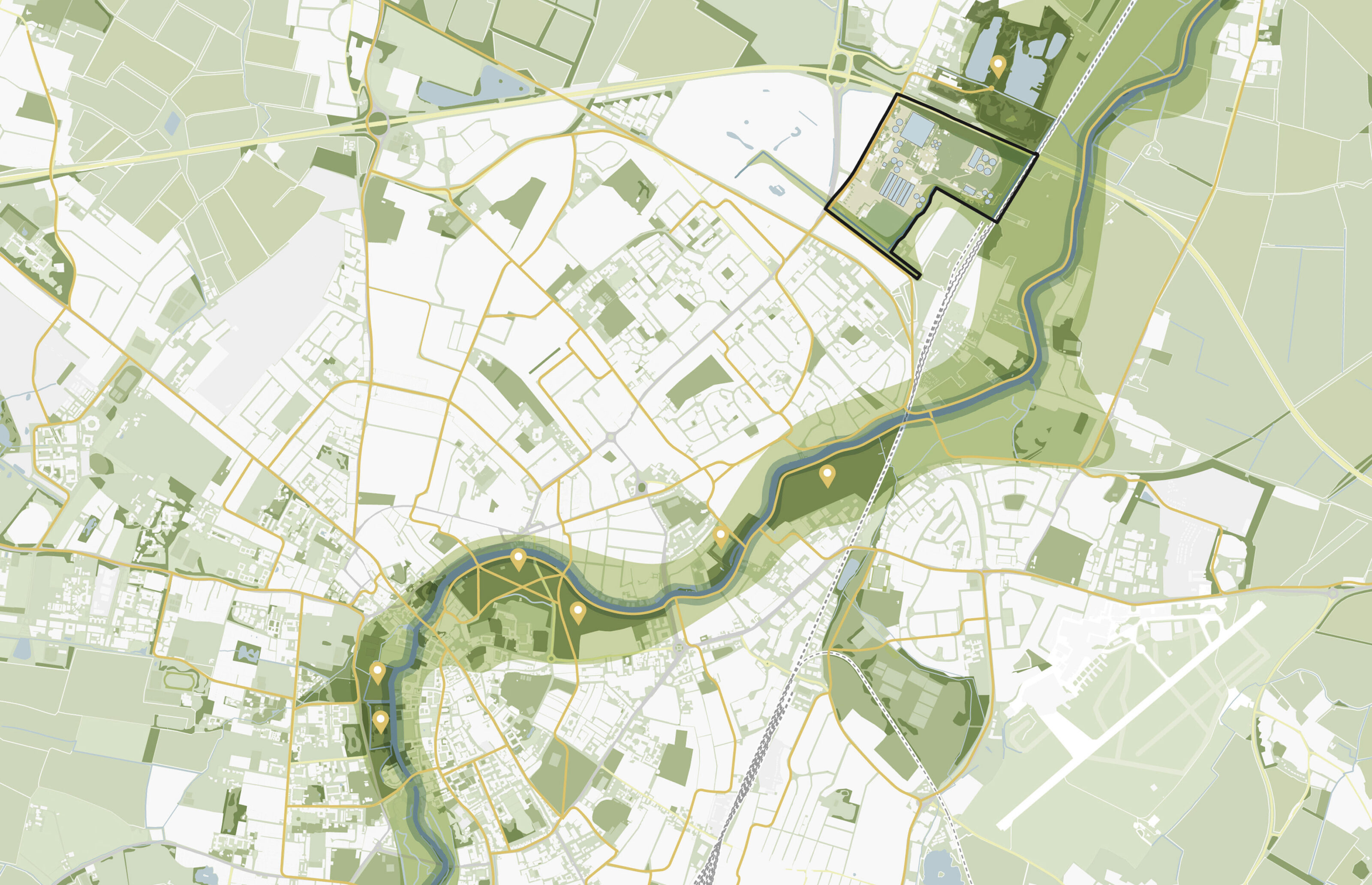
Cambridge’s existing green and blue network is a character defining feature of the city, linking urban areas to its broader farming and country landscape. The North-east [AW1] Cambridge area is driven by a focus on education, innovation, and employment.
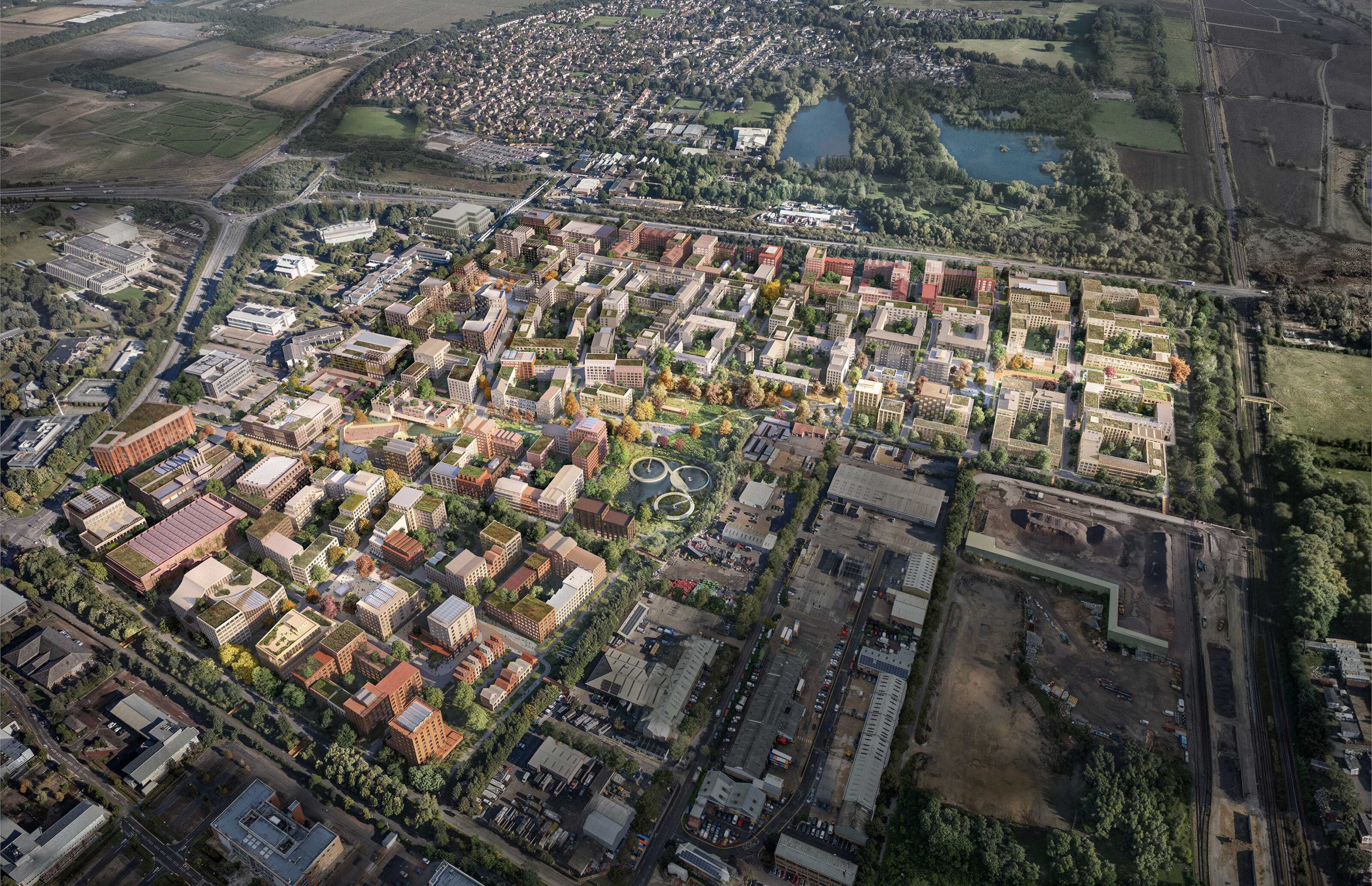
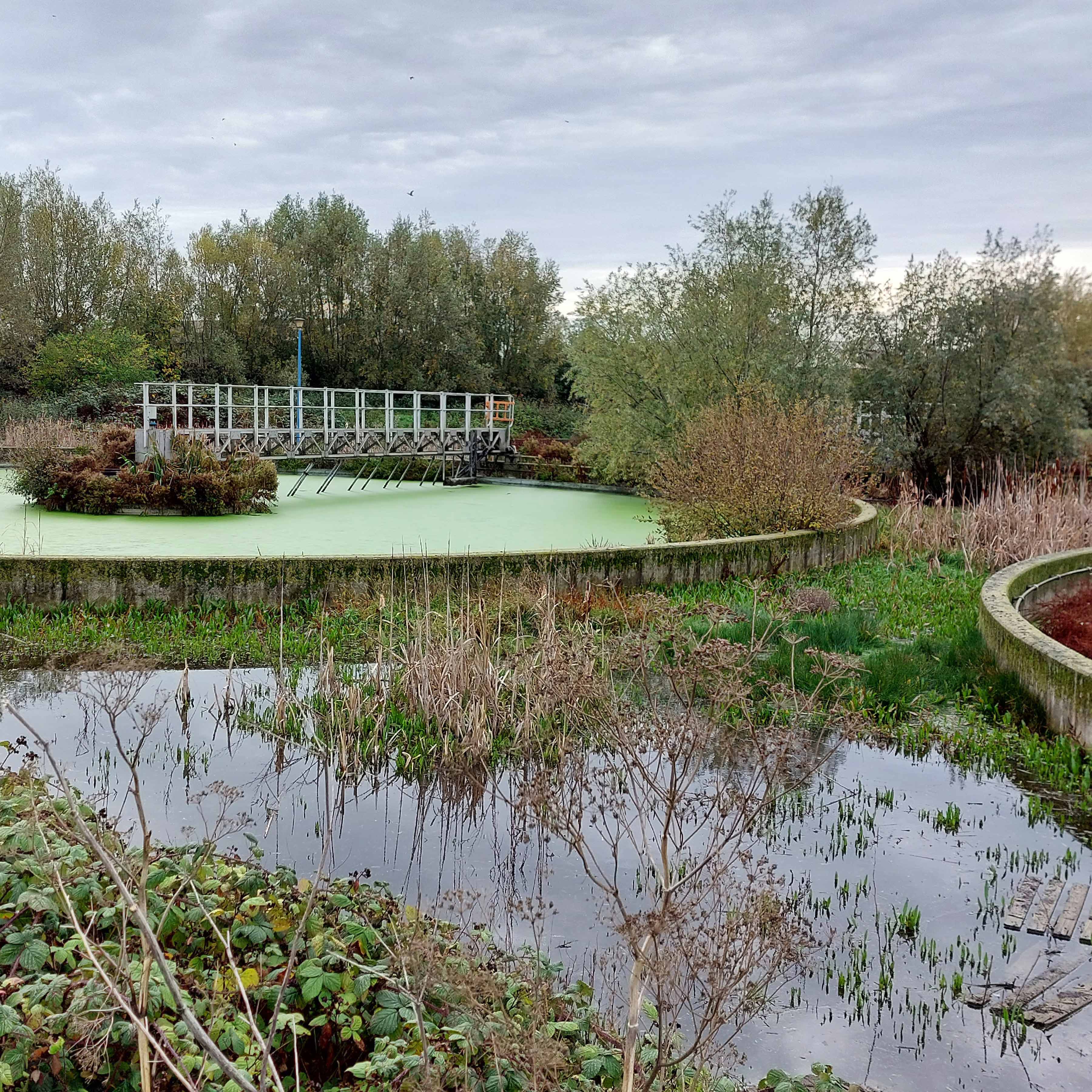
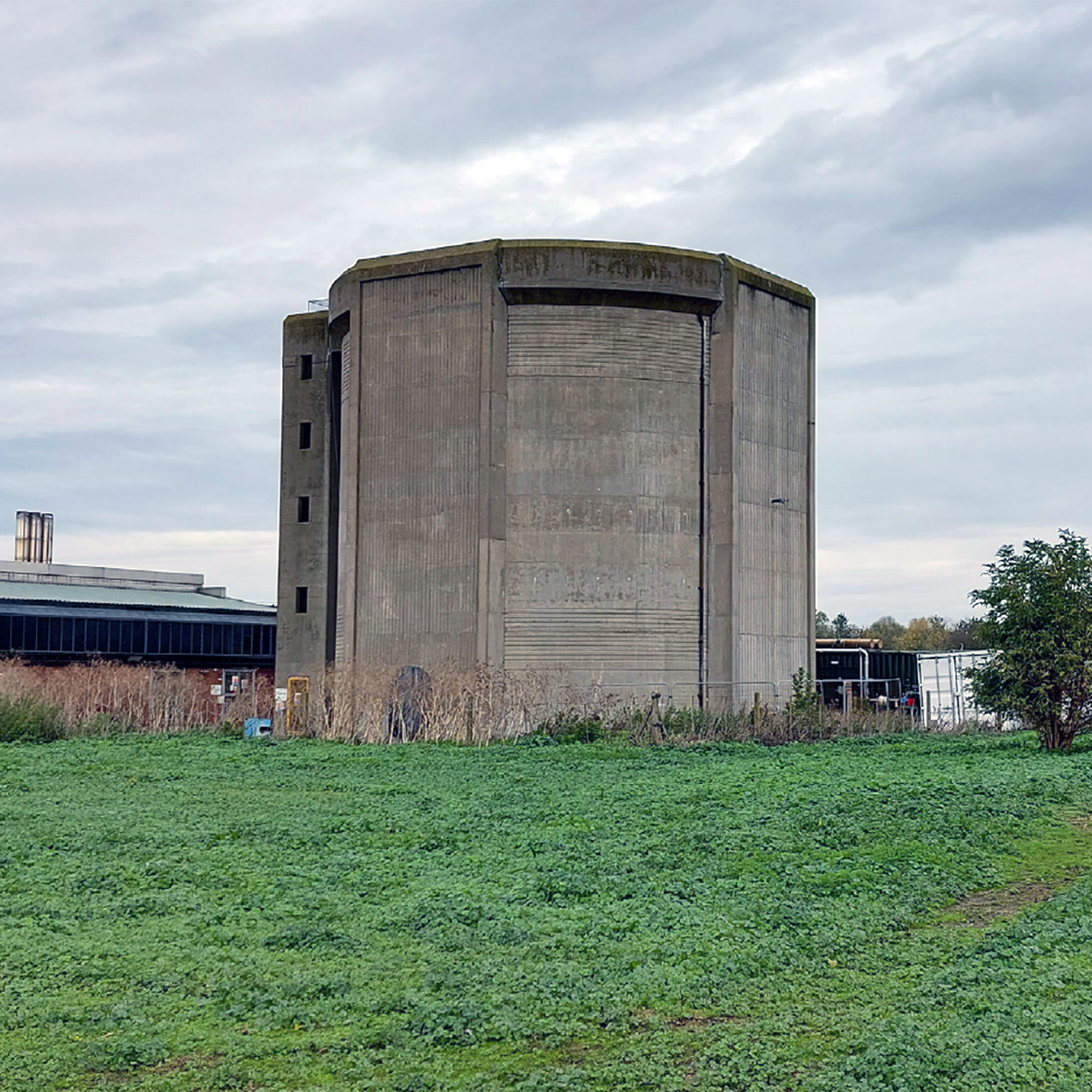
Today the site functions as the Anglian Water Waste Water Treatment Facility and is located just a 20-minute cycle or bus ride from central Cambridge. Only a 10-minute walk from Cambridge North Station, the location offers sub-hour train services to London.
Using what's already there
Hartree is currently a complex brownfield site with significant industrial constructions and in possession of several key landscape structures that enhance its ecological value, including eco-corridors along the edges of the site.
While some pose challenging contexts to increase permeability, others provide opportunities to rebuild streetscapes that integrate the new development into a broader more cohesive urban fabric.

What sounds so simple will revolutionise how we build towns forever.
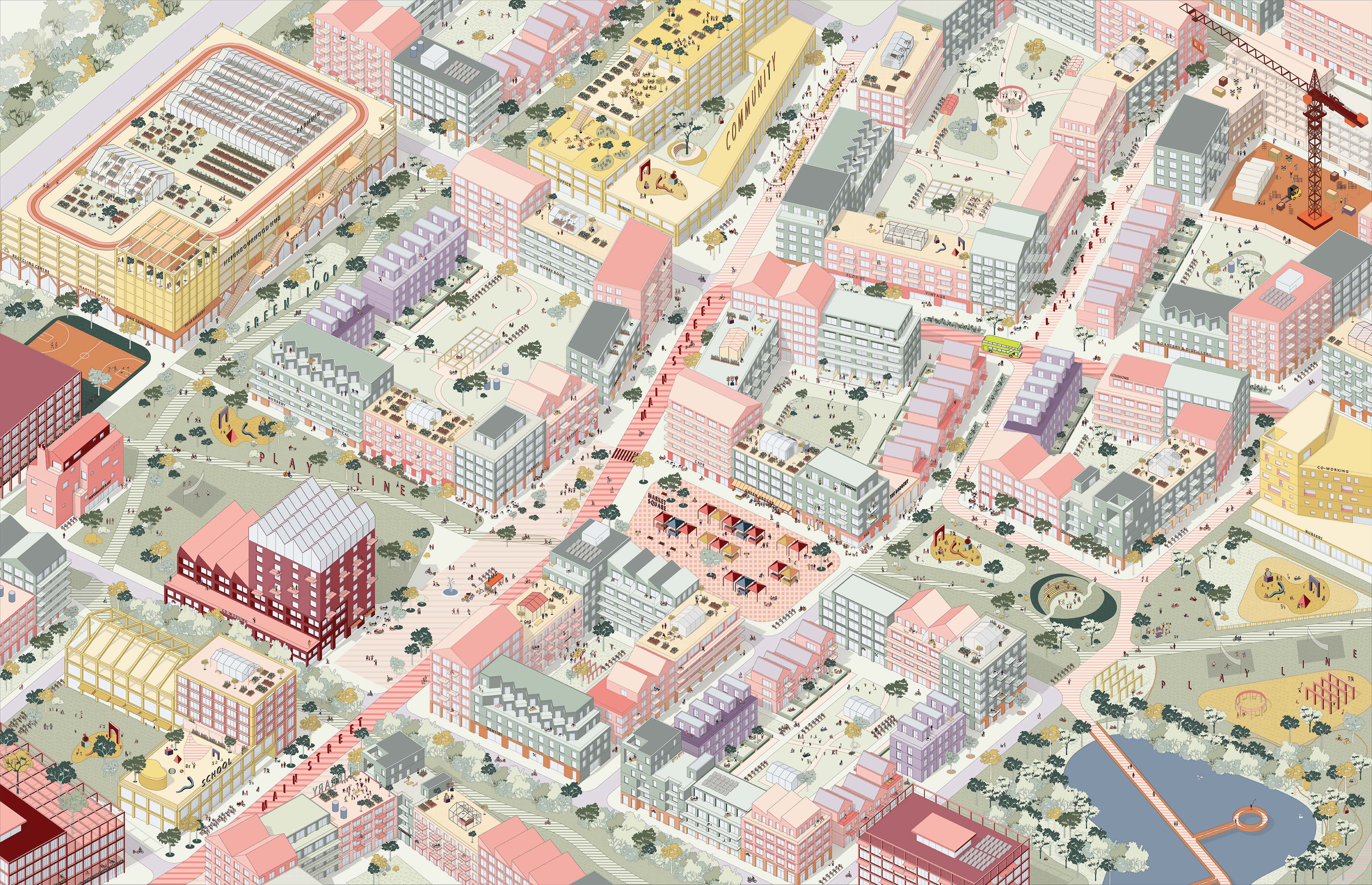
More than just homes
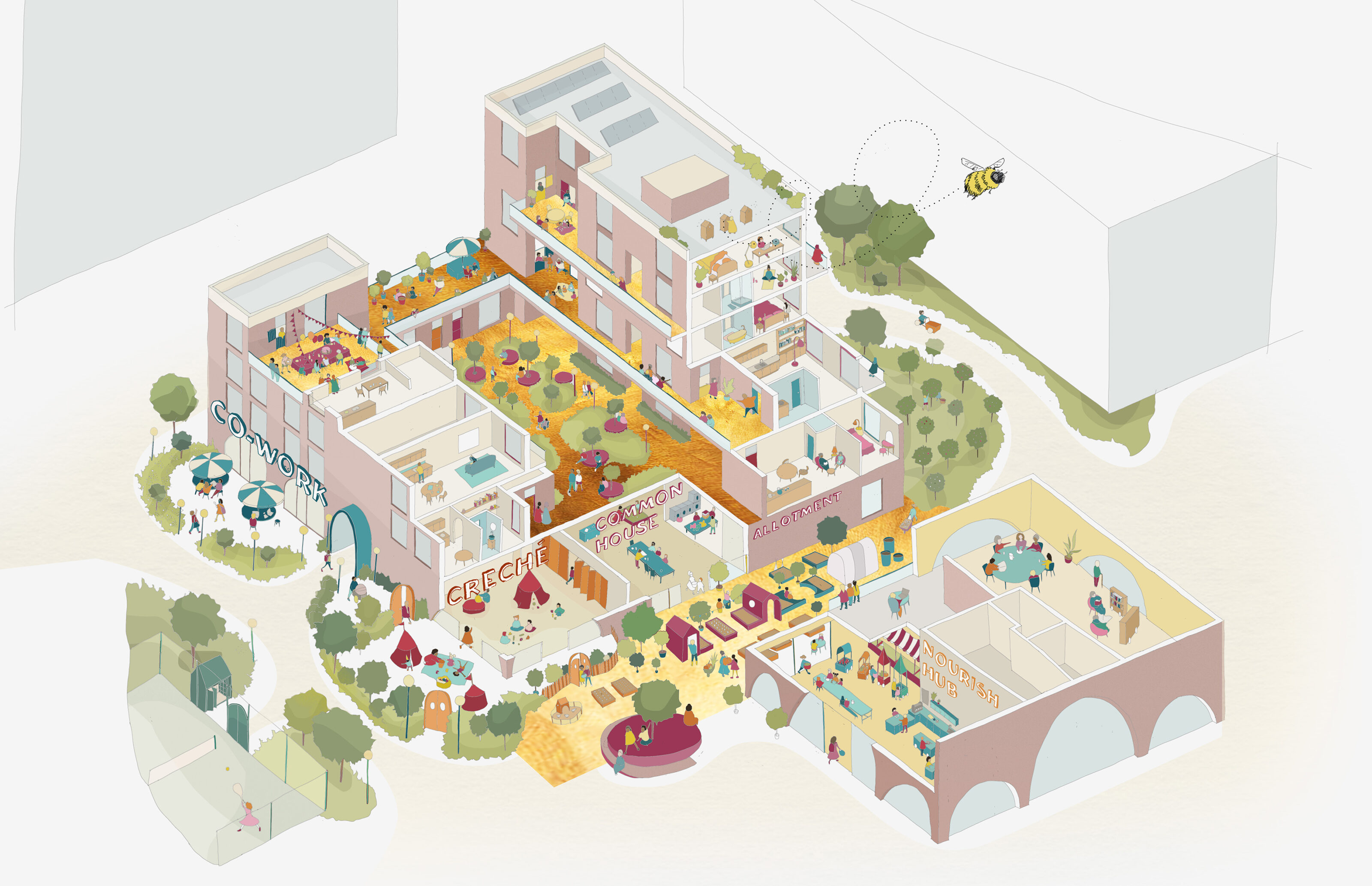
Hartree is a low-car, low emission, residential-led mixed-use quarter of 5600 homes. Driven by the 5min neighbourhood model, Hartree will provide residents with two new primary schools, a library, community centres, a medical hub, shops, local sports facilities, recycling centres, last mile logistics and over 6000 jobs.
Hartree presents a unique opportunity to positively impact the long-term health and well-being of its residents as Cambridge’s newest and most forward-looking neighbourhood, embodying a vision of health, accessibility, sustainability, and community.
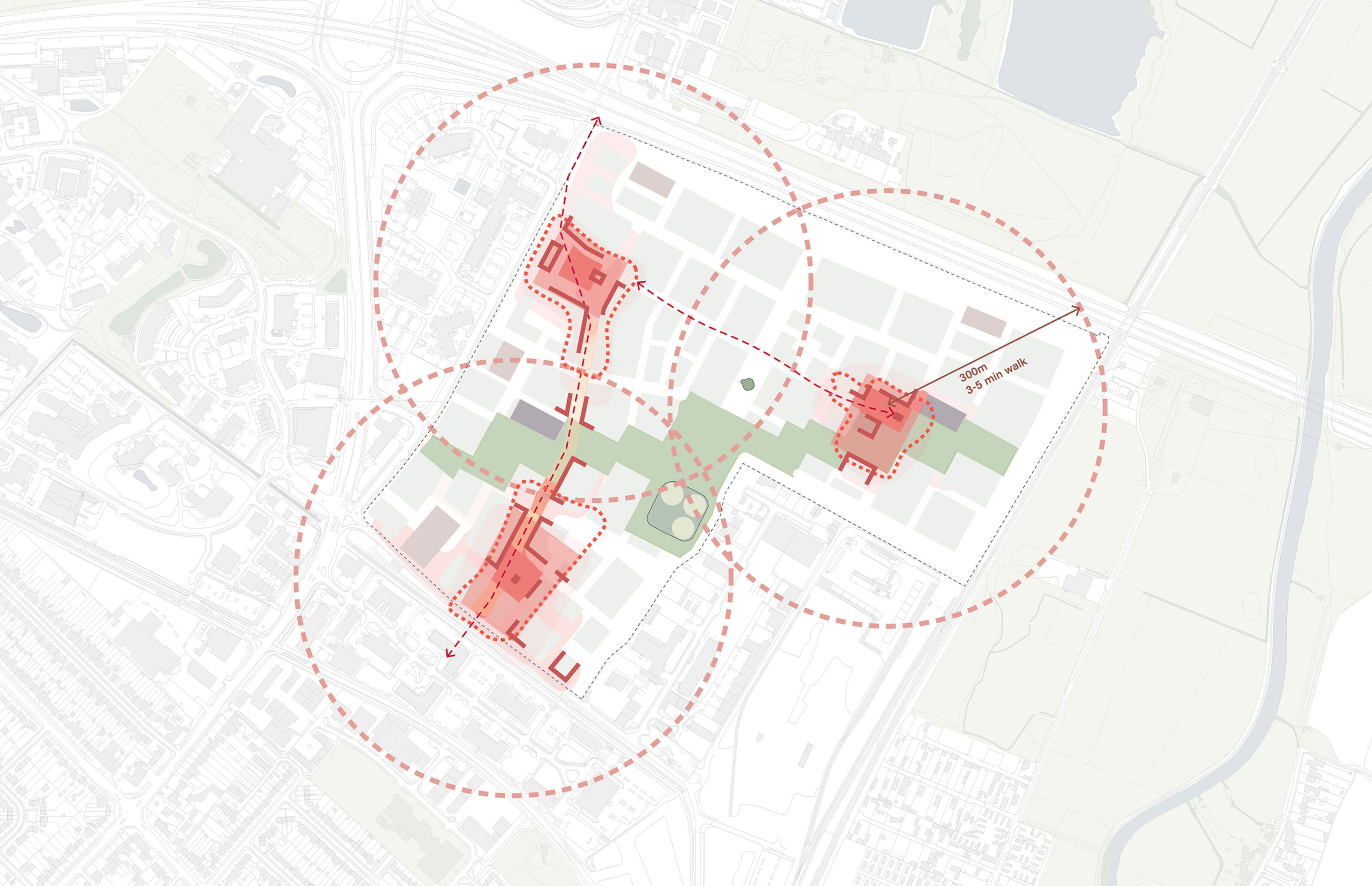
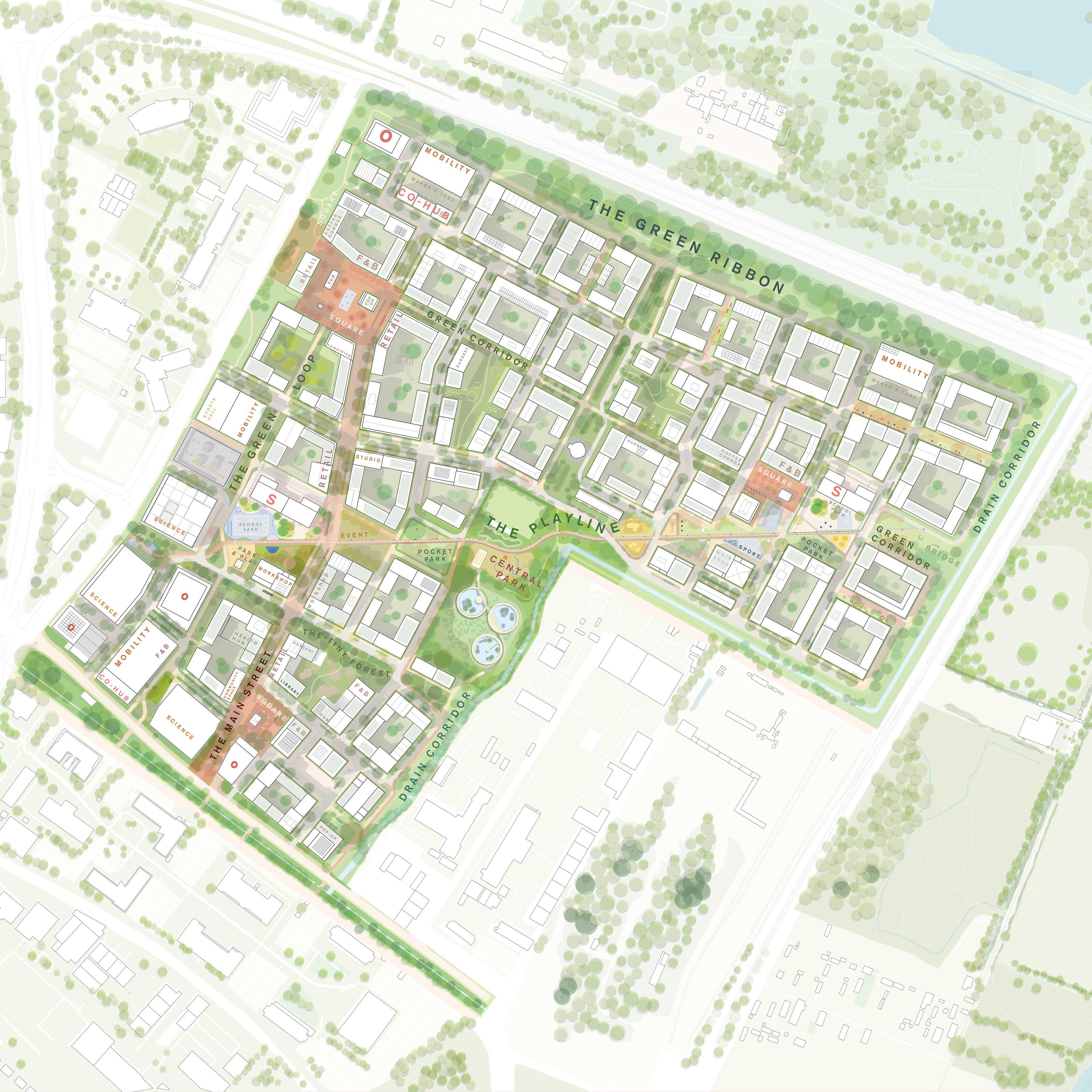
Three 5-minute neighbourhoods
Hartree’s three neighbourhoods each provide a unique mix of community and retail uses, employment spaces, and housing options. The distinctiveness created by selectively clustering land uses promotes a flexible, inclusive spatial economy, ready to adapt to future everyday errands and are situated close to homes and integrated into an active travel network.
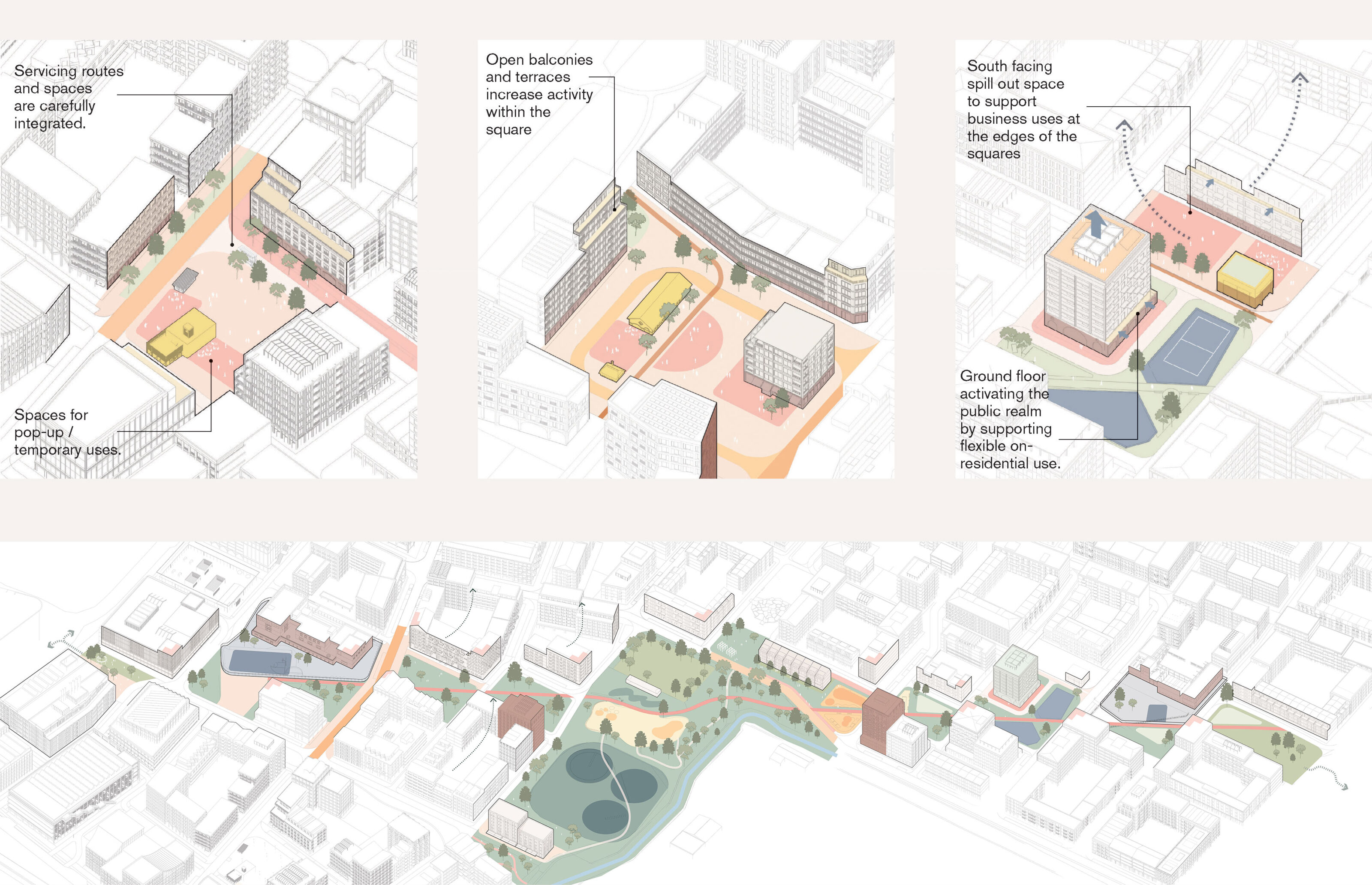
Mixing uses
To ensure Hartree will become an interesting place to be, strategic clustering of residential and non-residential uses is celebrated at building, square and neighbourhood level across the site. The three levels of clustering shape a resilient urban environment with adaptable spaces that support both micro and larger areas of public realm.
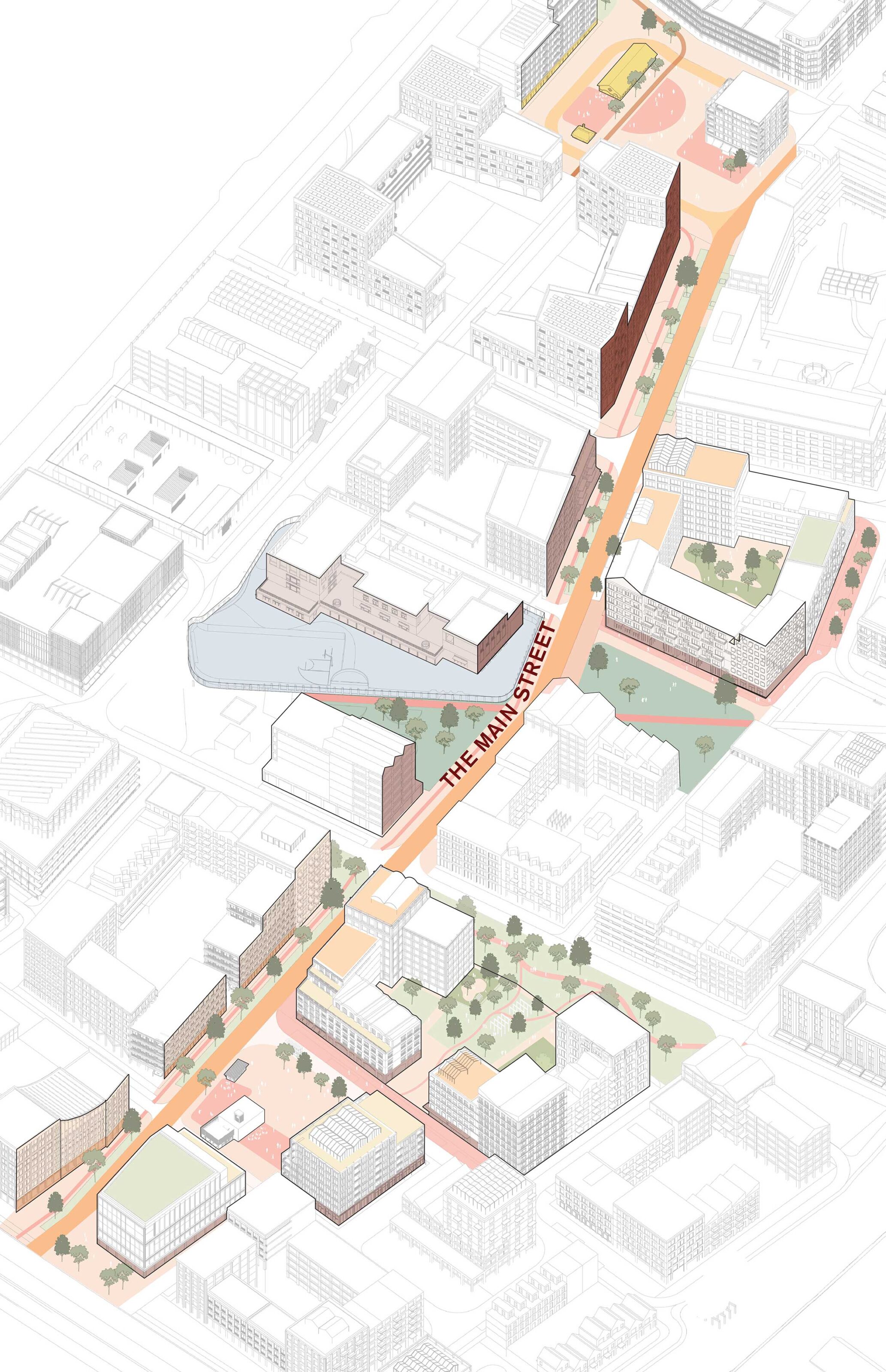
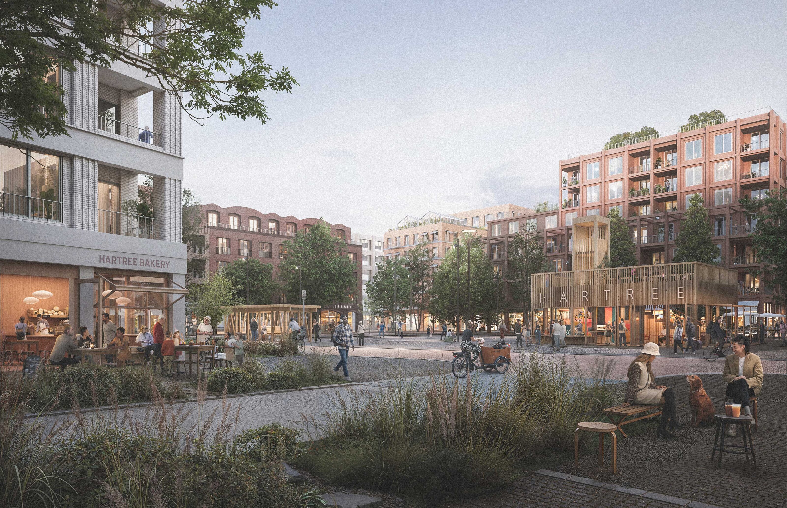
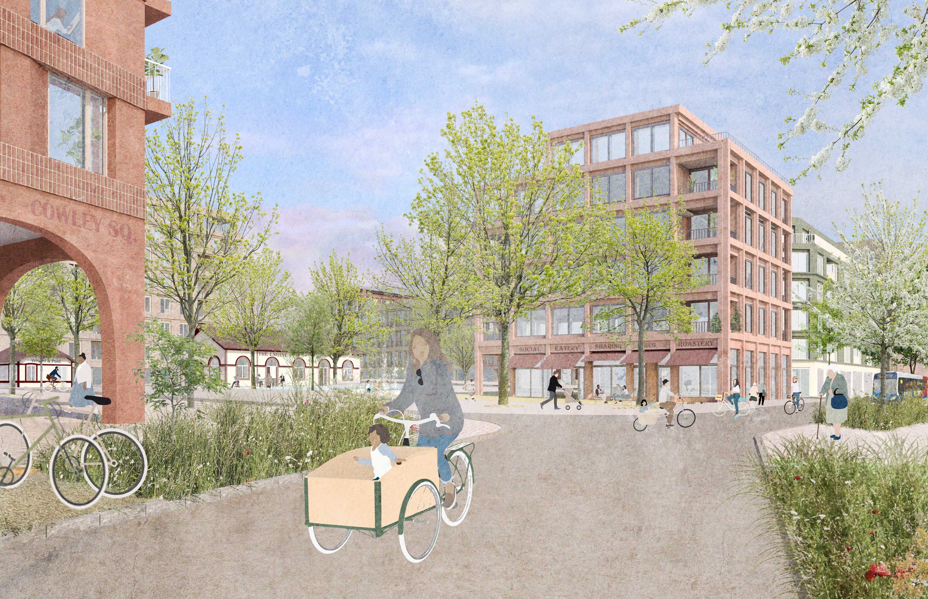
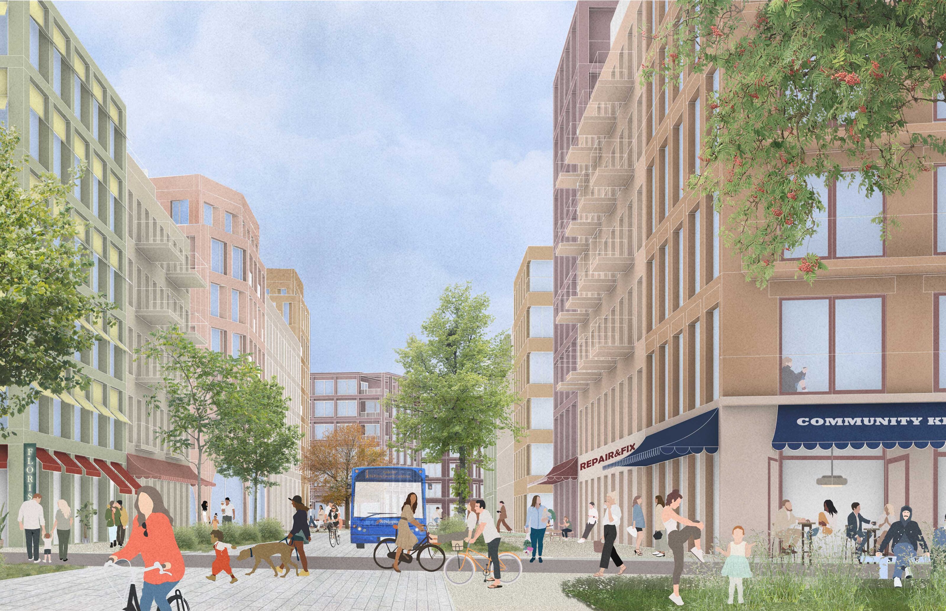
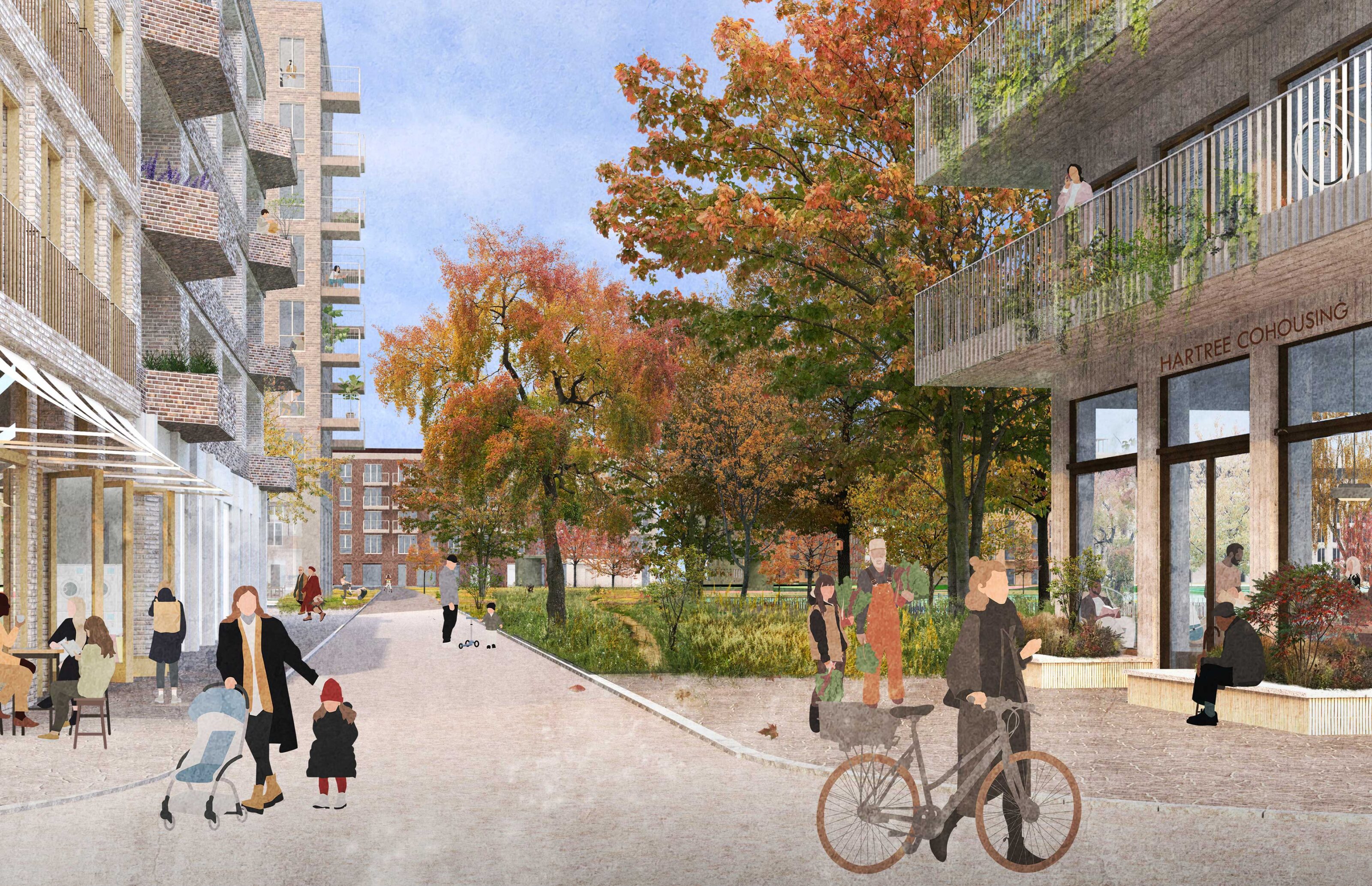
The Main Street
The Main Street is the most ‘civic’ street in Hartree. The southern part is more ‘town centre’ in nature with parts of the street flanked by stand-alone commercial buildings. Further north the street has a more residential character, defined predominantly by mixed-use layered buildings with more public commercial, retail or community uses at ground floor.
Meanwhile uses play a crucial role in the evolving clusters of activity within Hartree. While the illustrative scheme presents the ‘end state’ of the masterplan, flexibility in delivering core services and amenities has been intentionally built into Hartree’s civic spaces. This allows for a variety of non-residential formats to accommodate different uses in the interim, as the community develops and prepares to welcome larger, long-term tenants.
A variety of shapes and sizes
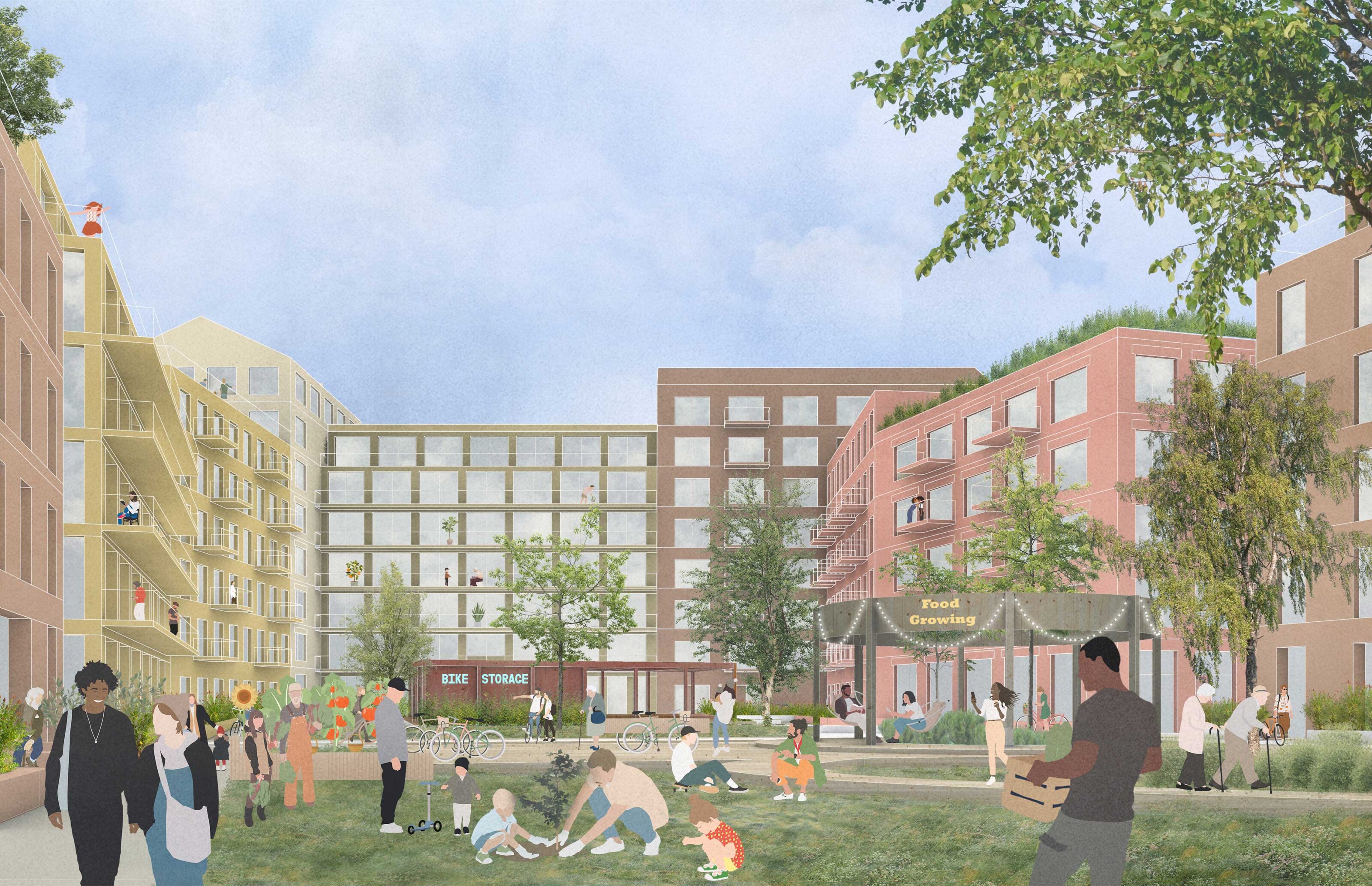
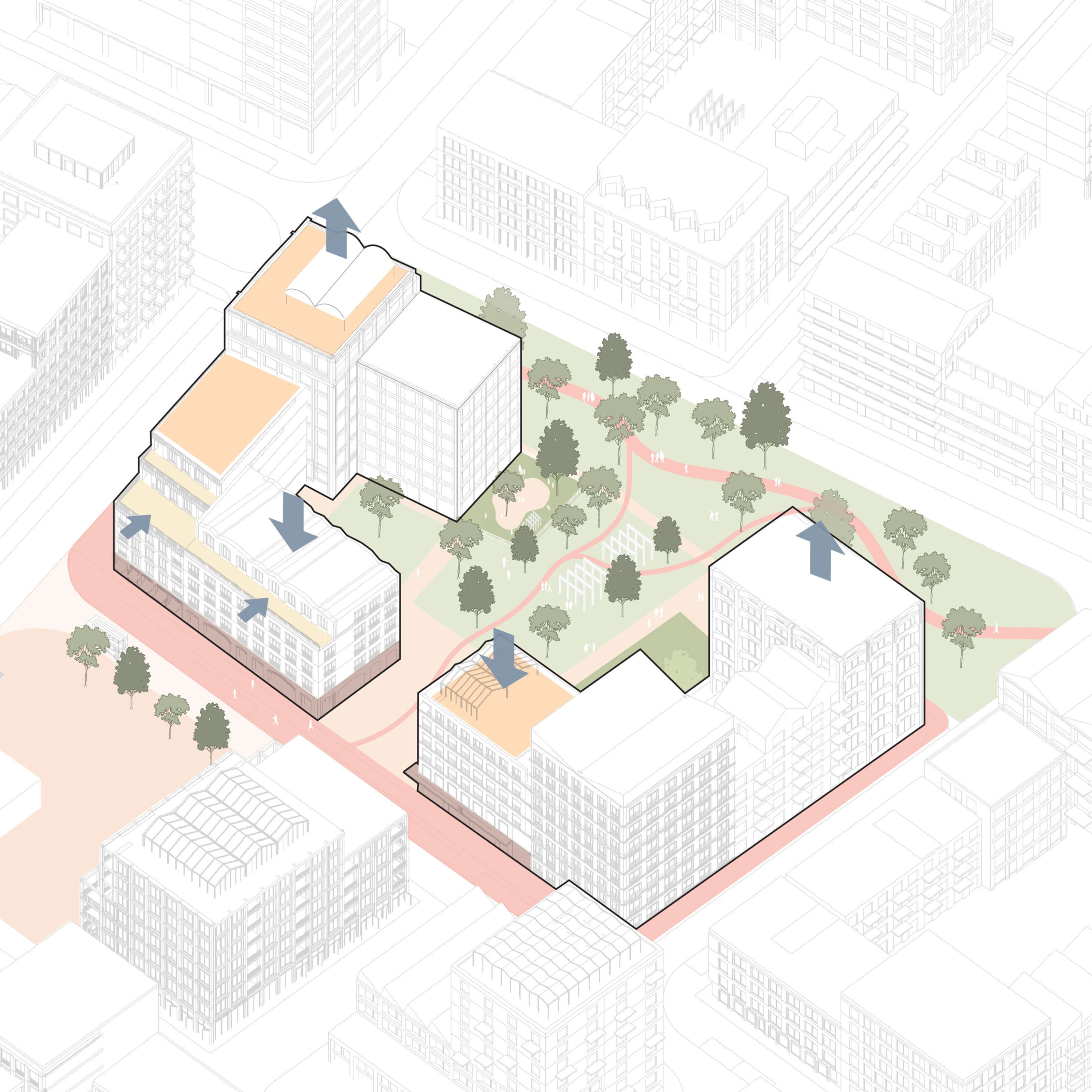
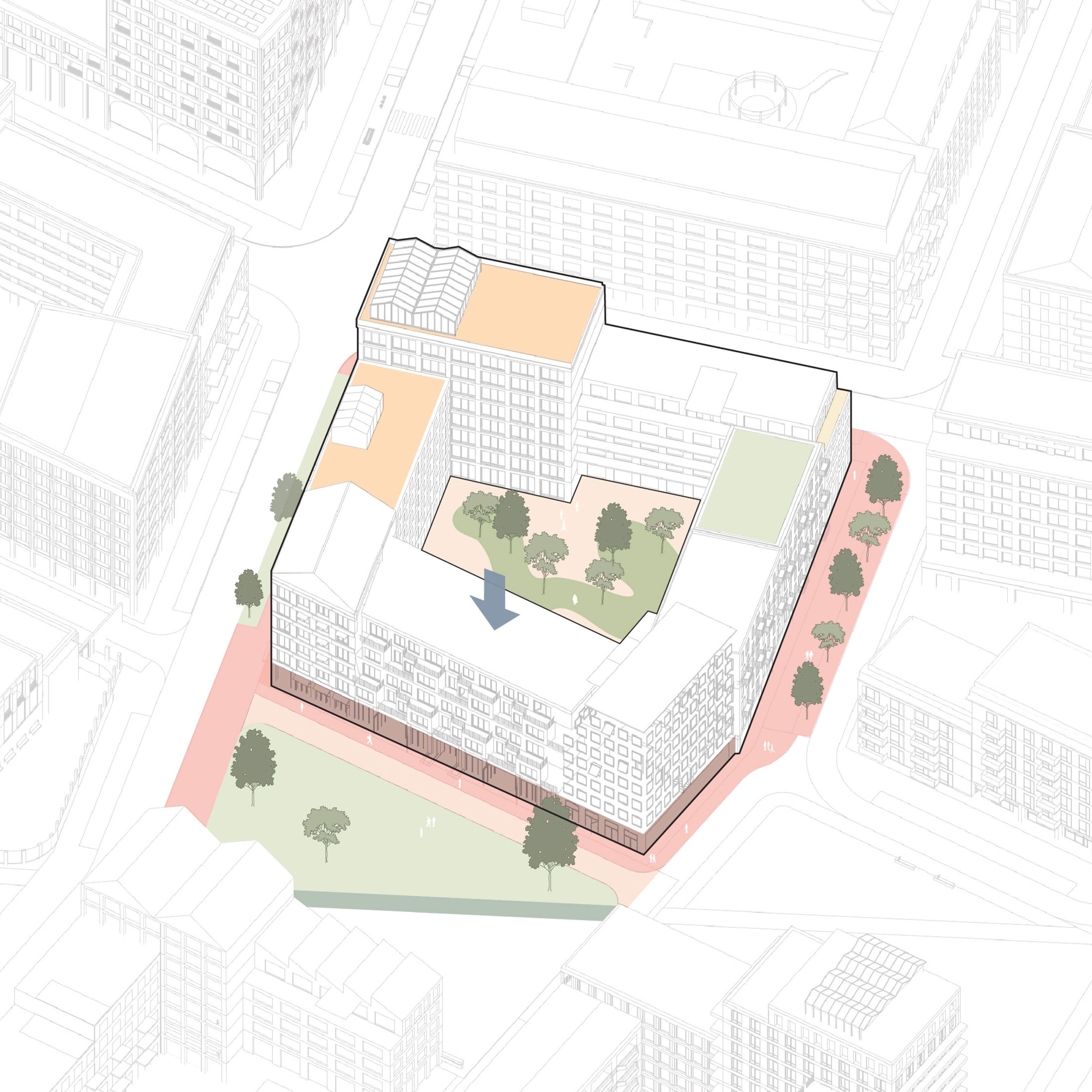
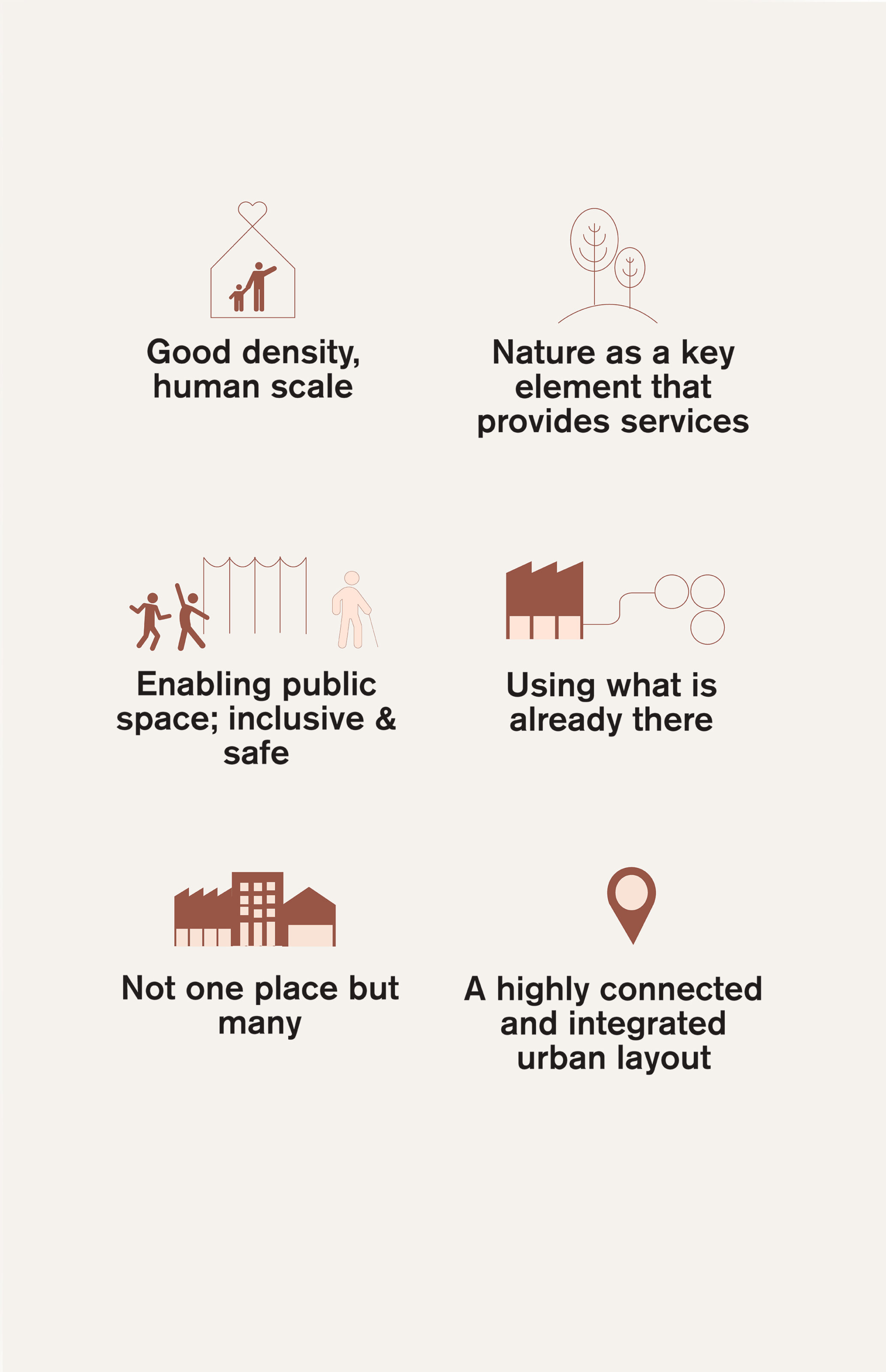
A key aspect of good density is balancing open and built space. With a consistent site density, the Hartree masterplan offers diverse residential and commercial types through several urban block types that achieve this balance.
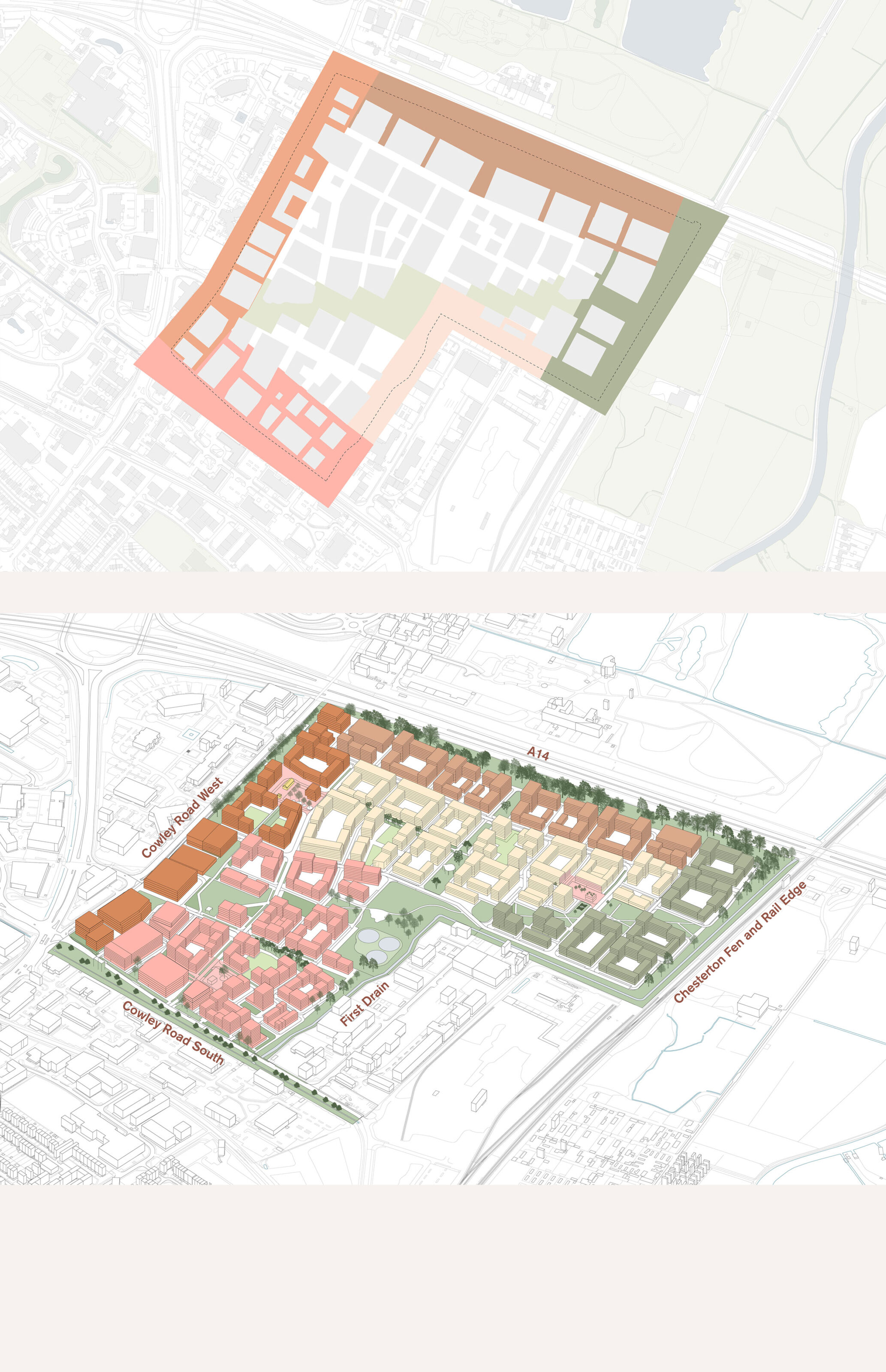
Responsive Urban Form
Hartree’s urban design starts with a tailored approach to its six unique edge conditions, integrating the development into Cambridge’s urban and natural landscape. This foundation guides the neighbourhood-scale design within the site, employing a nuanced approach that considers density, microclimate, and a distinct sense of place. It is shaped to ensure high-quality, comfortable homes with outdoor spaces that encourage year-round use, incorporating weather-appropriate designs like shade, wind protection, and greenery for comfort. Together, they create a varied and diverse range of building expressions, drawing design cues from broader local examples of Cambridge’s distinctive townscape.
Many Types of Homes
Hartree will provide up to 5,600 homes designed to passive standard and delivered across a variety of tenure types and housing typologies. These include family apartments, co-housing, self or custom build, specialised housing for older people, artist and live/work homes, post grad housing, and purpose-built houses in multiple ownerships. Different home types are strategically distributed across the site and in many cases across individual blocks to ensure flexibility in the masterplan’s delivery and prevent socioeconomic zoning between neighbourhoods.
Kjellander Sjöberg led a large team of award-winning British Architects who plot tested various places across the site. The team included: Bell Phillips Architects, Haworth Tompkins, Alison Brooks Architects, Nooma Studio, Feilden Fowles, 5th Studio.

Good Density
Hartree is designed for higher density living, focusing on creating sustainable, vibrant, and lively mixed-use environments. At a more granular scale, Cambridge’s built form is defined by layering, setbacks, stepped rooflines, closeness to nature, and strong street-level connectivity, all within a palette of predominantly brick, stone, and masonry materials.
Moving Around
Hartree promotes low care usage and active travel by offering high-quality routes and transport options designed for people, set within safe and thoughtfully planned street-level environments. The route network design connects key destinations such as schools, shops and parks, ensuring strong connectivity within the site and to surrounding pathways. By transforming the site from a cul-de-sac into a vibrant urban quarter, the route network lays the foundation for an expanded bus and cycle network.
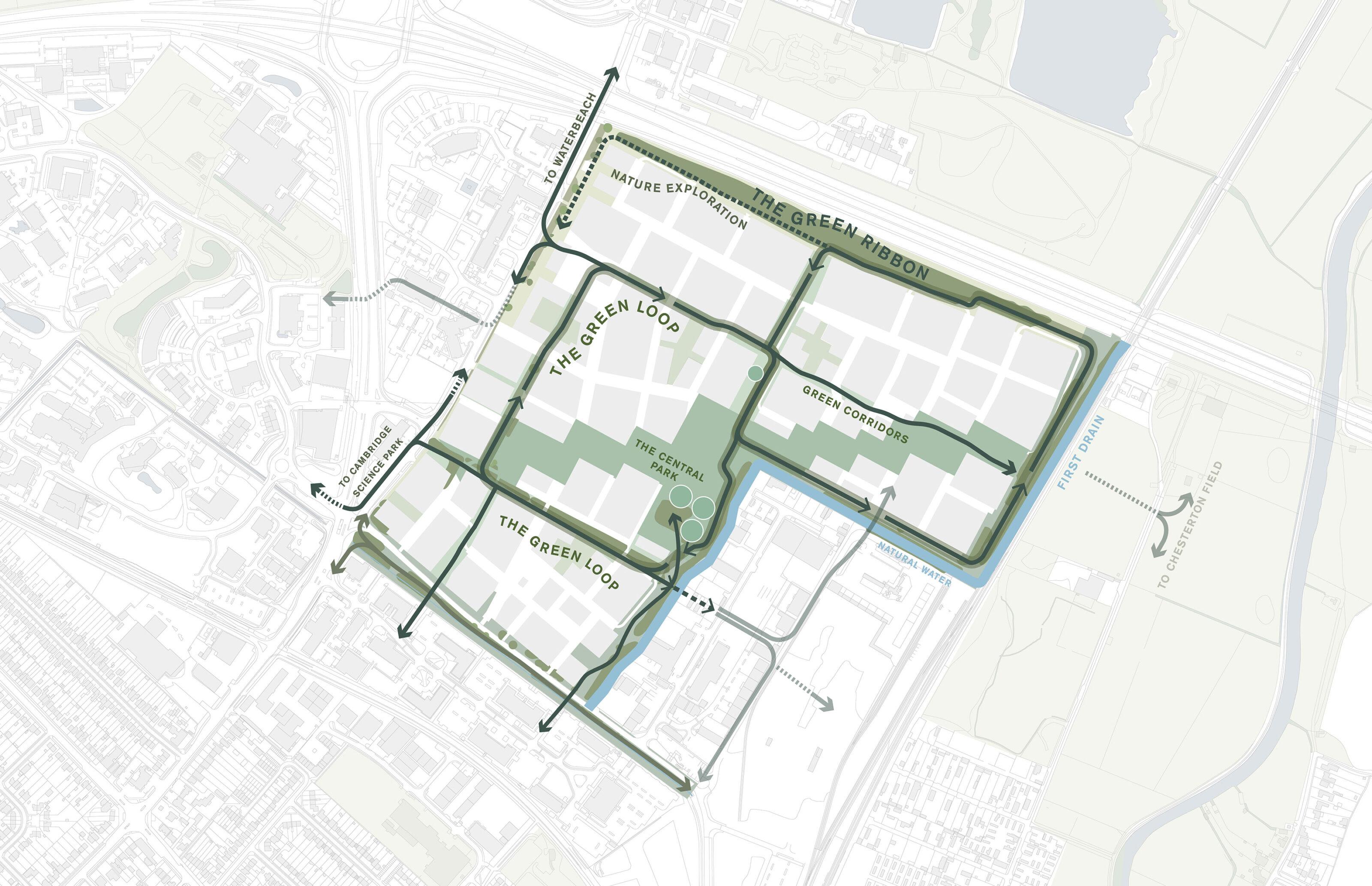
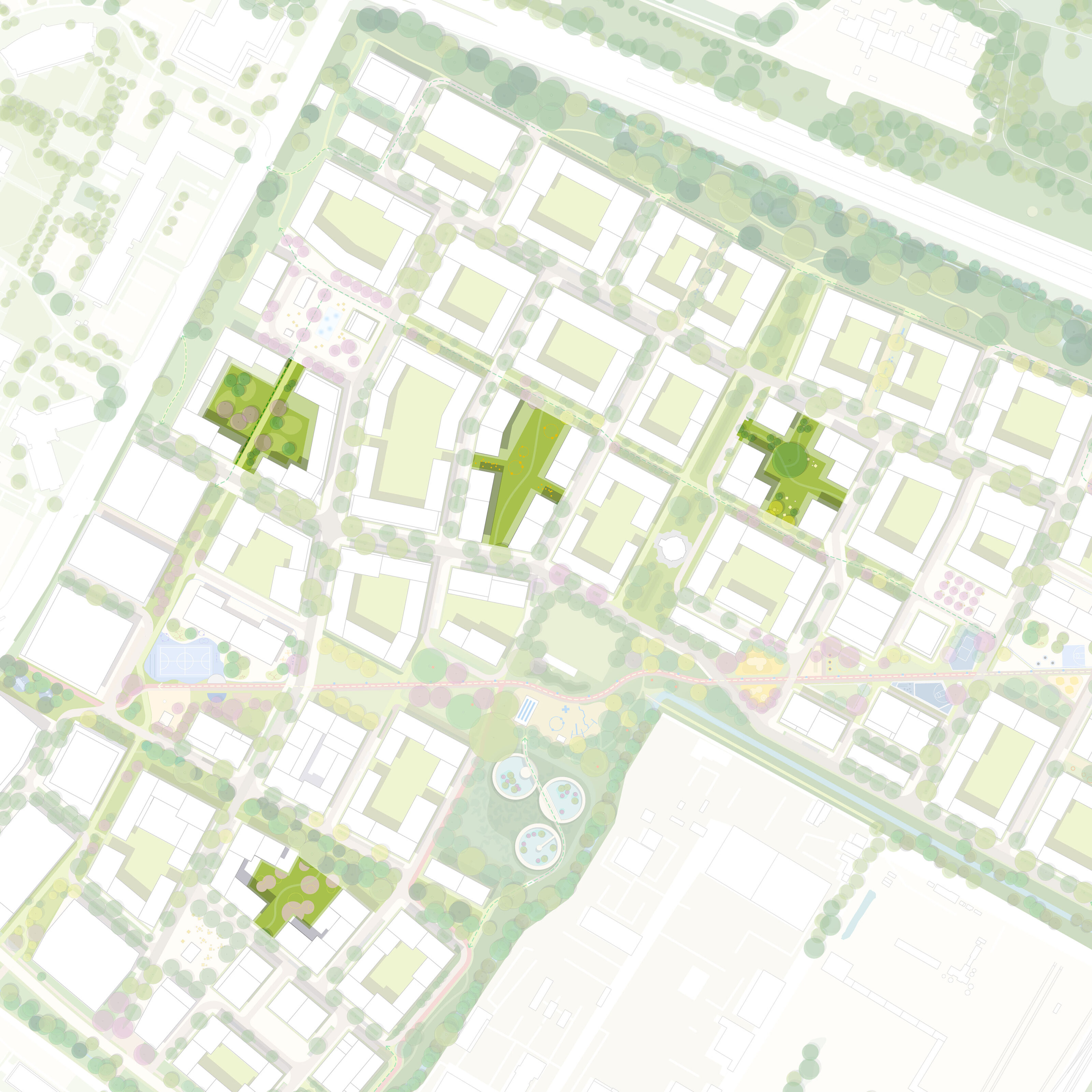
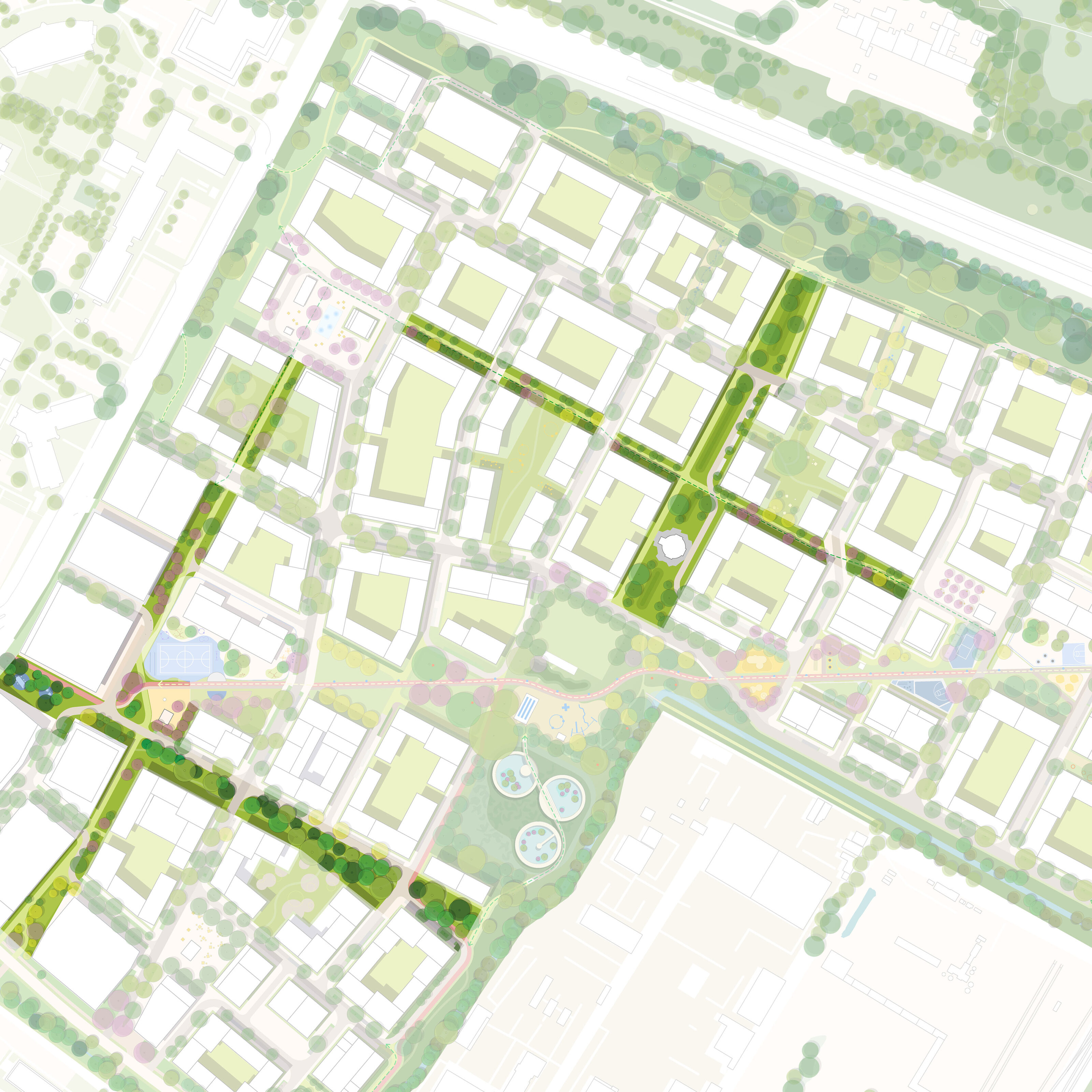
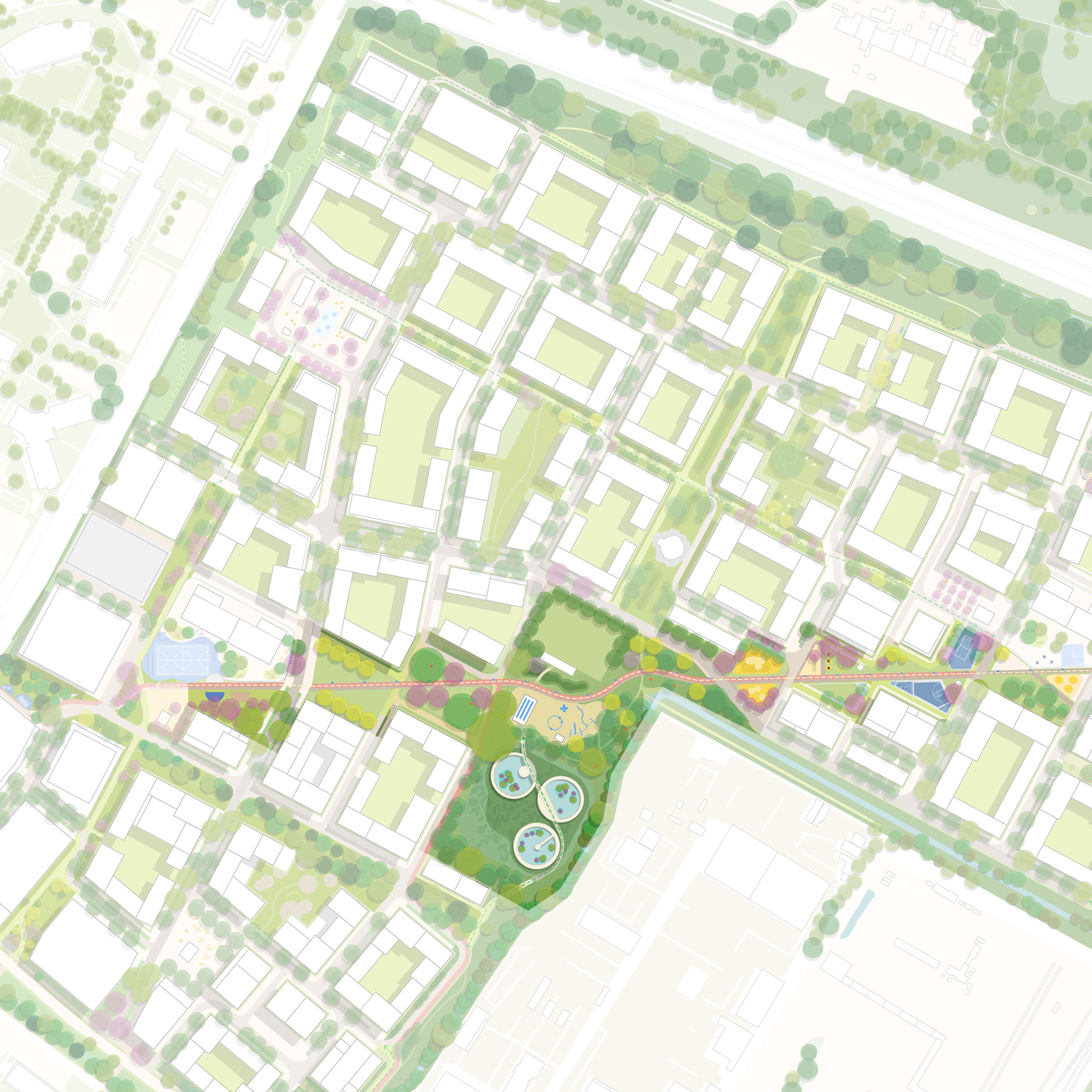
Living Landscapes
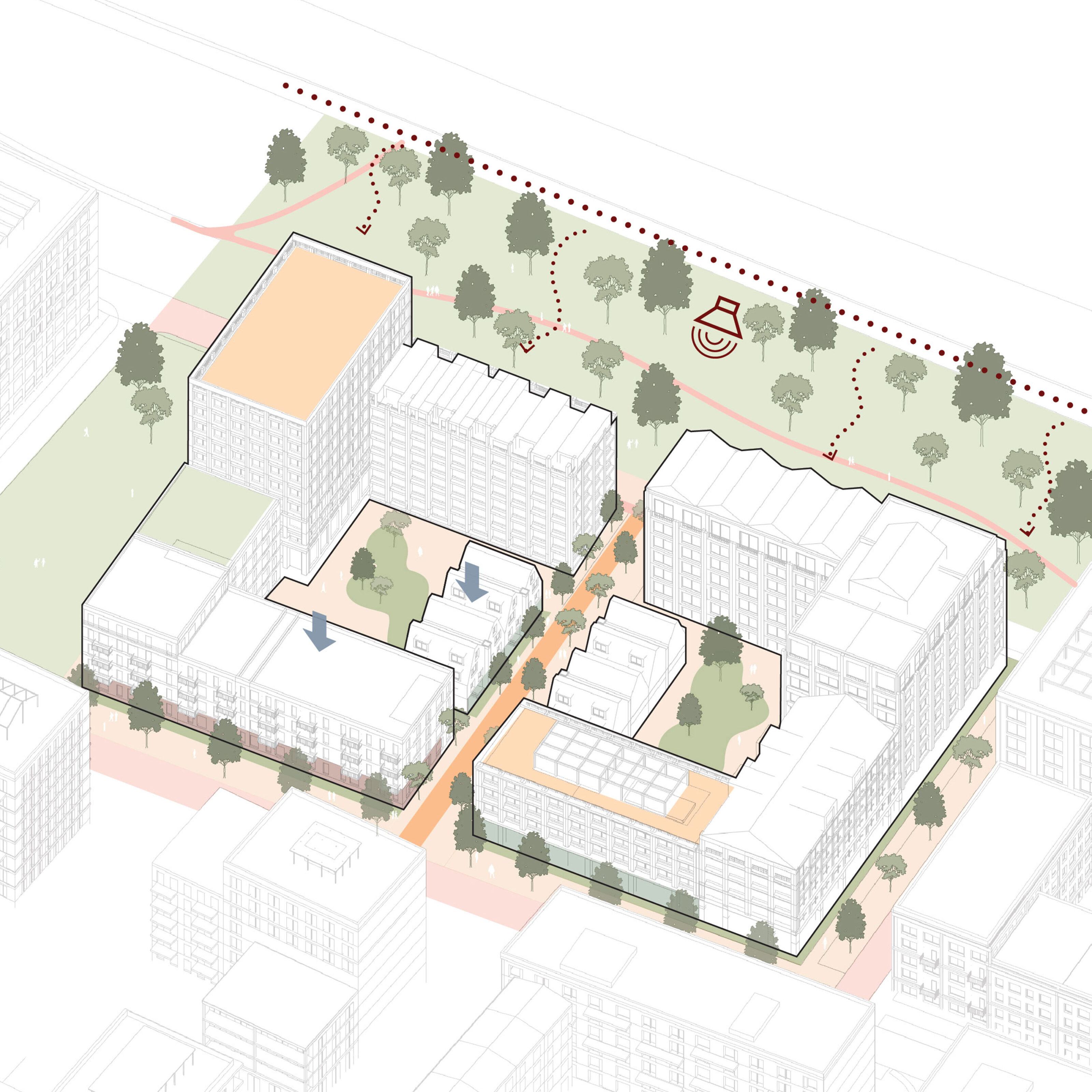
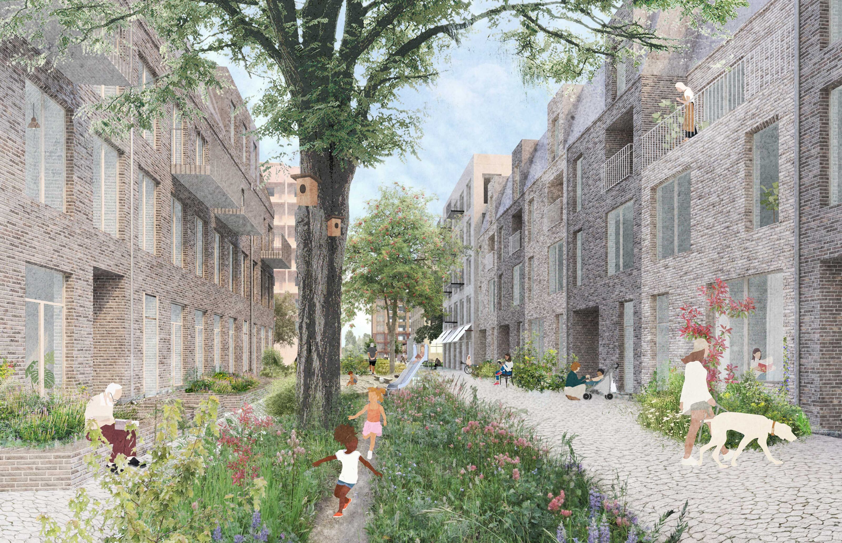
Hartree’s landscape strategy focuses on preserving as much of the existing habitats and landscape structures as possible. A diverse programme of activities for people and habitats is distributed across various types of open spaces, connecting every block to a green open space.
The new landscape network integrates with neighbouring larger landscapes, connecting walking and cycling routes and paving the way for potential future expansion into adjacent areas.
Images by LOLA highlighting key landscape structures within the masterplan. These connect private and public open spaces; each designed with a bespoke play programme and integrated water retention assets.
The Playline
The Playline, stretching 670m diagonally and incorporating the 2.9-hectare Central Park at its centre, forms Hartree’s largest open space. It offers extensive areas for the community, including children, teenagers, and informal sports. It connects the two primary schools at each end, with local community services and homes in a car-free environment. The adjacent frontages shape a series of interconnected green “rooms” that can be experienced either as a whole along the central axis or individually, shaped by the ground floor activities at the edges.
Shaped by Many
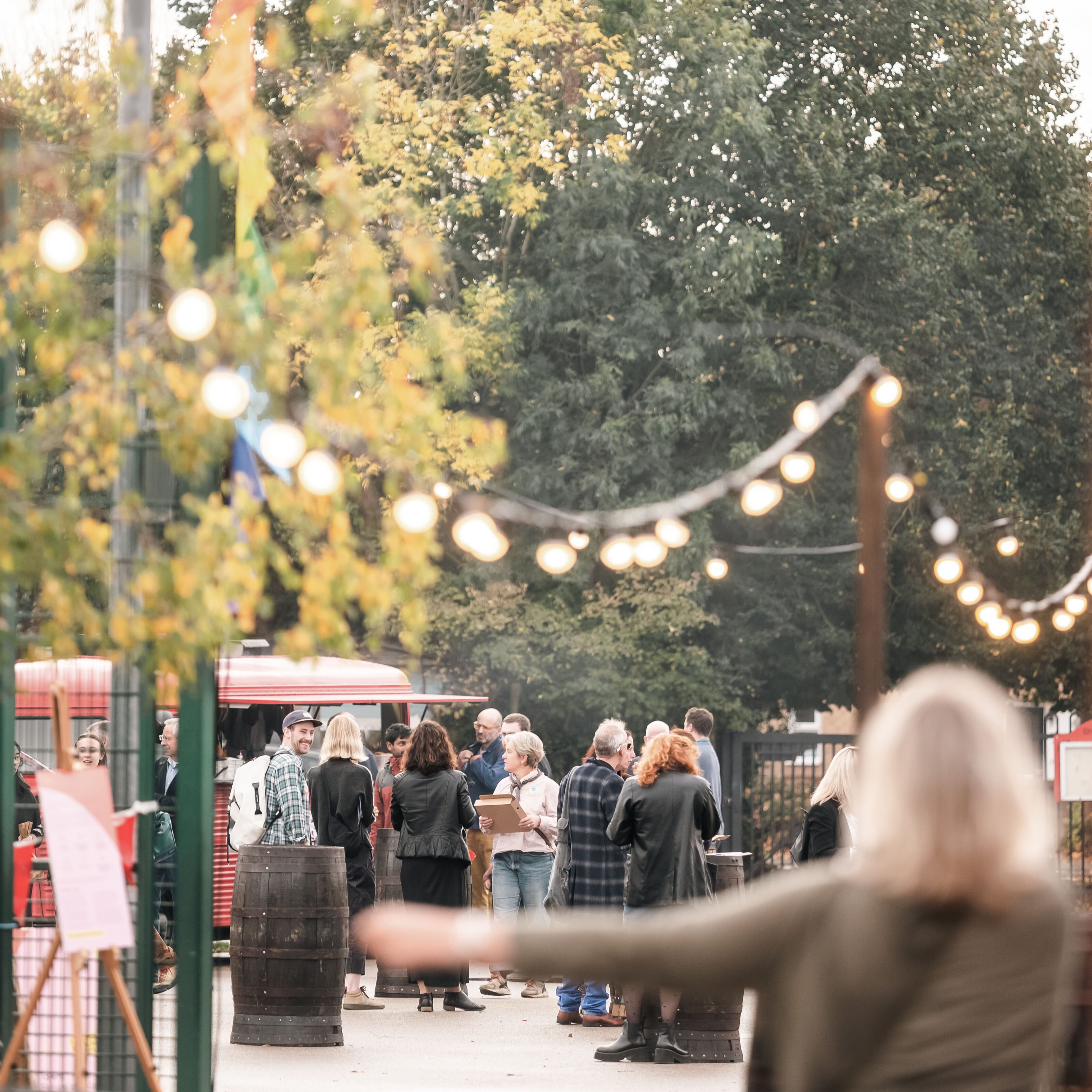
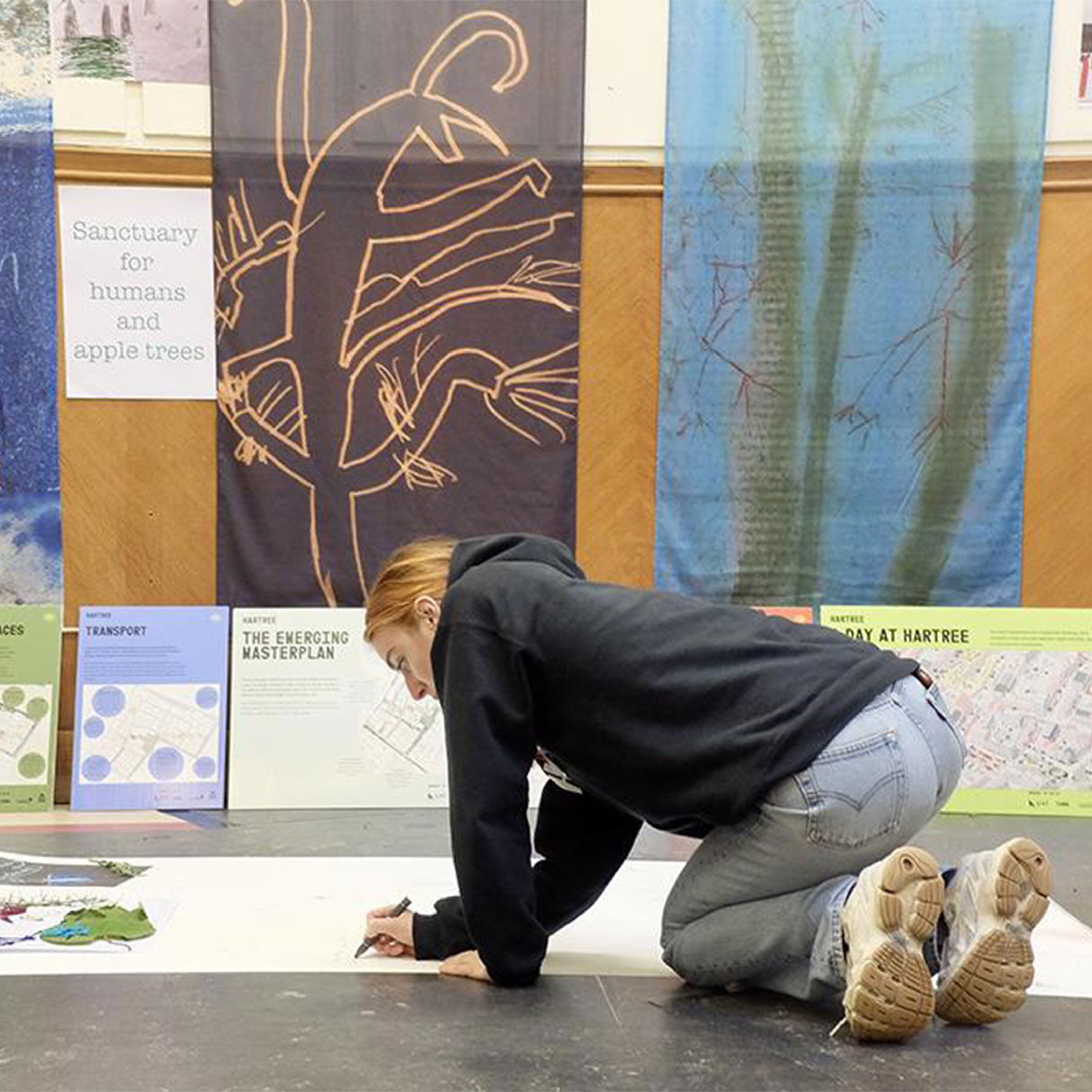
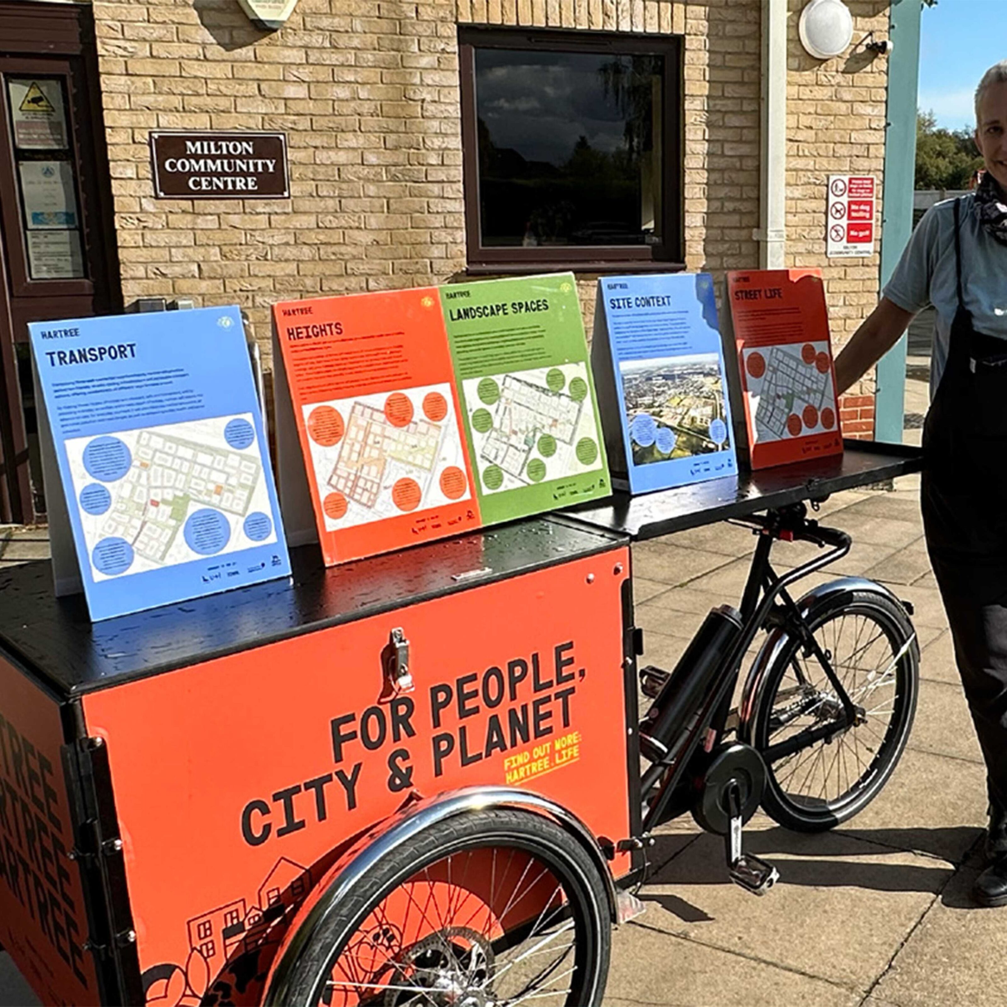
A detailed engagement programme was curated for Hartree, through a wide range of in-person and online forums that included formats such as citizen exchange, festivals, post occupancy surveys, roadshows and young people workshops.
A key element of engagement was the ‘Ideas Exchange’ which consisted of a cross section of Cambridge residents unaffiliated with any specific group or forum. Meeting consistently over the term of the project, it was a platform to discuss the project’s emerging work through a series of conversations held over several years.
Making a unique and special new place in Cambridge requires a bespoke and collaborative team. As the Masterplan Lead, Kjellander Sjöberg headed an exceptional team of creative practices and technical consultants, each bringing expertise to the project. The wider team includes sustainability strategists Useful Projects, E.C.F communication & engagement, Pell Frischmann engineering, Urban Movement transport & mobility and Live Work- service designers tasked with unpacking the challenges analogous to building robust and adaptable communities.
Design Quality
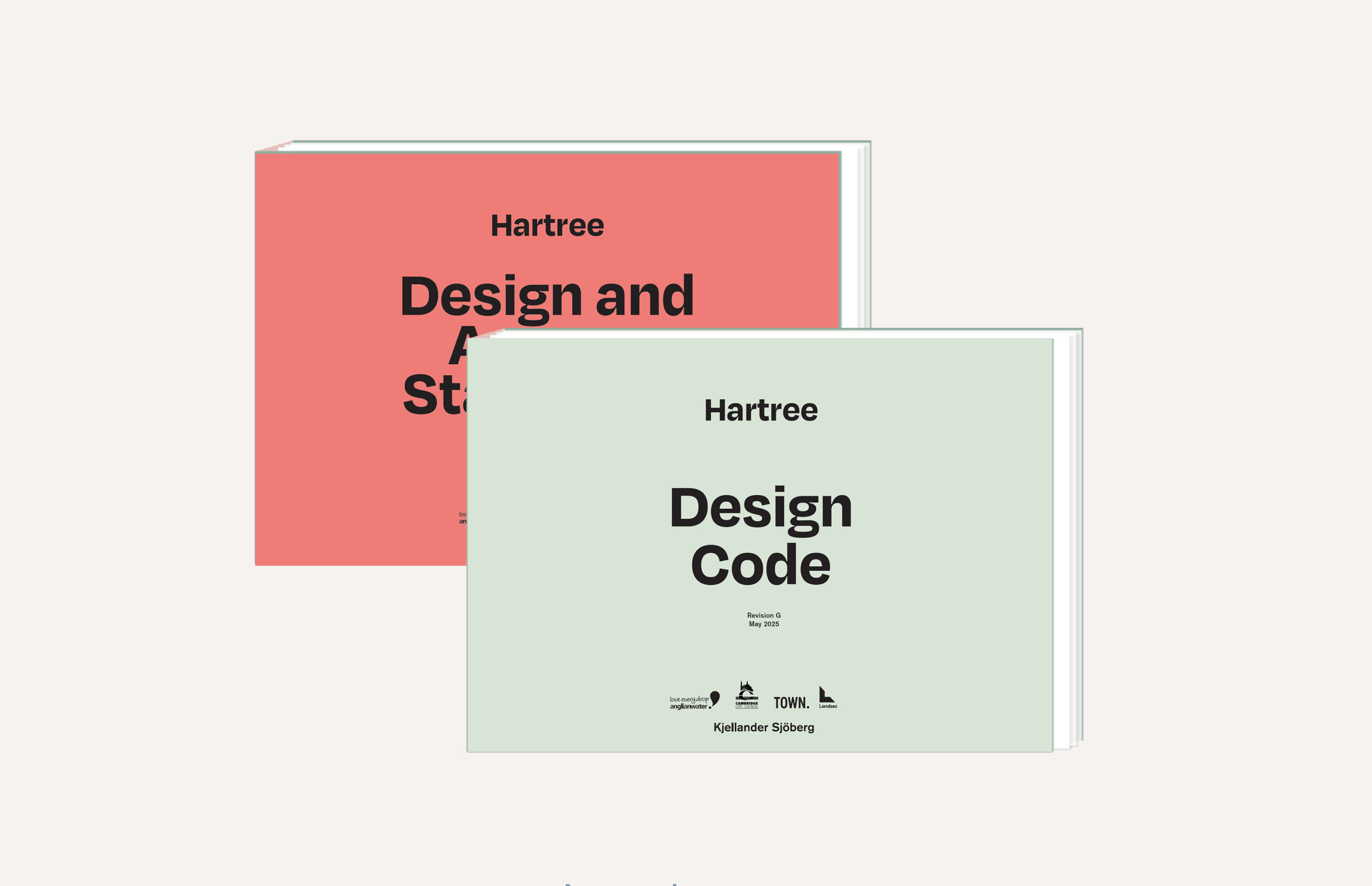
A Design Code, along with a set of Parameter Plans and a Design and Access Statement, was prepared by Kjellander Sjöberg for formal approval by the local planning authority. The Design Code outlines approved rules and requirements for the detailed design of Hartree, to be delivered throughout later phases. These documents ensure the delivery of a high-quality neighbourhood that reflects the vision, aspirations, and values of Hartree.